-
Calla Lily Valley’s Springtime Beauty
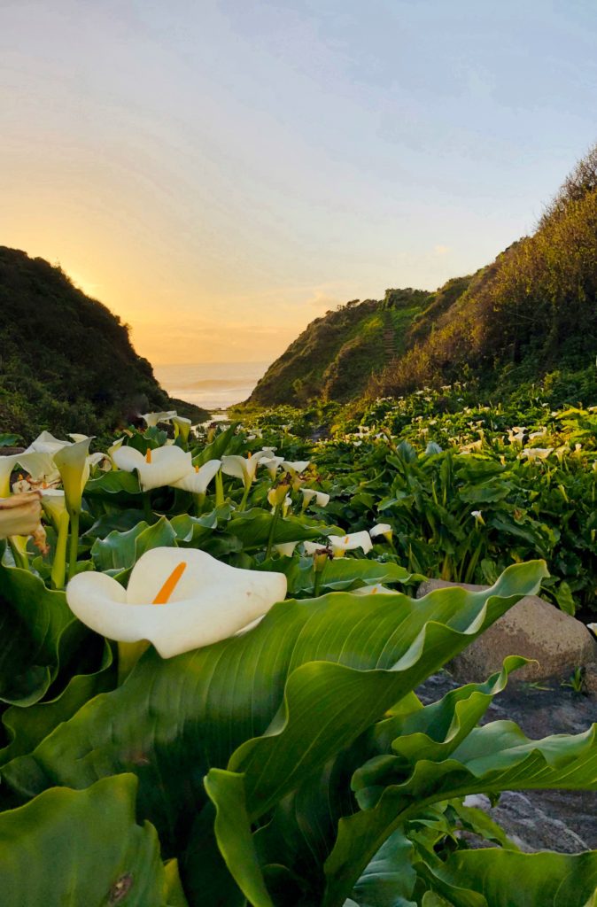
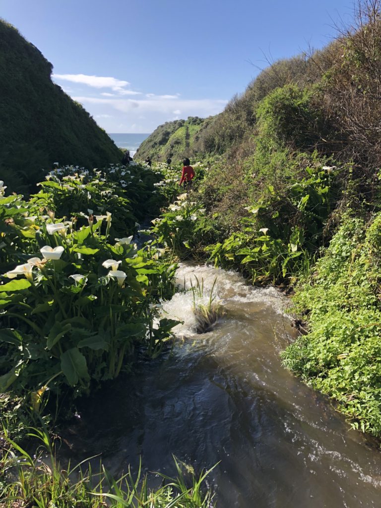
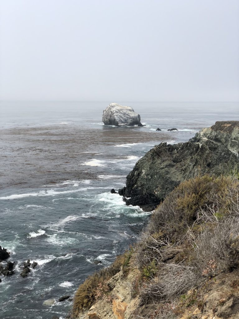
Calla Lily Valley is nestled amidst a ravine surrounding Doud Creek as it rushes down to the ocean. It is directly across Hwy 1 from the historic Doud Ranch and is technically part of Garrapata State Park. It is named for the captivating and graceful calla lilies that appear here in the spring, usually in late February to early March.
Calla is a name of Greek origin meaning “beautiful”. In the language of flowers, white calla lilies symbolize marital bliss and devotion—which may be why they are often featured in wedding bouquets. They are also used to express sympathy. There is just something about white calla lilies that affects your psyche. White is often associated with purity, innocence, light, goodness, simplicity, illumination, cleanliness, beginnings, spirituality, possibility, sincerity, protection, and perfection.
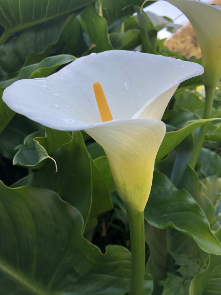
The flower is native to Africa and consists of a spathe, the outer part of the flower, and the spadix, the yellow spike in the center. 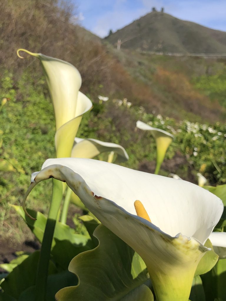
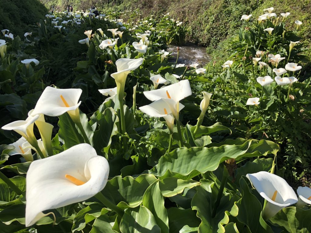
Calla Lilies grow from rhizomes that reproduce prolifically, making them a symbol of fertility and plenty. They are extremely hardy and semi-aquatic, making it no surprise that they are abundant around Doud Creek!
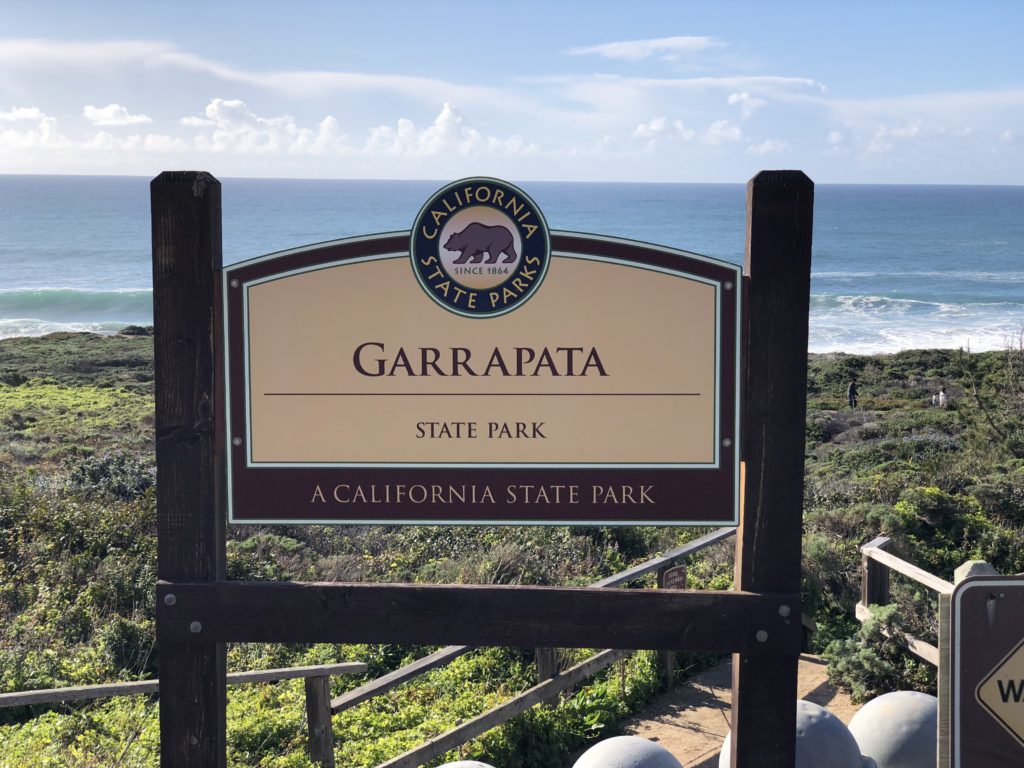
You can access Calla Lily Valley via two entrances. The first, shortest (.5 miles) and easiest route is at gate 18. The second, longer and more challenging route is at gate 19 where the Garrapata sign is located. You may park on the ocean side of Hwy 1.
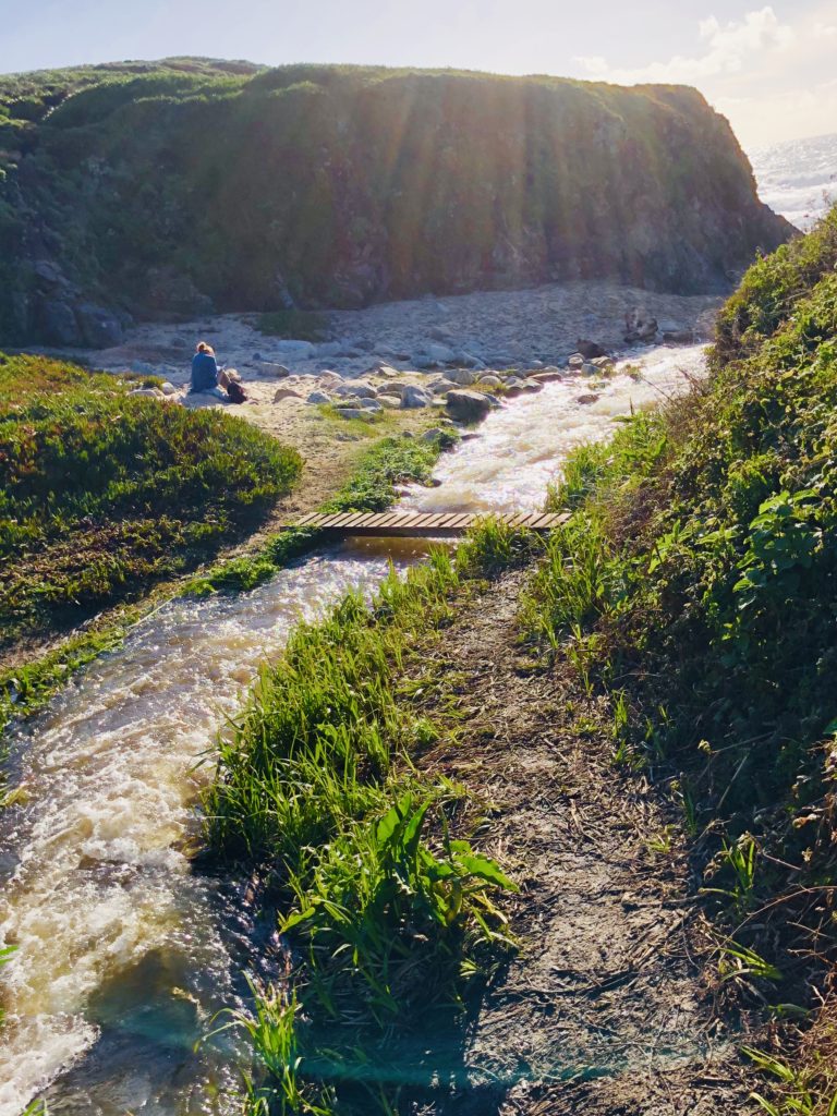
It seems pretty banal walking along the pathways, until you come to the valley and suddenly, there they are! The luminous proliferation of snow-white blossoms overwhelms you with their color and scent.
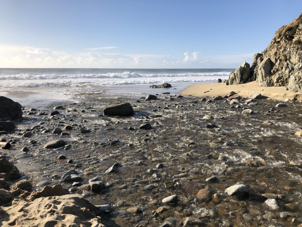
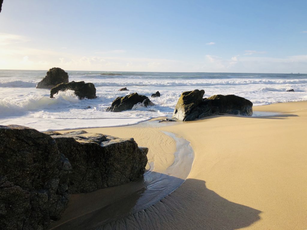
If you follow the creek to where it empties into the ocean and turn left, you will see beautiful Garrapata Beach with a myriad of sea stacks, dramatic waves, and extensive sea-washed pieces of driftwood.
Helpful Tips:
- Parking is available along the dirt pullout at Gate 18 and Gate 19 for Garrapata State Park, near mile-marker 63.
- Wear old shoes or rain boots as it can be quite muddy and wet on the creek banks.
- The best time to visit is during the week as it can be crowded on weekends.
- Wading or swimming in the ocean is not recommended due to dangerous waves and rip tides.
I hope you get to see Calla Lily Valley! Thank you for visiting my blog. Wishing you peace, love, happiness, & beautiful vistas!
-
Partington Cove: Tanbark Tunnel to the Sea
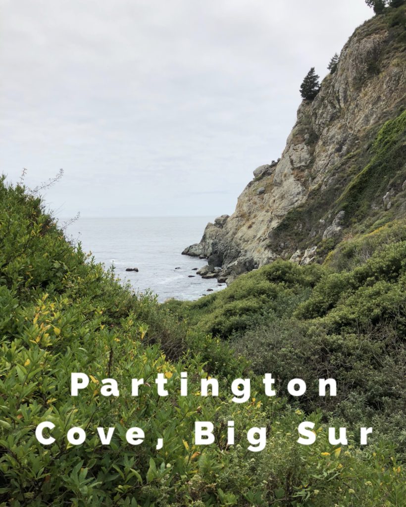 If you have ever wished to find pirates or buried treasure in the Monterey area, your best bet is Partington’s Cove. I think the name should be changed to Pirate’s Cove because it resembles something out of Robert Louis Stevenson’s Treasure Island. It is located 1.8 miles north of the entrance to Julia Pfeiffer Burns State Park, and 6 miles south of Nepenthe. It is easy to pass by due to poor signage. Look for the trailhead turn-off inside a hairpin turn on the west side of Hwy 1. Once you reach the trailhead, follow the half-mile dirt trail downhill. At the bottom, it splits into two trails. Turn left at the bottom and cross a wooden footbridge above Partington Creek.
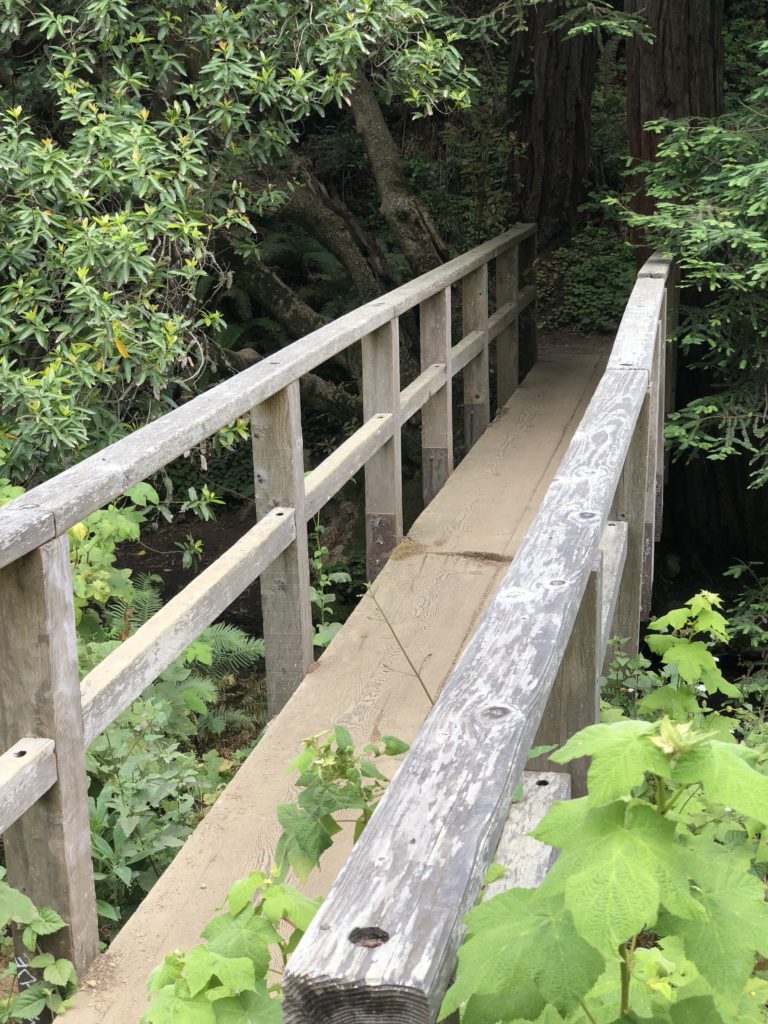 Follow the path along, and you will see a 100-foot-long tunnel bored through rock. The tunnel was constructed in the 1880s by homesteader John Partington, to enable the transport of lumber from the tanbark forest above the canyon to ships moored in the cove. Tanbark provided the tannins necessary to tan hides into leather. Mules were used to haul the lumber down the canyon to the ships.
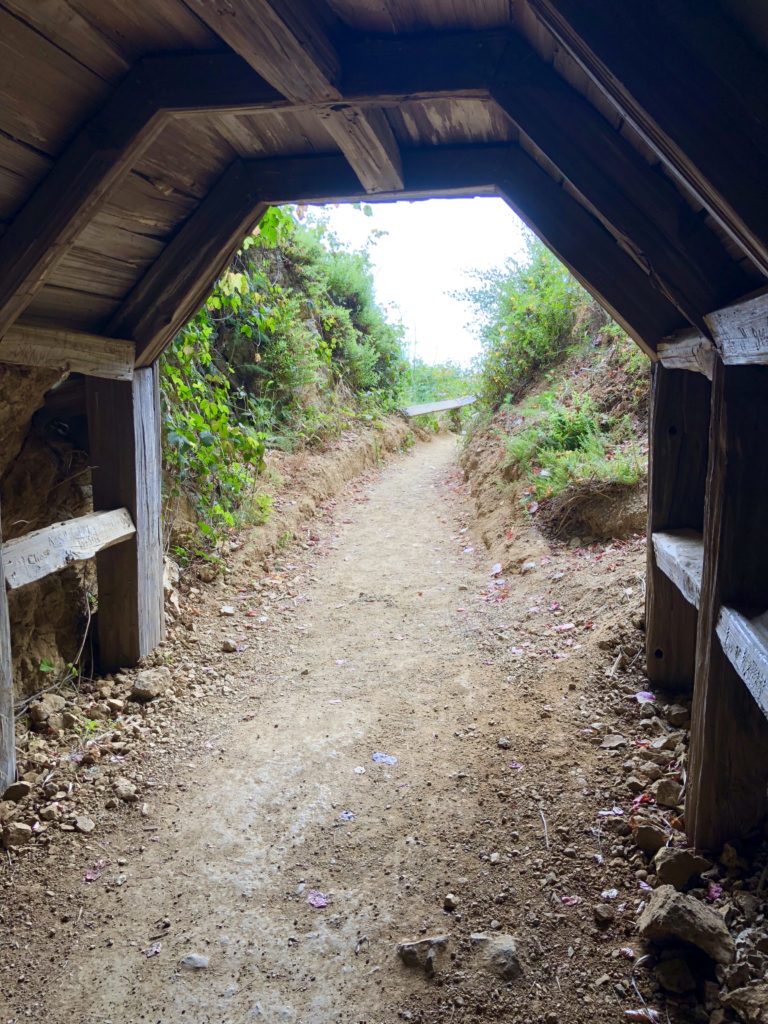 You can still see remnants of iron and wood structures used to moor the ships in the cove. You can also see tangled kelp forests as they sway gently in much of the cove. I imagine what it must have been like to see a ship moored here. It seems to me that swashbucklers could have been here. I can almost hear them chanting “Fifteen men on a dead man’s chest, yo-ho-ho and a bottle of rum!” Speaking of rum, Partington Cove also has been rumored to be affiliated with Prohibition bootlegging ventures, but this has never been substantiated.
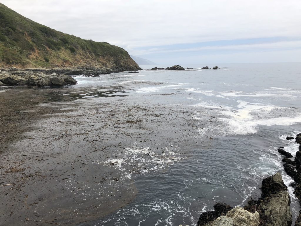 As you return and cross back over the footbridge, instead of turning right to return up to Hwy 1, turn left. Following this will lead you to a beach where Partington Creek cascades and spills over stony boulders and rocks into the ocean. It is a wonderful place to sit and reflect. As the waves crash onto the sandy shore, I think I hear a parrot shrieking “pieces of eight!” But I am shocked out of my reverie when I realize it is my friend calling me, “we’ll be late!” He has been thinking he saw a mermaid in the cove!Whether you like pirates or mermaids, experience Partington Cove yourself and let me know what you think. Adventure awaits!
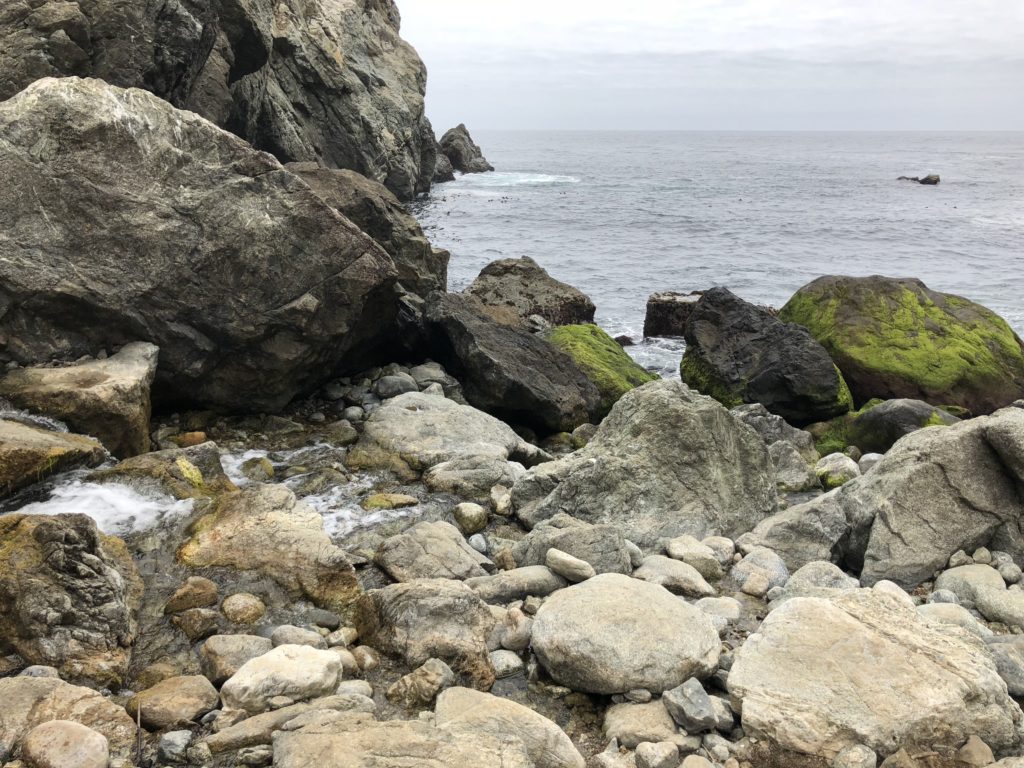 Wishing you peace, love, happiness, and beautiful vistas!
 -
Sand Dollar Beach & Jade Cove in Big Sur
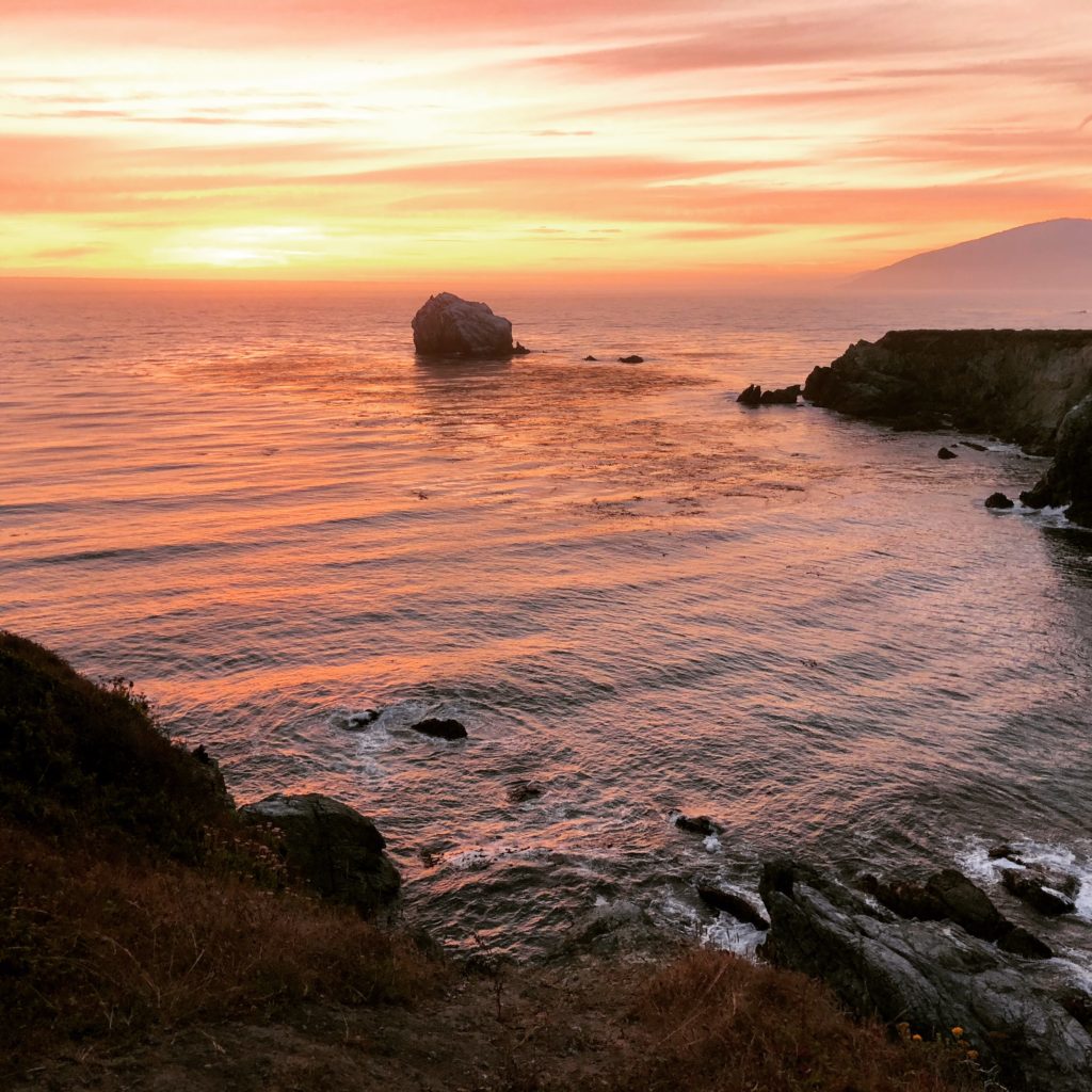
Sunset at Jade Cove in Big Sur We are heading south on Hwy 1 on a jade mission. An hour and 45 minutes after leaving Carmel, we spot it. The rinky-dink parking lot across from the Plaskett Creek Campground. Sand Dollar Beach awaits!
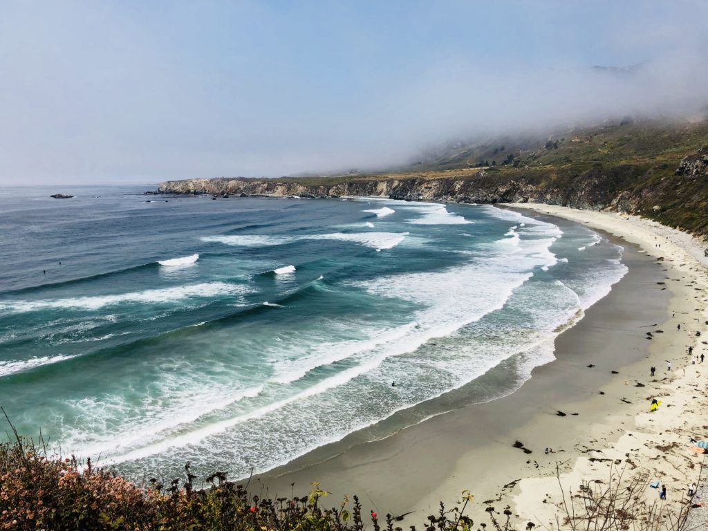
Sand Dollar Beach is the Largest Beach in the Area To get to Sand Dollar Beach, take the wide dirt path running parallel to the parking lot. The hike is .5 miles round trip. Start at the northwest corner of the parking lot and follow the trail for until you reach the steps leading 40 feet down to Sand Dollar Beach. It is extremely isolated and quiet here. There is no cell service, it vanishes shortly after you exit the south end of Carmel. No sound but the ponderous crash of waves as they break onto the beach and the whispering of the wind through the foxtails. Jagged cliffs plunge recklessly below to the sea. The rolling prairie above the beach is punctuated by several meandering trails. Many of these end abruptly and are surrounded by poison oak, however, some lead to breathtaking cliff top views of the beach.
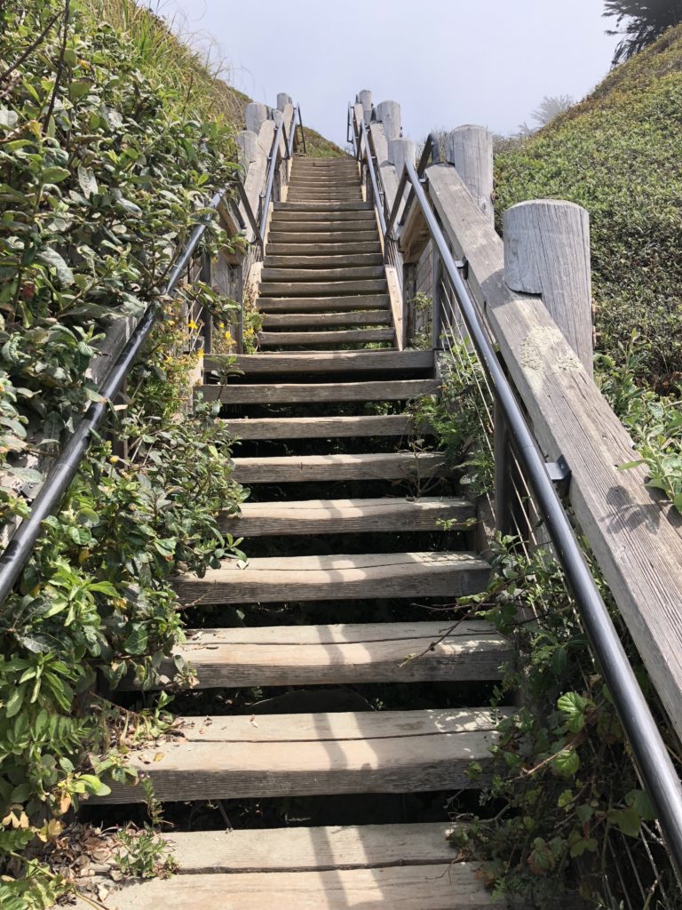
The Stairs Leading to Sand Dollar Beach There are many fun activities here including hiking, fishing, picnicking, and sunbathing. The beach is the largest in the area, a crescent-shaped arc of soft, white sand stretching for over half a mile. Surfing is also big here. Sand Dollar Beach is rated as one of the best surfing spots along this section of the coast. In addition, the level bluffs above the area are a designated hang glider and paraglider landing area. You may also see gray whales, elephant seals, sea otters, or shorebirds such as cormorants, brown pelicans, plovers, and gulls.
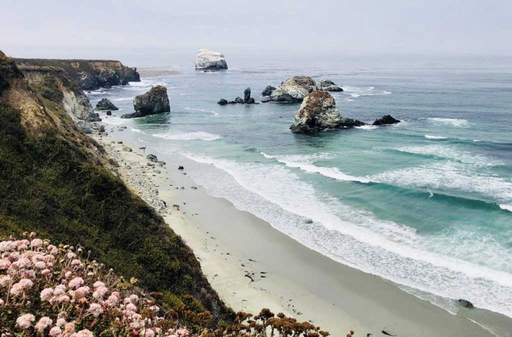
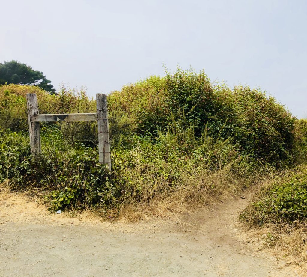
After you are done at Sand Dollar Beach, hike back to where you are parked and head further south for about 1/2 mile until you see a small pullout on the right side of Hwy 1. The trailhead to Jade Cove is unmarked, ostensibly to protect the area from overly ambitious jade seekers. Follow this trail straight back. Large jade boulders extend into the ocean and offshore you can see the picturesque 100-foot high Cave Rock, whose walls of jade are continuously pummeled by the crashing waves. As you near the ocean, follow the trail to the left through coastal grasses and wildflowers. You will pass three more boulders and then, when you see a pine tree, you are near the trail’s final descent to Jade Cove. The round trip hike is 1.5 miles.
The Unmarked Trailhead to Jade Cove Jade has been prized for thousands of years and was considered the “imperial gem” in China. It has been used throughout history for tools, weapons, jewelry and religious objects. It has even been used for its metaphysical properties; some people use it for a talisman, for feng shui, or practice “jade rolling” which is said to draw out negative energy and balance your chi. Jade Cove in Big Sur is the hang out for jade-a-holics who diligently search along the beach or even perform meticulous dives off the coast in search of the beautiful mineral. There is even an annual Big Sur Jade Festival held nearby. People come from all over the world to the three-day fall event to sell and showcase their work, ranging from tiny, delicate pieces of jewelry to huge slabs of stone harvested from the sea.
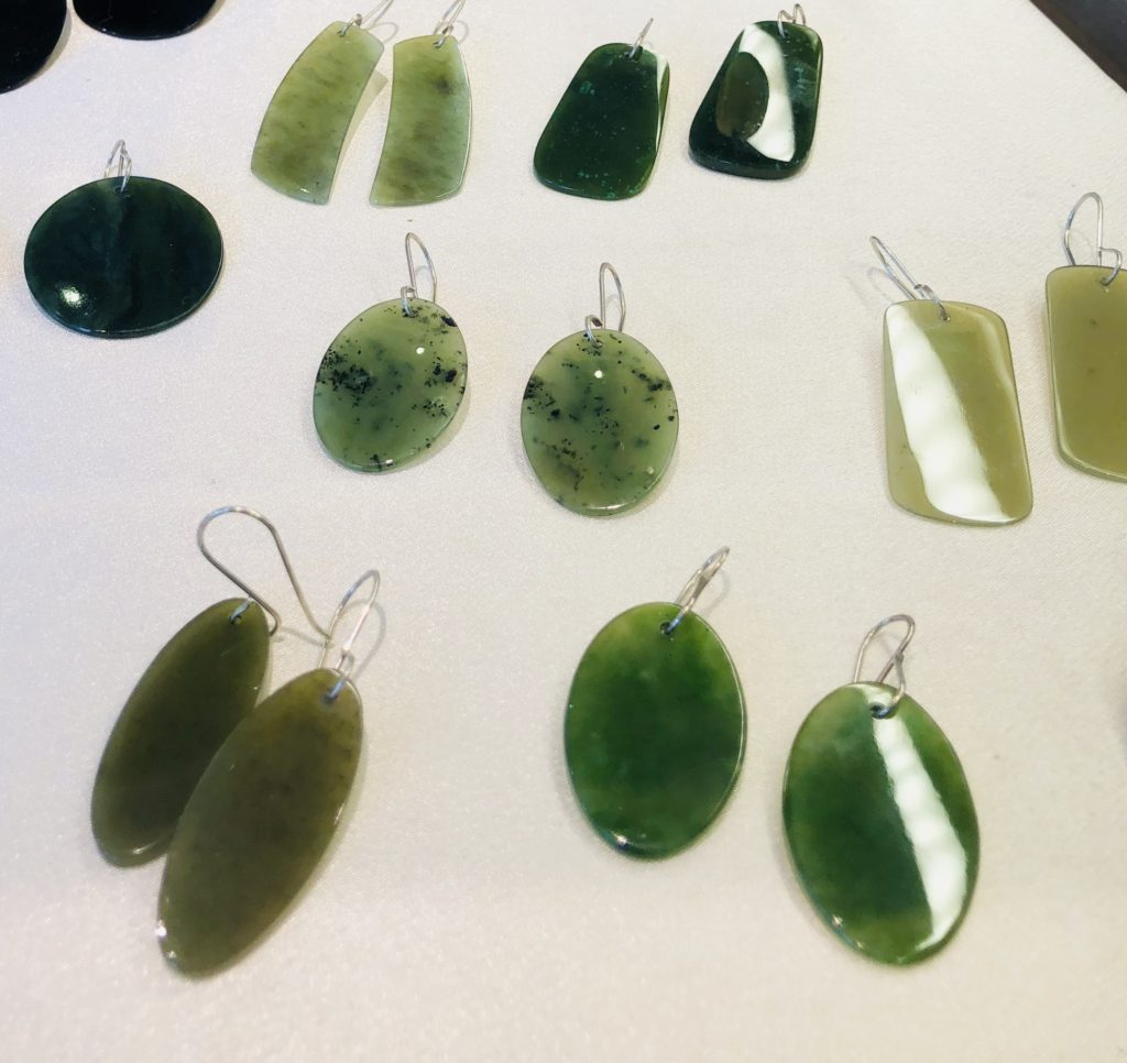
Jewelry made from Big Sur Jade; available at Nepenthe I recently met a girl running on the path to Jade Cove named Joy, who said she often finds jade there and makes it into jewelry which she occasionally sells at her mother’s shop in Pacific Grove, the Rabbit Hole. She kindly showed me what real Big Sur Jade looks like and when I returned home, I did additional research online for information that can help identify it. Apparently, the most problematic look-alike in the area is serpentine. The difference between serpentine and jade is that jade is much, much harder. How hard? If you scrape it with a pocket knife or can opener, serpentine will easily scratch, but jade will not. There are other tips offered including spitting on the stones, licking the salt off them, etc. I cannot vouch for any of these techniques.
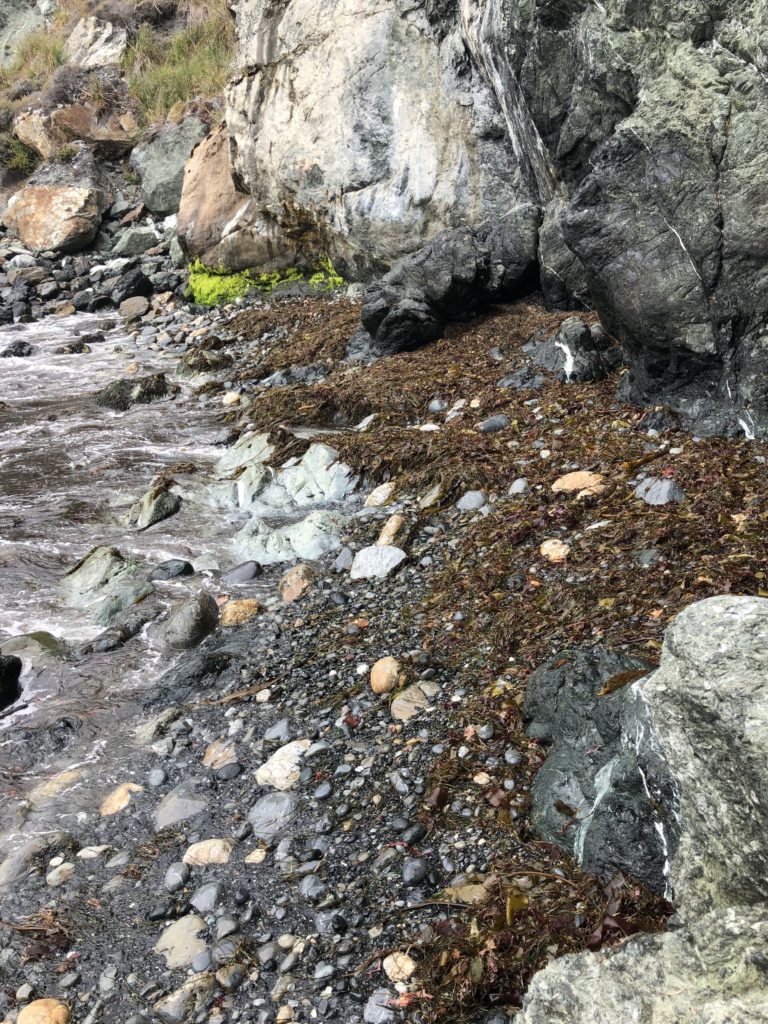
Who knows what the tide will bring in at Jade Cove! It is always a treasure hunt here. Be aware that there are regulations regarding removing jade from the area. 1. Only loose jade from submerged lands may be collected, from below the mean tide level. 2. No tools may be used except a hand tool to maneuver and lift the jade or scratch its surface to determine its authenticity. 3. Divers may use lift bags with a combined capacity of not more than 200 pounds. For more information on regulations see: montereybay.noaa.gov
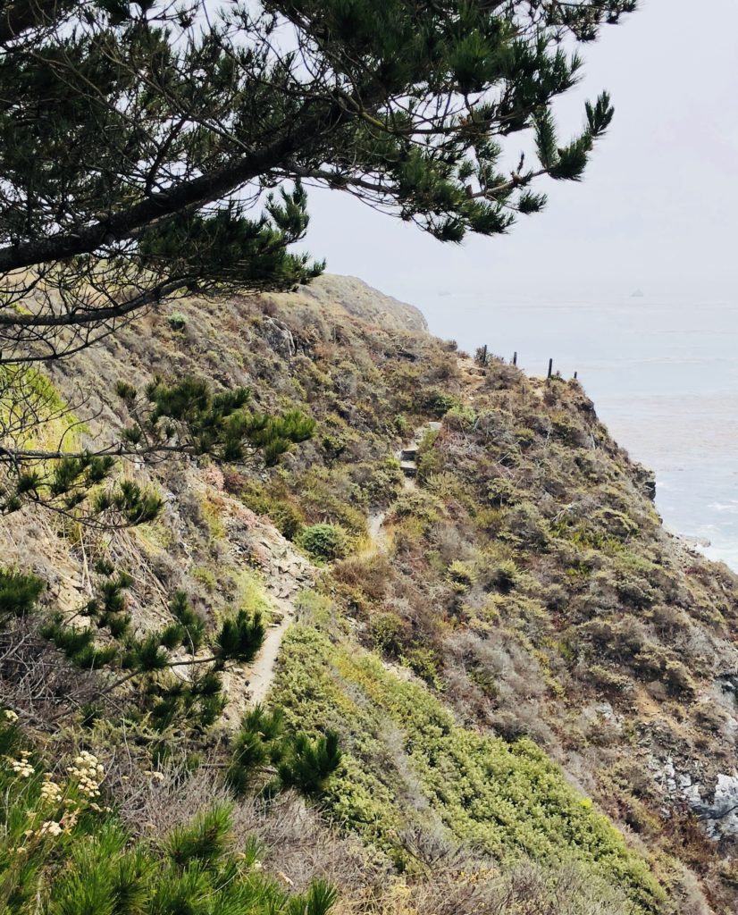
The Rambling Trail to Jade Cove Despite their rugged beauty, Jade Cove and Sand Dollar Beach can also be quite dangerous. Swimming and wading are not recommended due to dangerous rogue waves and strong rip currents. Hiking down the steep and at times slippery and ambiguous path to Jade Cove can also be a bit challenging and is not recommended for inexperienced hikers. There is a rope to hold onto at the bottom of the trail to facilitate a safe descent. Be sure to wear long sleeves, head covering and tick repellent if you will be hiking through the brush. The area is known for harboring ticks and people often leave with unintended guests, much to their chagrin.
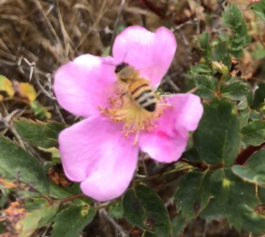
Wild Roses Growing Along the Jade Cove Trail To reach Sand Dollar Beach and Jade Cove, travel south approximately 60 miles from Rio Road in Carmel on Hwy 1 or 30 miles north of San Simeon. No camping is permitted except at Plaskett Creek Campground, located directly across Hwy 1 from the parking lot and also at nearby Kirk Creek Campground. A parking lot, picnic tables, and restrooms are available at Sand Dollar Beach, but there is a 10.00 fee to park there. If you camp at Kirk Creek or Plaskett Creek Campgrounds you can use the Sand Dollar Beach Day Use Area without paying the fee. There are also numerous turnouts nearby along Hwy 1 where you can park for free. Sand Dollar Beach and Jade Cove are open daily from sunrise-sunset and are day use only. Dogs on leashes are allowed. No bonfires are allowed on the beach.
Thank you for visiting my Blog! Wishing you peace, love, happiness & beautiful vistas!