-
Seven Best Places for Wildflowers in Monterey County!
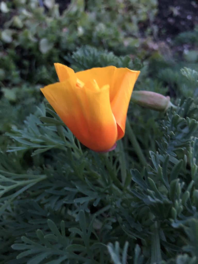
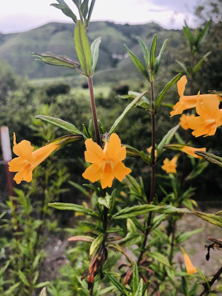
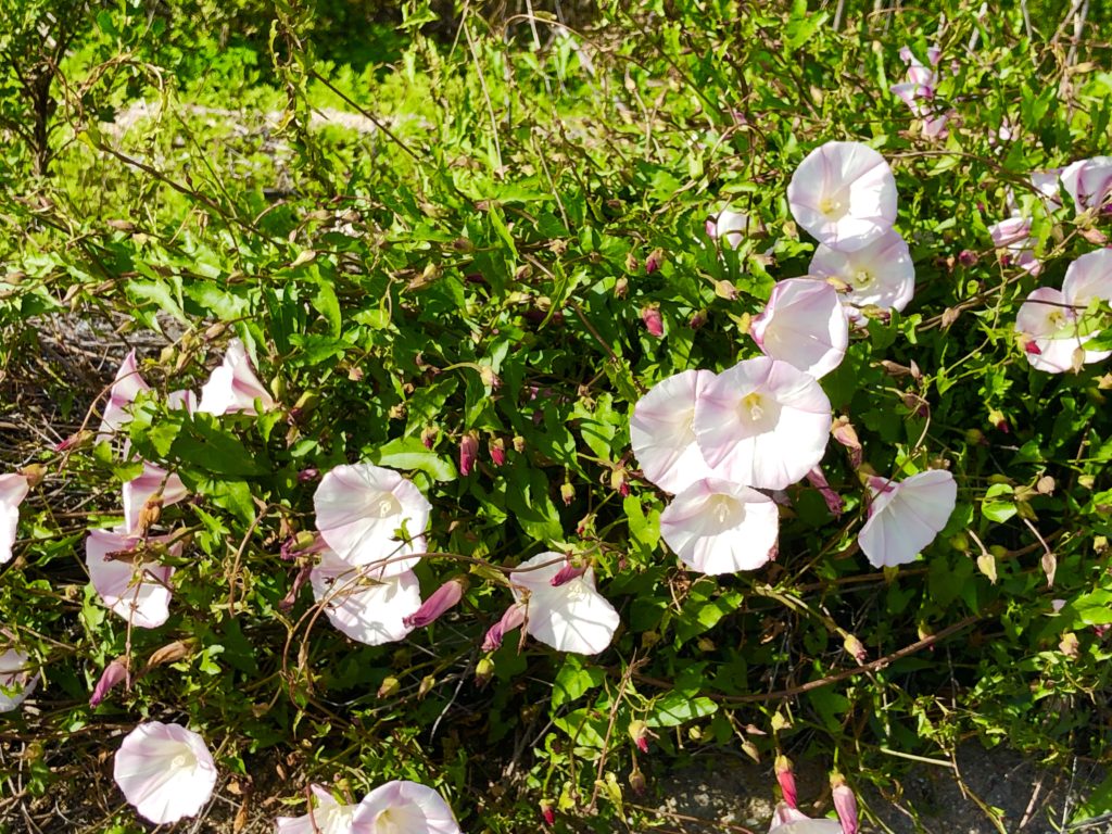
It’s spring in Monterey County, and that means wildflowers! As both a hiker and a flower lover, I am always excited this time of year to watch for the profusion of blooms. You can see nearly every color in the rainbow along the coastline, in the canyons, and everywhere in between. Here is a list of some of my favorite places to see wildflowers in my neck of the woods.1. Corral de Tierra. Located midway between Salinas and Monterey, Corral de Tierra is well known for its pastoral beauty. In the spring it features many beautiful wildflowers. There is an abundance of wildflowers along both Corral de Tierra and San Benancio roads as well as at my farm here, including morning glories, shooting stars, jonquils, and lupines. Corral de Tierra is an amazing place to hike and bike and admire these gorgeous blooms.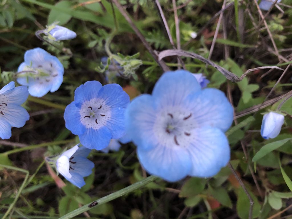
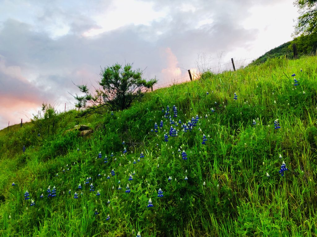
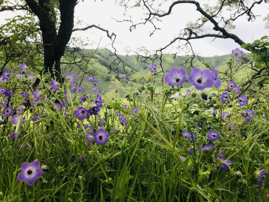
These heavenly blue flowers cover the hillside along the dirt road I live on. 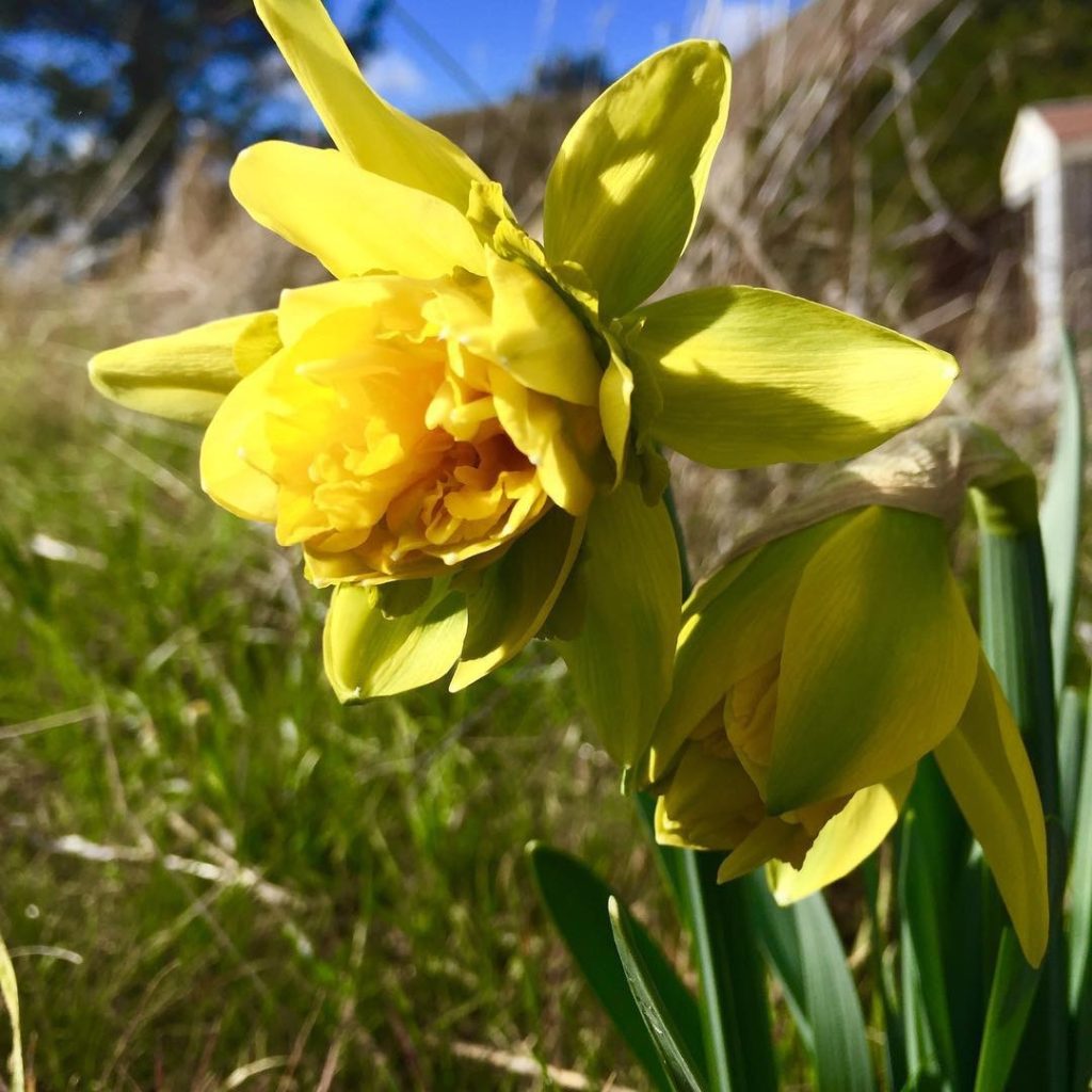
Wild jonquils appear at my farm every spring. “I will be the gladdest thing under the sun! I will touch a hundred flowers and not pick one.”–Edna St. Vincent Milay
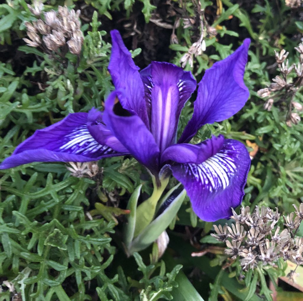
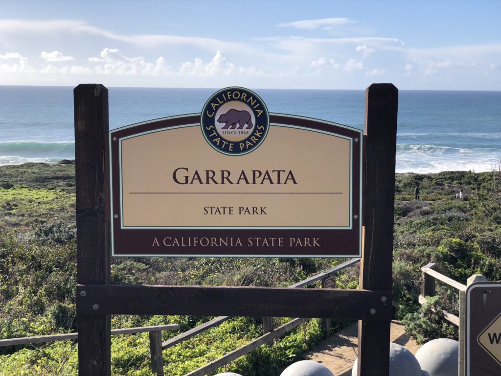
Wild lupines proliferate on the hillsides in Corral de Tierra. 2. Garrapata State Park, located off Hwy 1, is a heavenly place in springtime. You will not only be treated to amazing views of the coastline, but you will also see colorful wildflowers. During my recent visit, I spotted wild irises, poppies, and Indian paintbrush.
“To see a world in a grain of sand and a heaven in a wildflower” –William Blake.
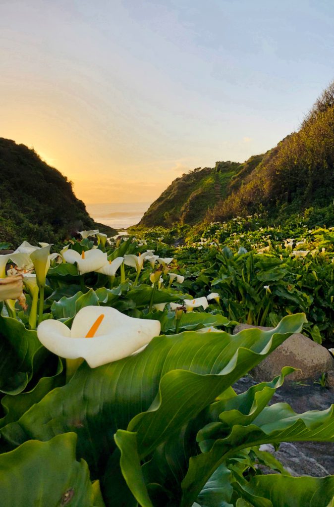
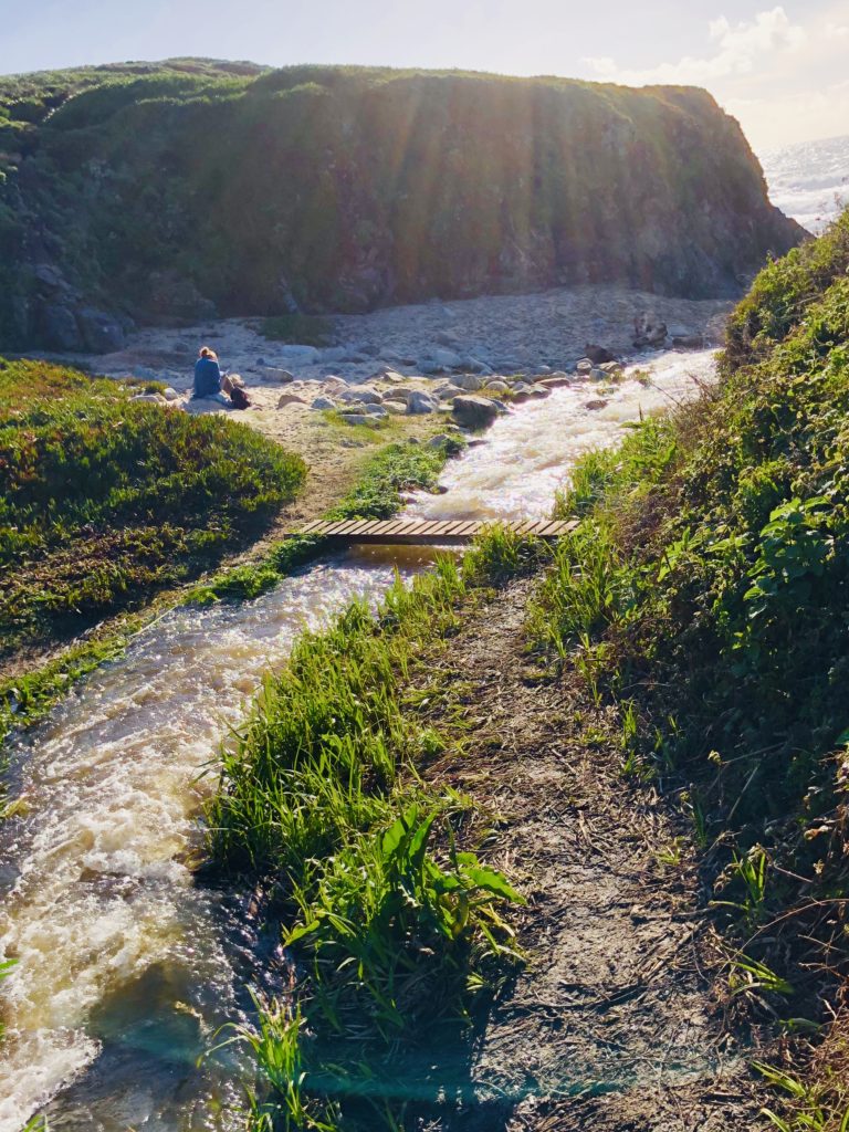
 3. Further south, follow meandering coastal trails to Calla Lily Valley. This magical place will soothe your senses. Calla lilies surround Doud Creek as it rushes into the ocean near a secluded beach.
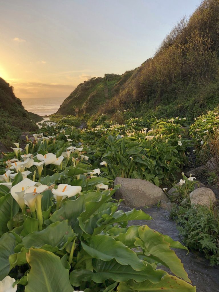 “I think I like wildflowers best,” I explain. “They just grow wherever they want. No one has to plant them. And then their seed blows in the wind and they find a new place to grow”–Rebecca Donovan
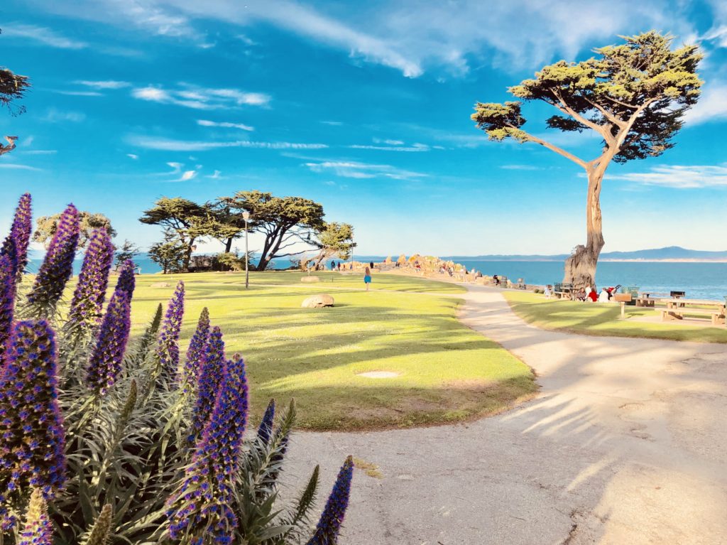
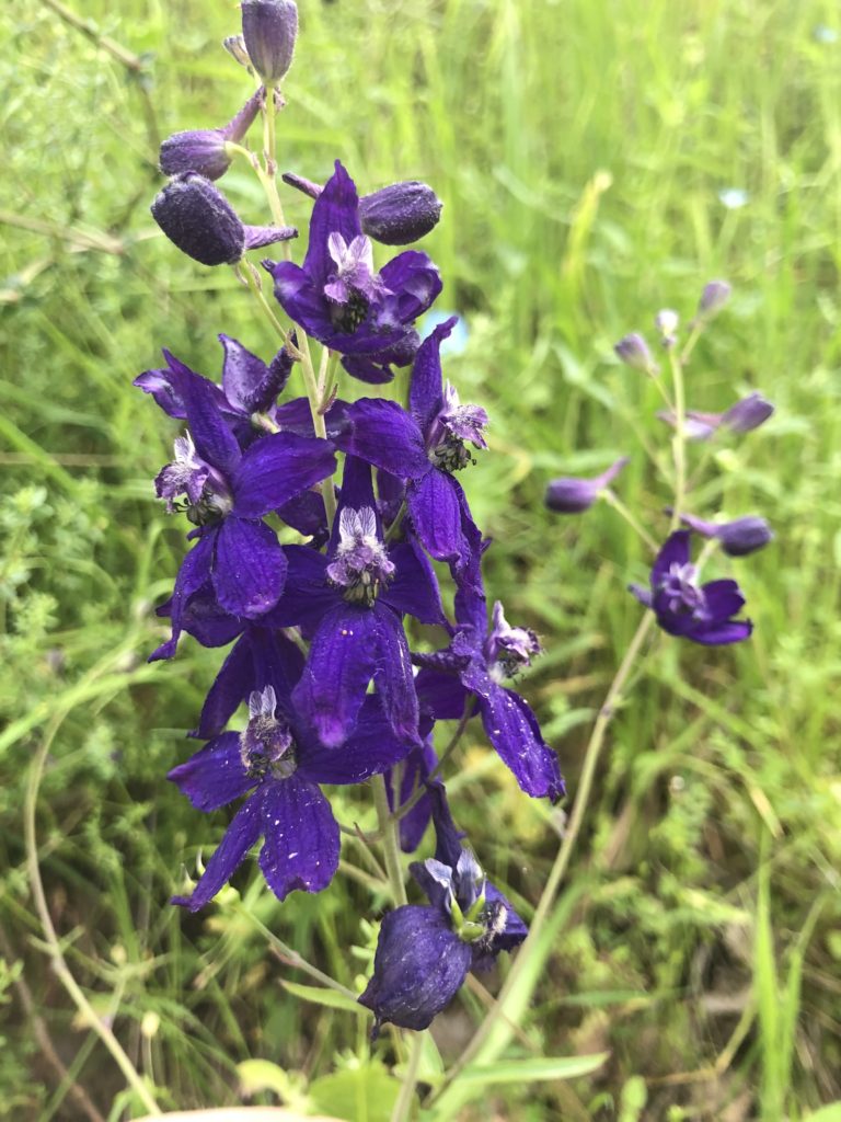 4. Asilomar Beach in Pacific Grove. Beginning in late March and early April, a profusion of ice plants form a brilliant carpet along the coastline here. If you want a truly amazing experience, start at Lovers Point and continue along the Monterey Bay Recreational Trail towards Pebble Beach. You will not be disappointed!
 5. Garland Ranch Park. The plethora of trails here offer hikes for every level from beginner to advanced. I have done many different hikes here and I can tell you that spring is a magical time to view wildflowers here. The Terrace trail, in the Garzas Canyon section of the park, is especially popular for monkey flowers and shooting stars.
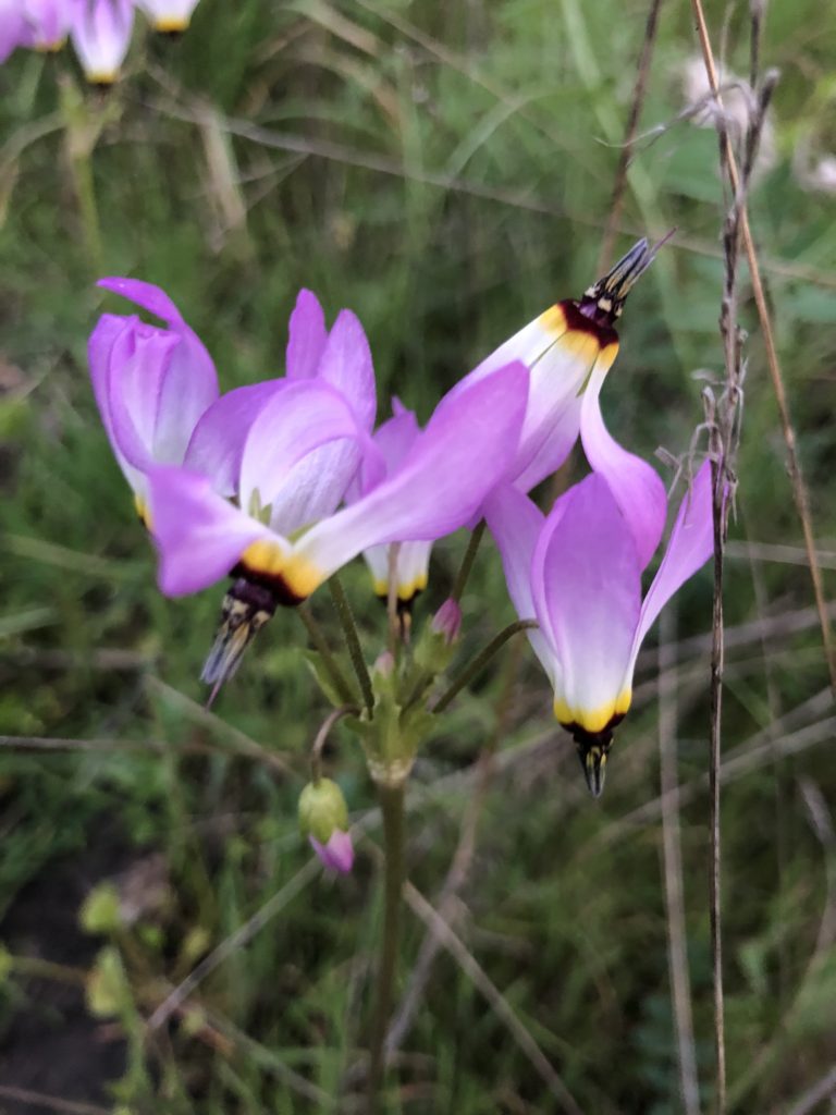
6. Fort Ord Park. This 7200-acre park is home to over 35 species of rare plants and animals, including a myriad of wildflowers. Hiking and biking are popular activities on the trails winding through this popular place, and it is a sure bet that you will spot some lovely wildflowers this time of year.
7. Toro Park. Located near Corral de Tierra off Highway 68, this park is also a great place to find wildflowers. Hiking and biking trails abound, offering spectacular vistas of the countryside and beautiful views of the emerging wildflowers.
“Love is like wildflowers; it’s often found in the most unlikely places.” –Ralph Waldo Emerson.
I hope that you are able to enjoy the beautiful wildflowers this spring! Thank you for visiting my blog. Wishing you peace, love, happiness & beautiful vistas!
-
Lovers Point: Legendary Park in Pacific Grove
 Featuring panoramic views stretching from Monterey to Pebble Beach, Lovers Point will bewitch you. Located in Pacific Grove, on the tip of the Monterey Peninsula, it is merely the icing on the cake. Pacific Grove is called “Butterfly Town, USA” because monarch butterflies return here year after year. It is also known as “America’s Last Hometown” because of the strong community spirit binding together this quaint Victorian town. It is home to the Asilomar Conference Center, Point Pinos Lighthouse, and also hosts the annual Feast of Lanterns. Additionally, it has been the setting for several films, most recently the “Big Little Lies” HBO series.
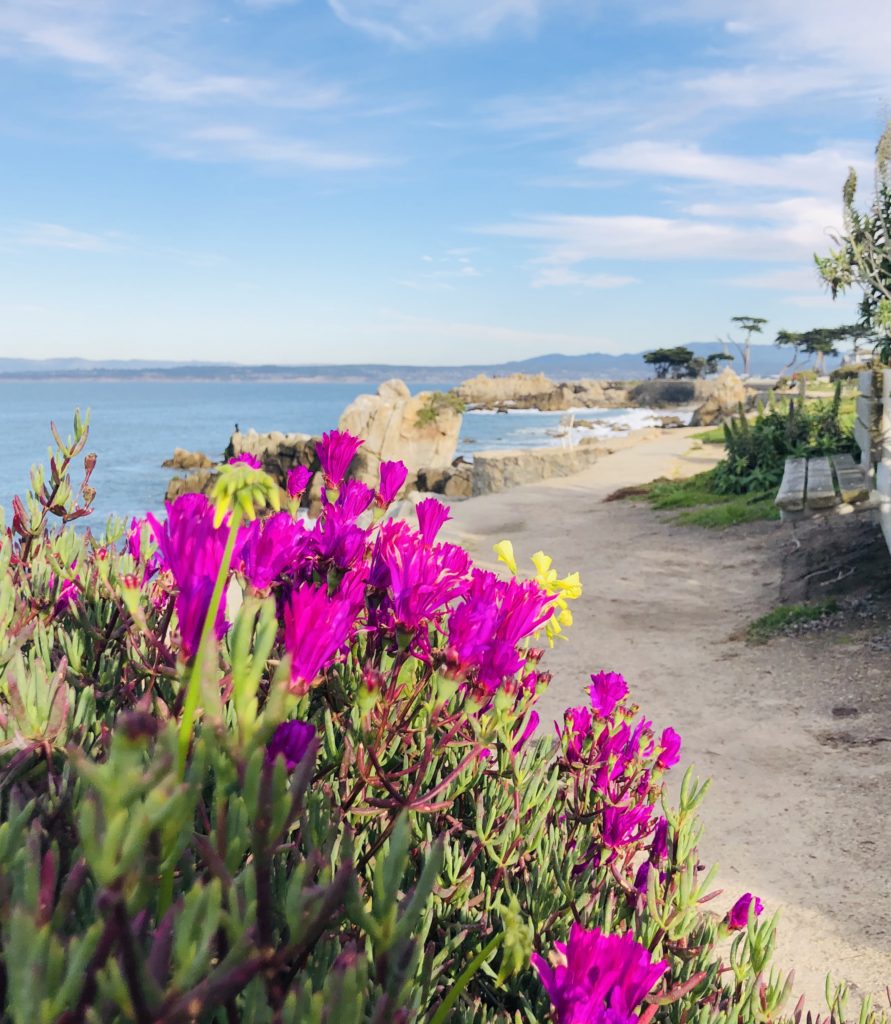 Lovers Point is a dalliance between land, sea, and sky that never fails to charm. Its natural beauty has been an inspiration for decades. In the 1890s, the area was an artist’s haven. At that time, a movement seeking to create art in outdoor settings in natural light and weather conditions, called en plein air, was the rage. The movement, which started in France, soon swept through Europe and expanded to the United States beginning in California. Today, you may still see plein air artists set up with their easels and paints.
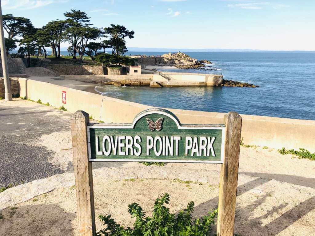
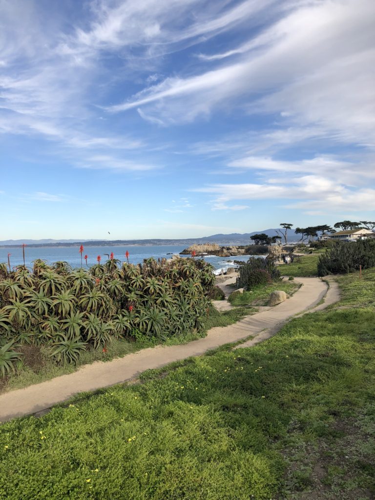
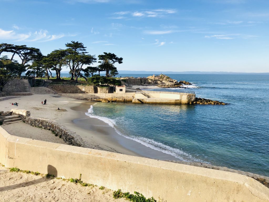
Lovers Point is a place to experience not only beauty but also adventure. The park consists of 4.4 acres. Sand volleyball, rock climbing, surfing, kayaking, biking, scuba diving, paddle boarding, snorkeling and strolling along the ever-popular waterfront coastal trail are just some of the fun things to do here. The coastal trail stretches for 18 miles, from Castroville in the north to the far tip of Asilomar Beach in the south. It follows the path of the now defunct Southern Pacific Railroad.
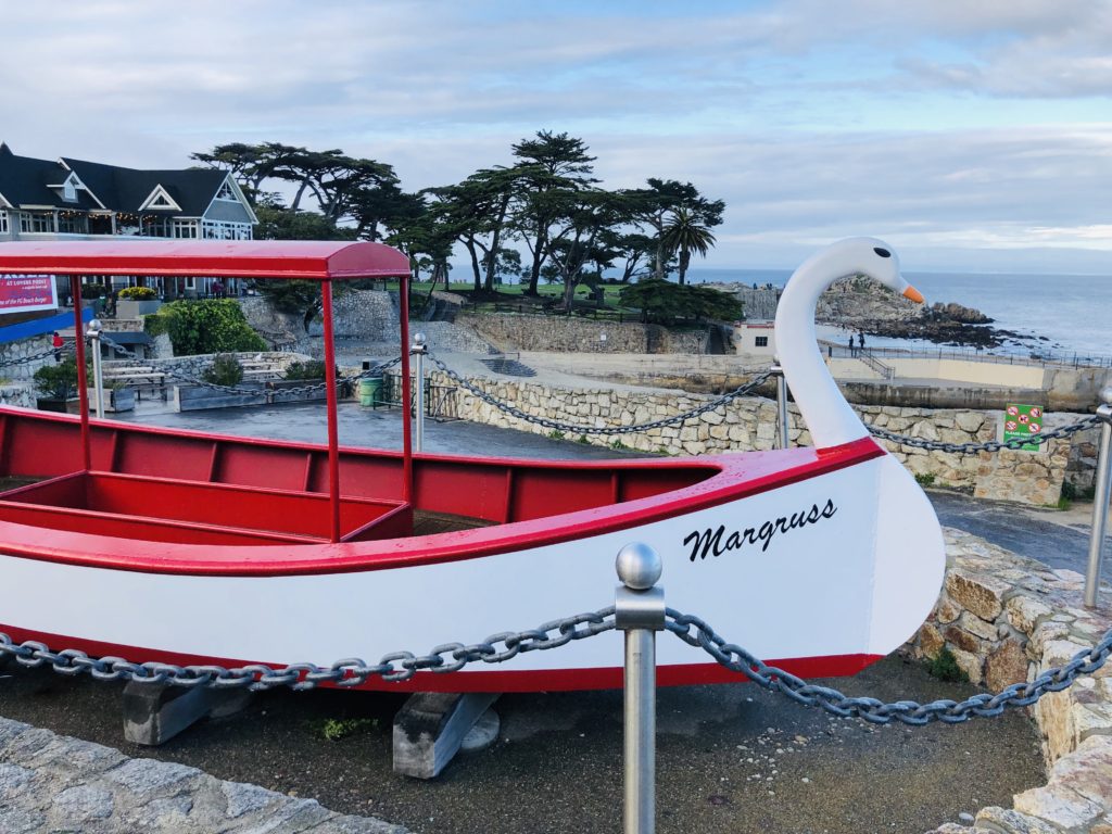
Located above a sand volleyball court is one of the last remaining swan boats from Lover’s Point. The swan boats of Pacific Grove were originally introduced in the 1890s to enable visitors to explore the area by sea. The swan boat fleet was owned and operated by Nathanial “Dad” Sprague for more than 50 years. The boats were then operated by a variety of owners until the mid-1970s.
The beach at Lovers Point faces west and has a concrete wall and breakwater, making it one of the few safe swimming places in the area and popular for families and children. Be advised, however, that the water here is very chilly year round.
 Lovers Point State Marine Reserve, created in 2007, lies directly offshore Lovers Point Park. It is one of four marine protected areas on the Monterey Penisula. It includes a variety of wondrous flora and fauna including kelp forests, sea otters, harbor seals, pelicans, cormorants and more.
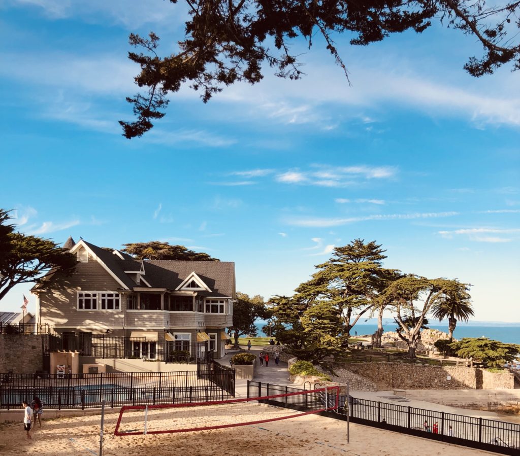
Helpful Tips:
- Numerous benches, BBQ grills and picnic tables are available.
- Fishing is prohibited in the Lovers Point State Marine Reserve.
- Bikes, kayaks, surreys, paddleboards, scuba diving gear, surfboards, and other rentals are available at Lovers Point by Adventures By The Sea.
- Nearby restaurants include The Beach House and The Grill at Lovers Point.
- Public restrooms are available.
Thank you for visiting my blog! Wishing you peace, love, happiness & beautiful vistas!
-
Calla Lily Valley’s Springtime Beauty
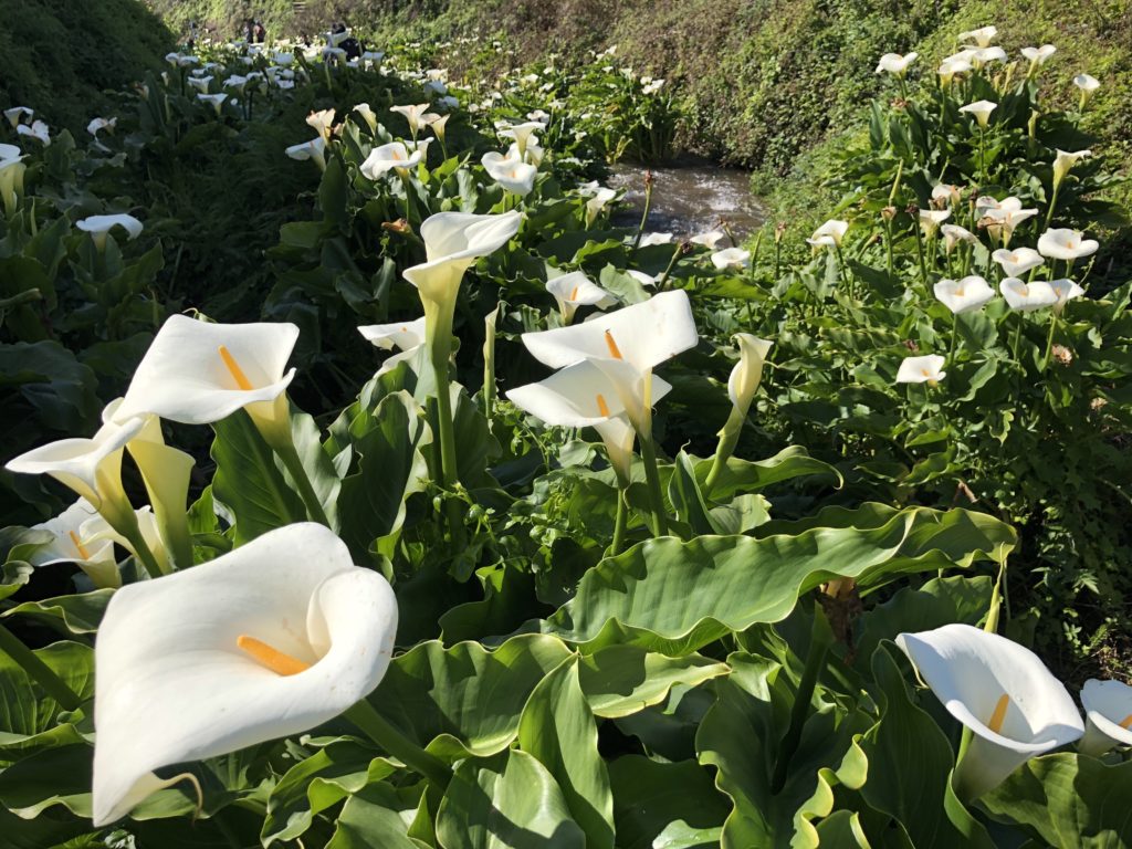
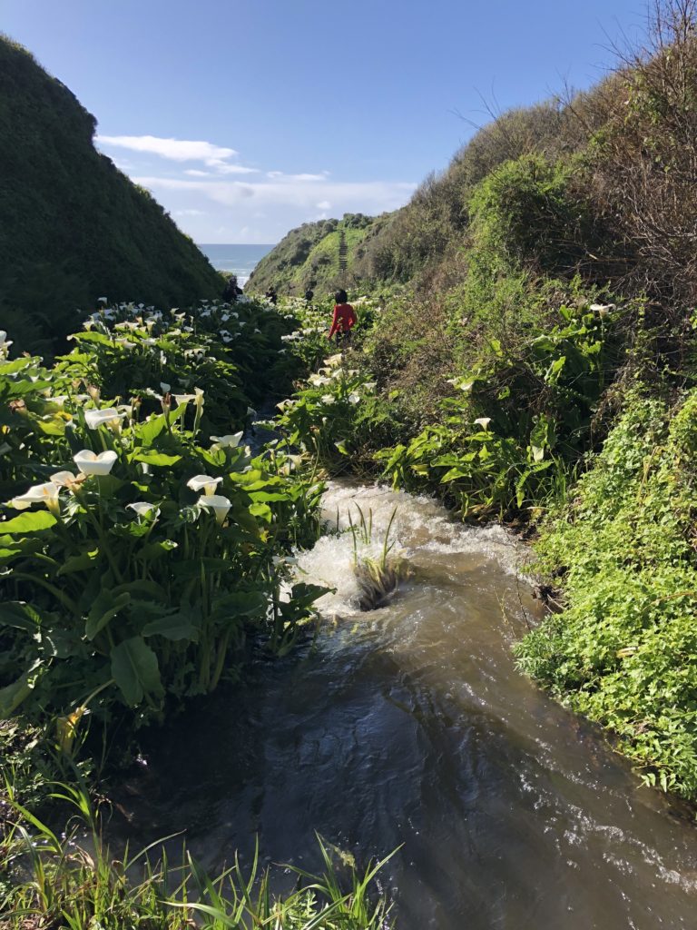
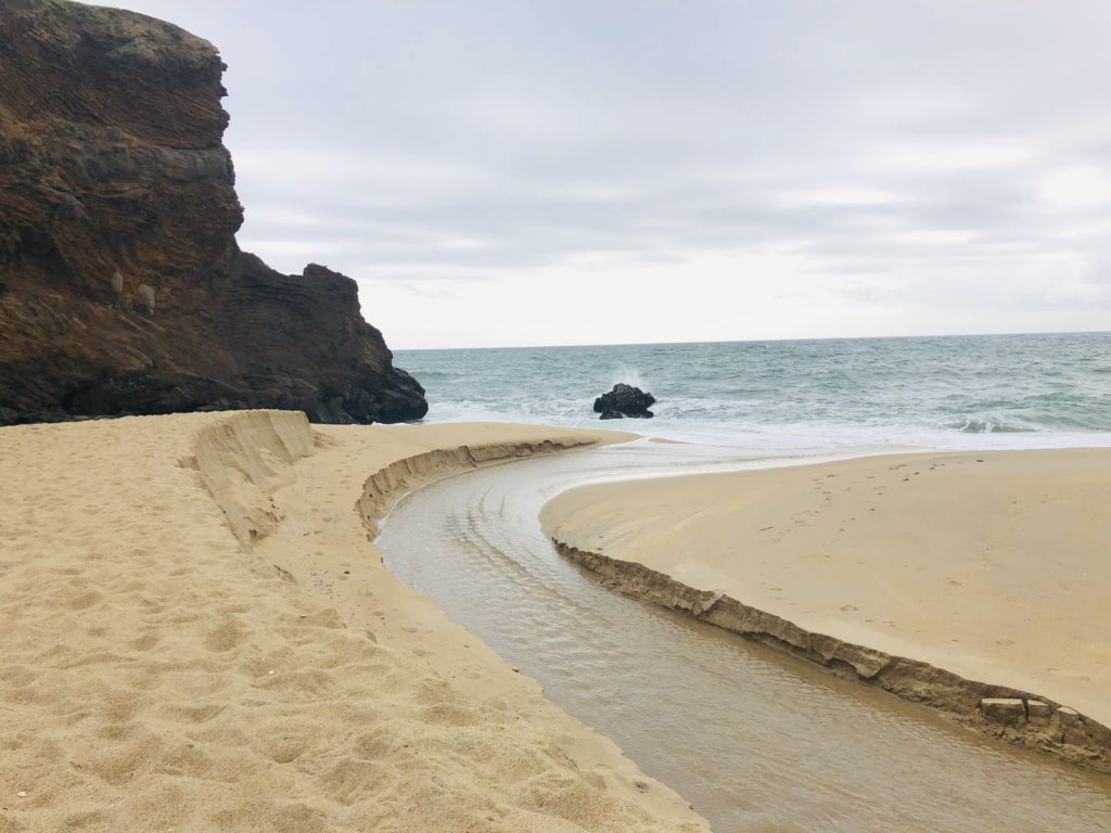
Calla Lily Valley is nestled amidst a ravine surrounding Doud Creek as it rushes down to the ocean. It is directly across Hwy 1 from the historic Doud Ranch and is technically part of Garrapata State Park. It is named for the captivating and graceful calla lilies that appear here in the spring, usually in late February to early March.
Calla is a name of Greek origin meaning “beautiful”. In the language of flowers, white calla lilies symbolize marital bliss and devotion—which may be why they are often featured in wedding bouquets. They are also used to express sympathy. There is just something about white calla lilies that affects your psyche. White is often associated with purity, innocence, light, goodness, simplicity, illumination, cleanliness, beginnings, spirituality, possibility, sincerity, protection, and perfection.
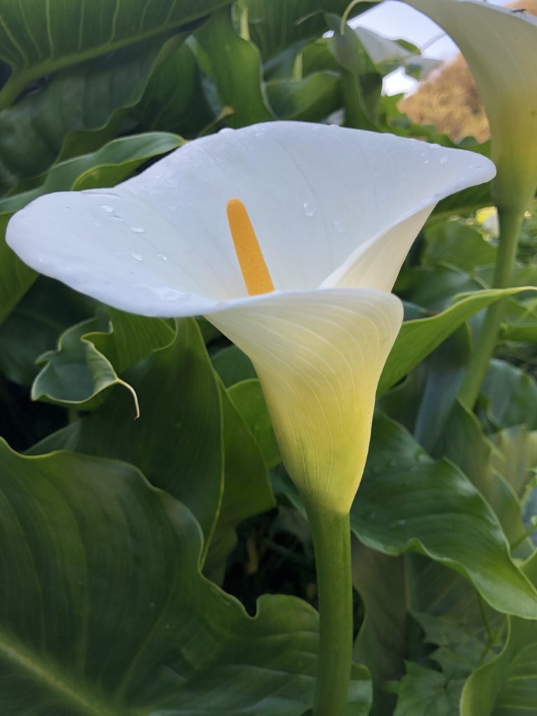
The flower is native to Africa and consists of a spathe, the outer part of the flower, and the spadix, the yellow spike in the center. 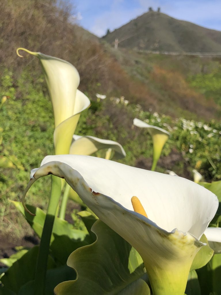
Calla Lilies grow from rhizomes that reproduce prolifically, making them a symbol of fertility and plenty. They are extremely hardy and semi-aquatic, making it no surprise that they are abundant around Doud Creek!
You can access Calla Lily Valley via two entrances. The first, shortest (.5 miles) and easiest route is at gate 18. The second, longer and more challenging route is at gate 19 where the Garrapata sign is located. You may park on the ocean side of Hwy 1.
It seems pretty banal walking along the pathways, until you come to the valley and suddenly, there they are! The luminous proliferation of snow-white blossoms overwhelms you with their color and scent.
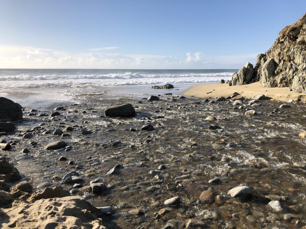
If you follow the creek to where it empties into the ocean and turn left, you will see beautiful Garrapata Beach with a myriad of sea stacks, dramatic waves, and extensive sea-washed pieces of driftwood.
Helpful Tips:
- Parking is available along the dirt pullout at Gate 18 and Gate 19 for Garrapata State Park, near mile-marker 63.
- Wear old shoes or rain boots as it can be quite muddy and wet on the creek banks.
- The best time to visit is during the week as it can be crowded on weekends.
- Wading or swimming in the ocean is not recommended due to dangerous waves and rip tides.
I hope you get to see Calla Lily Valley! Thank you for visiting my blog. Wishing you peace, love, happiness, & beautiful vistas!
-
Panther & Hole-in-the-Wall Beach
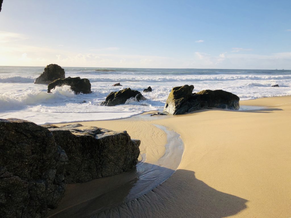
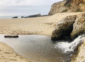
 The minute you set foot on idyllic Panther Beach you will be mesmerized by the magical sights and sounds. Sunlight glistens on the sand, seagulls hover on the ocean breeze, and majestic waves splash and crash rhythmically onto the beach. Secluded and private, Panther Beach will entice you with its beauty. It features not only a magnificent walk-through sea cave, but also a rushing seasonal waterfall. The waterfall cascades from the base of a cliff to form a waterway that wends its way down the beach to the sea.
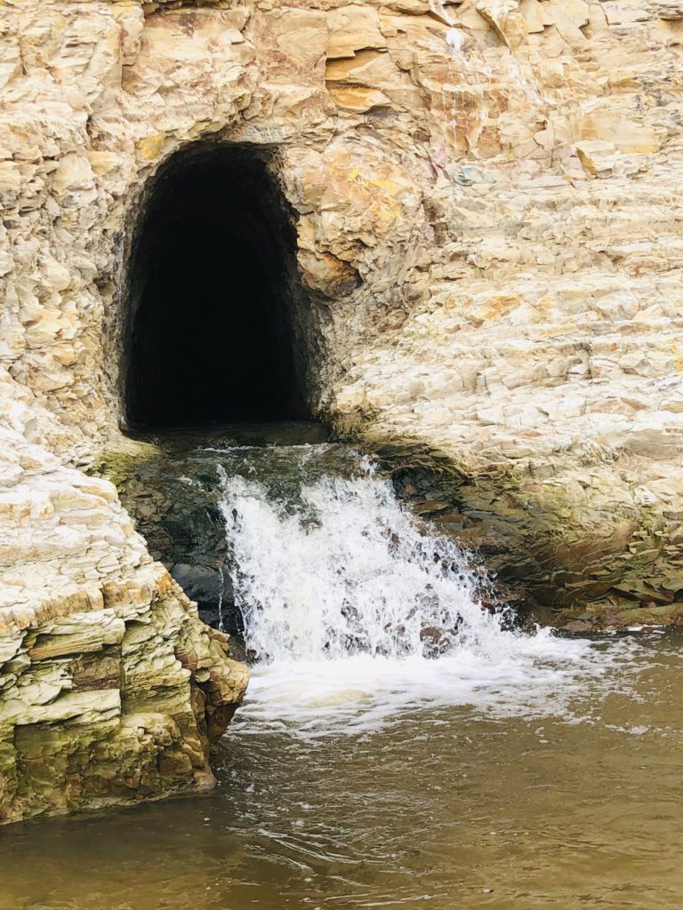
Panther Beach and Hole-in-the-Wall Beach are part of the Coast Dairies State Park, which spans about a six-mile segment west of Hwy 1 in Santa Cruz County, north of Santa Cruz and south of the small town of Davenport. Coast Dairies State Park also includes Bonny Doon, Laguna Creek, Davenport Landing, Shark Fin Cove & Beach, and Scott Creek Beach.
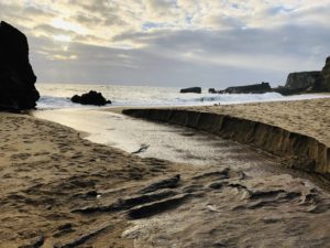
The creek cuts a path through the sand and into the sea. 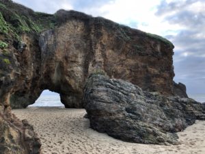
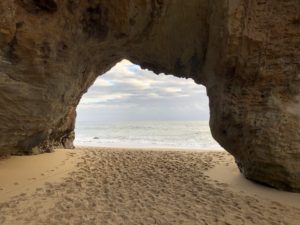
Behind a rugged stone wall on the south end of Panther Beach, a sea cave leads you to secluded Hole-in-the-Wall Beach. At high tide, it is difficult as well as dangerous to access due to strong surf. If you enter Hole-in-the-Wall Beach at low tide, be mindful of the tides because you could be trapped if the high tide comes in unexpectedly. This is the only way in and the only way out.
The ocean stirs the heart, inspires the imagination, and brings eternal joy to the soul.–Wyland
Hole-in-the-Wall Beach is accessible at low tide. Nothing soothes the soul like a day by the ocean. This beach is such an inspiring and joyful place to relax and rewind. It is a great place for beachcombing, rock climbing, sunbathing, photography, and hiking Be aware that the trail leading down to the beach is steep and moderately challenging and may be too difficult for inexperienced hikers. Also, during the spring rainy season, it can be muddy and slippery.
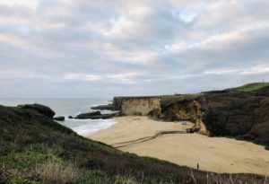
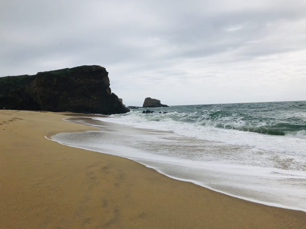
The view from above Panther Beach. Where:
Panther Beach and Hole-in-the-Wall Beach are located off Hwy 1 north of Santa Cruz at mileage marker 26.5, approximately two miles south of Davenport.
Helpful Hints:
- Hours are 8 am to sunset.
- Parking is available on an unmarked, elevated dirt area between Hwy 1 and the railroad tracks on the ocean side.
- No horses, vehicles, fires, glass, camping or alcohol is allowed.
- Be aware of the tides as high tides can cause entrapment.
- Swimming is not advised due to rip currents.
- To avoid crowds, try visiting during the week, when it is generally deserted
- Be respectful and pack your garbage in and out. Do not leave your refuse on the beach for others.
I hope you get the chance to visit this beautiful area! Thank you for visiting my blog. Wishing you peace, love, happiness, & beautiful vistas!