-
Calla Lily Valley’s Springtime Beauty
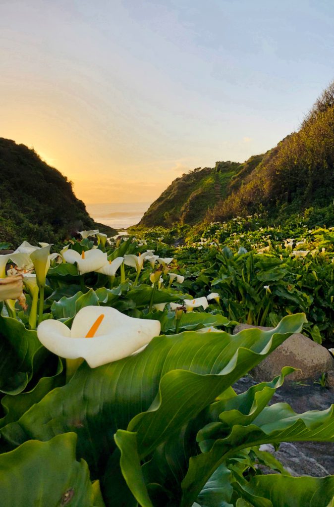
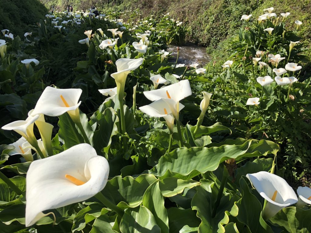
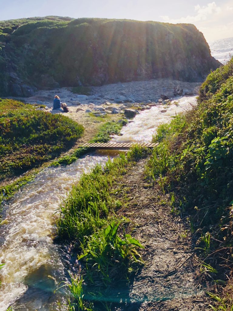
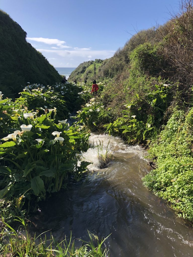
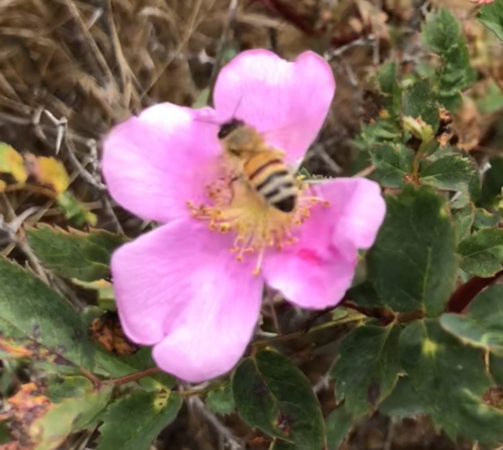
Calla Lily Valley is nestled amidst a ravine surrounding Doud Creek as it rushes down to the ocean. It is directly across Hwy 1 from the historic Doud Ranch and is technically part of Garrapata State Park. It is named for the captivating and graceful calla lilies that appear here in the spring, usually in late February to early March.
Calla is a name of Greek origin meaning “beautiful”. In the language of flowers, white calla lilies symbolize marital bliss and devotion—which may be why they are often featured in wedding bouquets. They are also used to express sympathy. There is just something about white calla lilies that affects your psyche. White is often associated with purity, innocence, light, goodness, simplicity, illumination, cleanliness, beginnings, spirituality, possibility, sincerity, protection, and perfection.
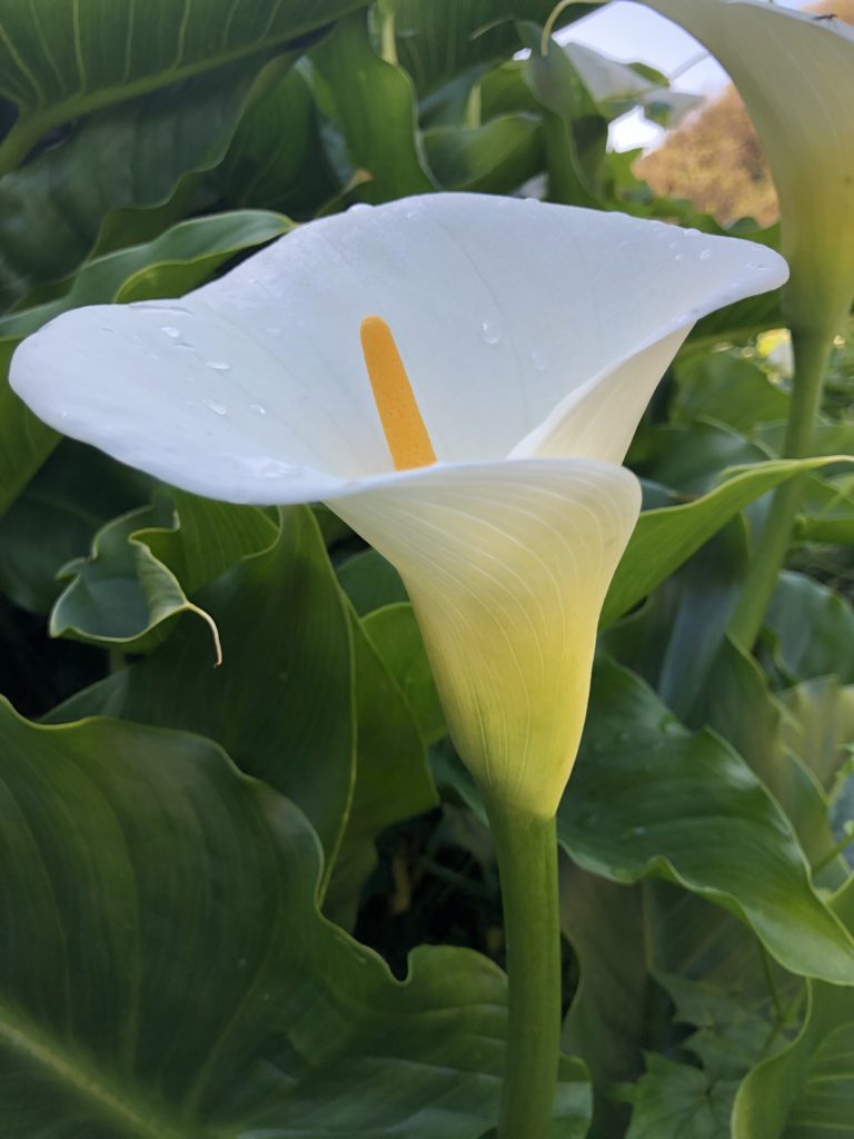
The flower is native to Africa and consists of a spathe, the outer part of the flower, and the spadix, the yellow spike in the center. 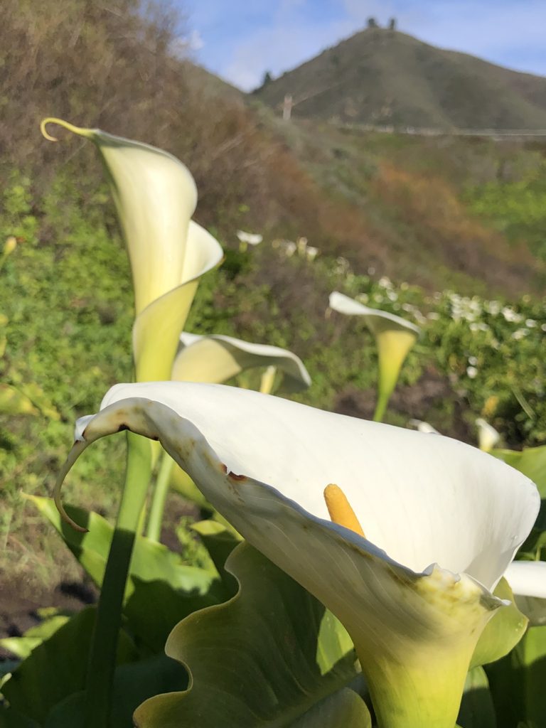
Calla Lilies grow from rhizomes that reproduce prolifically, making them a symbol of fertility and plenty. They are extremely hardy and semi-aquatic, making it no surprise that they are abundant around Doud Creek!
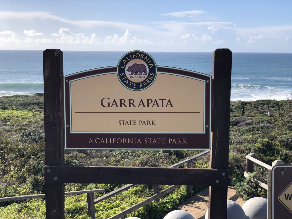
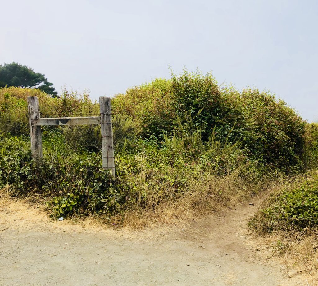
You can access Calla Lily Valley via two entrances. The first, shortest (.5 miles) and easiest route is at gate 18. The second, longer and more challenging route is at gate 19 where the Garrapata sign is located. You may park on the ocean side of Hwy 1.
It seems pretty banal walking along the pathways, until you come to the valley and suddenly, there they are! The luminous proliferation of snow-white blossoms overwhelms you with their color and scent.
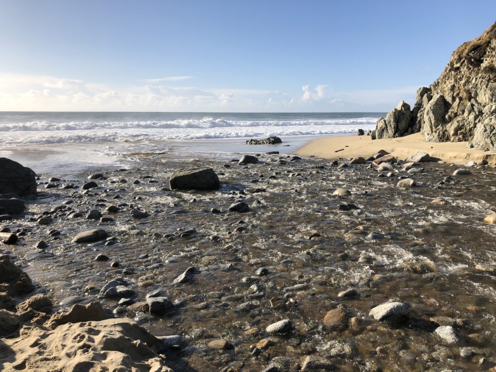
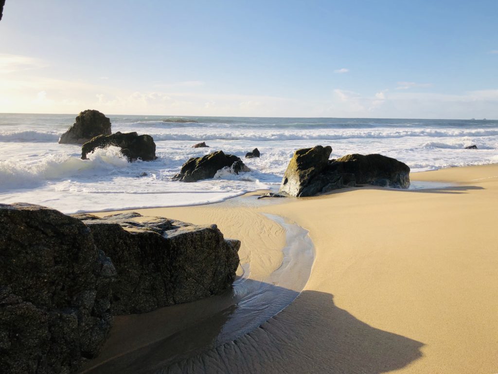
If you follow the creek to where it empties into the ocean and turn left, you will see beautiful Garrapata Beach with a myriad of sea stacks, dramatic waves, and extensive sea-washed pieces of driftwood.
Helpful Tips:
- Parking is available along the dirt pullout at Gate 18 and Gate 19 for Garrapata State Park, near mile-marker 63.
- Wear old shoes or rain boots as it can be quite muddy and wet on the creek banks.
- The best time to visit is during the week as it can be crowded on weekends.
- Wading or swimming in the ocean is not recommended due to dangerous waves and rip tides.
I hope you get to see Calla Lily Valley! Thank you for visiting my blog. Wishing you peace, love, happiness, & beautiful vistas!
-
Foraging for Fungi in Beautiful Big Sur
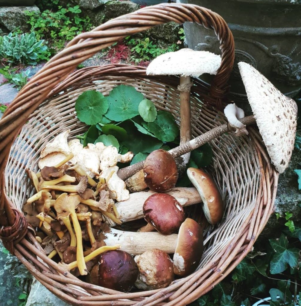 January is peak mushroom season in central coastal California. Each year the Big Sur area hosts a four-day Foragers Festival to raise money for the Big Sur Health Center, a non-profit facility that provides much needed local medical services. Multiple well-known restaurants and renowned chefs create magical meals featuring wild ingredients foraged in Big Sur paired with delicious local wines and beers. There are also raffles, auctions, and a “Fungus Face-Off”, which pits local chefs against each other in a cooking competition featuring fungi. While I have been known to consume mushrooms on my pizza and occasionally partake of portobellos I must admit that my knowledge of mushrooms is rather scant. Mushrooms are ubiquitous at my farm and I always wonder if they are edible or poisonous, so when I saw that the festival included foraging hikes led by fungi experts, I jumped at the chance.
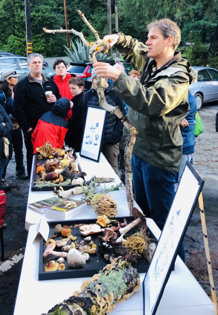
The hikes were led by Todd Spanier, who truly is a walking encyclopedia of knowledge as well as a talented chef. I liked that he could not only identify wild plants and fungi, but also explain how they could be used for culinary purposes. He explained that he started learning about mushrooms from his Italian grandfather when he was only five years old. Todd owns a company called “King of Mushrooms” which provides wild foraged foods to many local restaurants and businesses. He is considered to be a pioneer of the sustainable and wild food movements in California. If you would like to join Todd or other experts to learn about wild edibles, see Wild Food Walks.
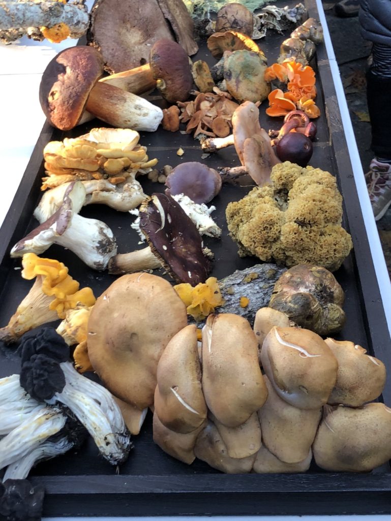
The Good (Edible) Fungi. 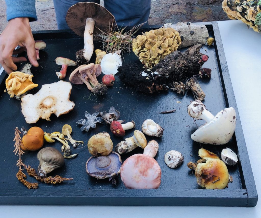
The Bad (Won’t Kill You But Yucky) Fungi. I learned that the biggest threat to fungi is not over picking, but rather, destruction of their habitat. I also learned that you can touch poisonous fungi and not worry about getting sick, that the only way to become ill is if you ingest the mushroom. Stories were also related regarding people from Asia and Russia coming to California and picking and eating mushrooms that looked identical to those in their original countries but which were toxic and poisonous. You can imagine the dire consequences. Yikes!
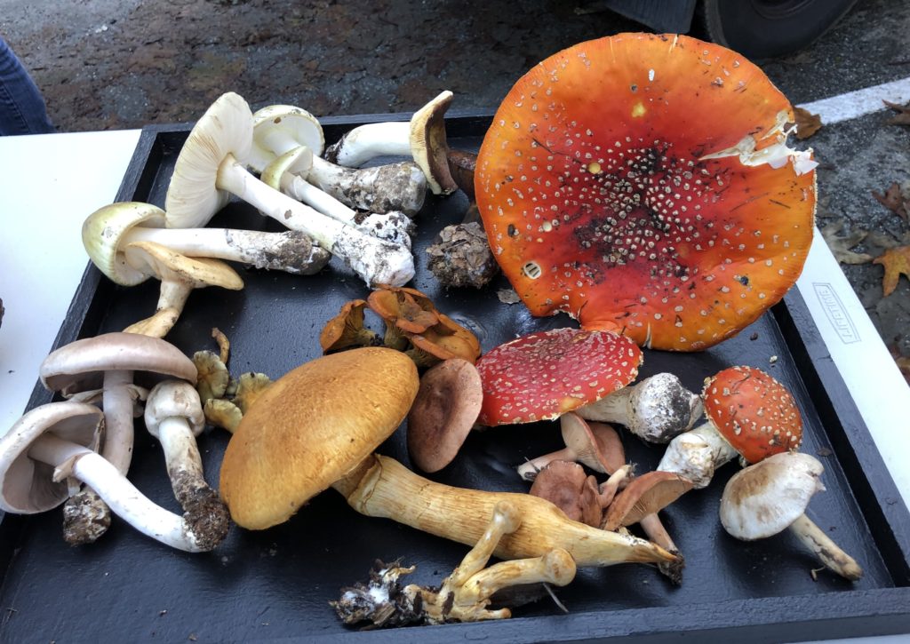
And the Ugly (Poisonous) Fungi. 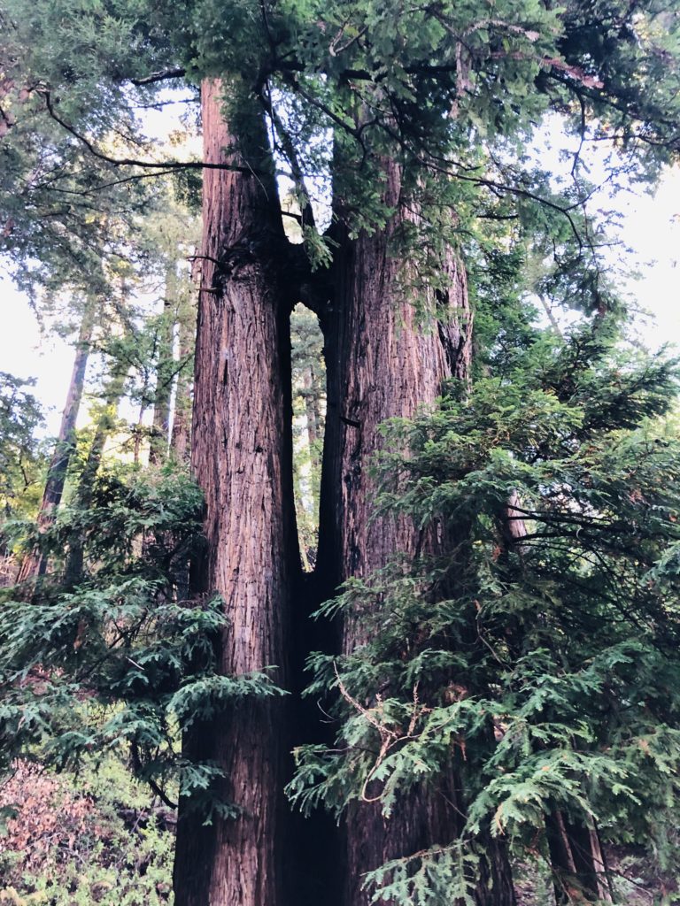
Conjoined redwoods along the way. It was a beautiful, sunny day as we entered the Big Sur forest following days of rain. We passed gorgeous copses of redwoods, bay laurels, and canyon oaks. Lauren, another of our guides, was very knowledgeable regarding edible items and pointed out horsemint, miner’s lettuce, and redwood sorrel.
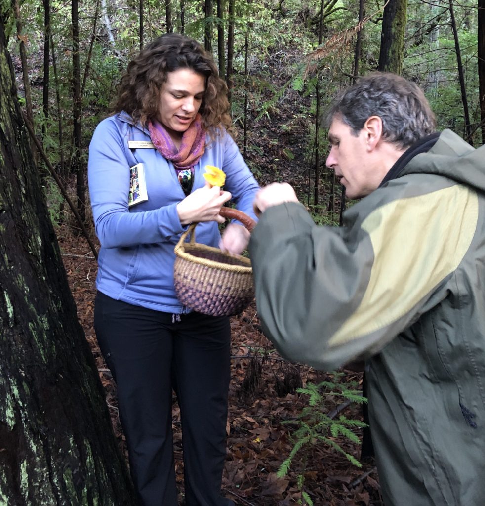
Lauren & Todd identifying our finds. 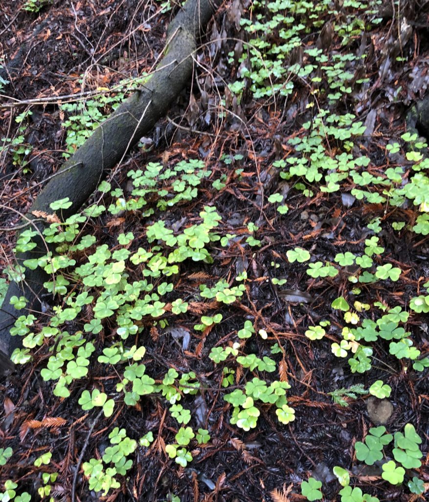
Redwood sorrel tastes like a tart green apple but should only be eaten in small quantities due to oxalic acid. 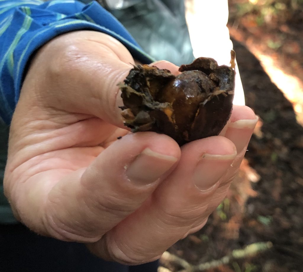
This is a nut, unfortunately, I do not remember the name! As many of you may know, I have a word obsession. I love learning new words, wordplay, etc. So, of course, I was stoked when I started learning about all the amazing fungi out there! Scientific nomenclature is interesting, but who can beat names like “Witches Butter”, “Candy Caps”, “Turkey Tails”, and “Slippery Jacks”?
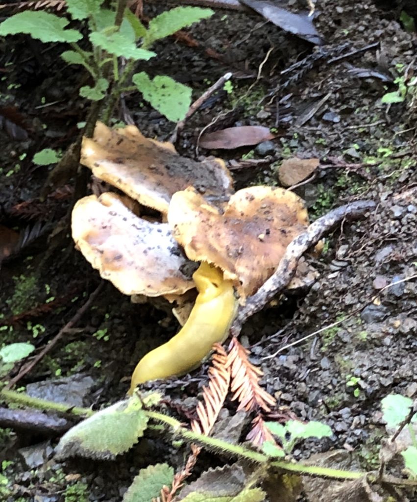
A banana slug feasts on honey mushrooms. Banana slugs were everywhere. Imagine my surprise when I learned that some younger males were licking them! I asked one kid why, and he said “licking a banana slug numbs your tongue and is a rite of passage.” Ewwwww. Boys are just weird.
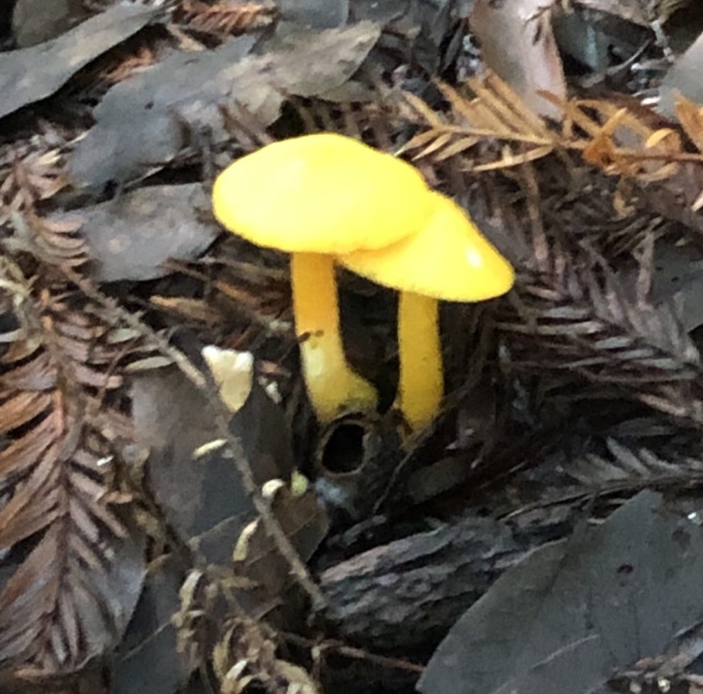
We saw many of these “Waxy Caps” on our hike. 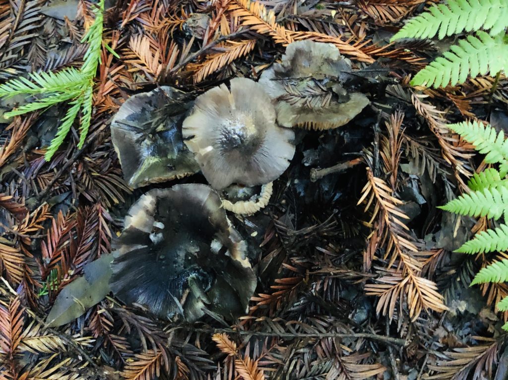
These “Black Knight” mushrooms were once popular in Europe but eating them over time can cause a toxic reaction. Avoid! Todd’s Takeaways:
- “Do not believe what you see on the internet.”
- “Do not eat mushrooms raw, you can get sick.” He stated that cooking mushrooms also enhances their nutritional value.
- “Know the tree, know the mushroom.” He said you can often tell what a mushroom is according to the tree it grows on or near.
- “Never eat a mushroom unless you are 100% sure of what it is”. There are some look-alikes that can befuddle even seasoned fungi seekers.
- “Use guidebooks to help identify fungi”.
Todd ended his hike by telling us “it doesn’t matter where we’re from, mushrooms connect us to nature and to our ancestry.” I for one would love to learn more and will be perusing my local library and also attending more foraging hikes. The best way to learn is from people who know their stuff, right? Whether you are a foodie, a nature lover, interested in sustainability, or just find the idea of foraging for wild mushrooms fascinating, you will enjoy this amazing experience. I can’t wait to try out more activities at the Big Sur Foragers Festival next year! For more information on this unique event, see Festival.
Thank you for visiting my blog! Wishing you peace, love, happiness, and beautiful vistas!
-
Ragged Point: Gateway to Big Sur
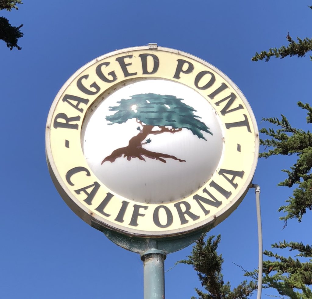 Known for its breathtaking views from its perch 400 feet above the wild Pacific coastline, Ragged Point Inn is often called the gateway to Big Sur. Ragged Point consists of not only an Inn, but also a cafe, restaurant, gift shop, mini mart, ice cream parlor, and gas station. It is basically a self-sufficient little community in the remote wilderness that is Big Sur.
 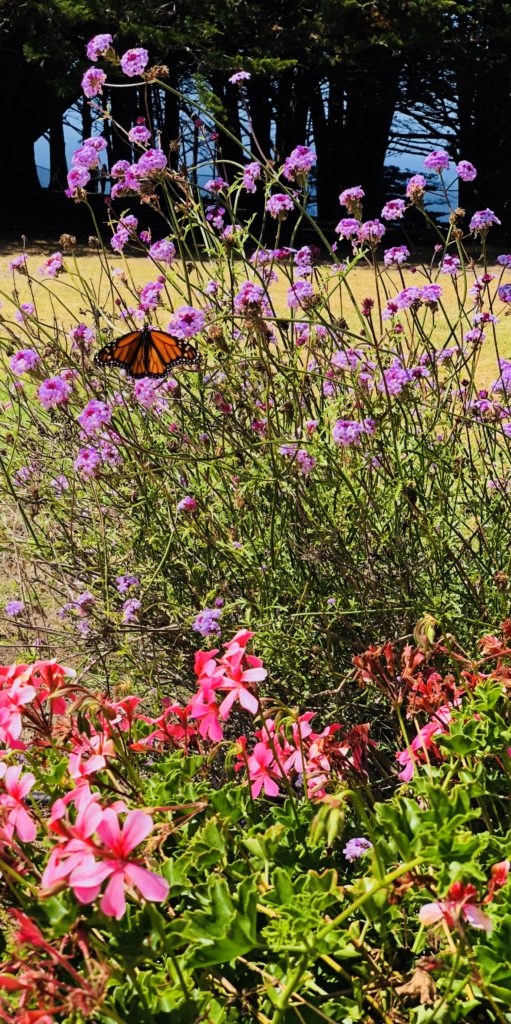 Ragged Point features beautiful flower gardens, fountains, and pathways filled with gently drifting Monarch butterflies and swiftly darting hummingbirds. Fabulous ocean vistas include myriad sightings of seals, dolphins, and migrating whales. Live music is an attraction on weekends and holidays, lasting throughout the summer into October. There are also photo ops at the “Portal to Big Sur”, a wooden sculpture that looks like a big donut (or toilet seat, you decide). There is also a fairly steep and somewhat challenging hiking trail leading down to the beach.
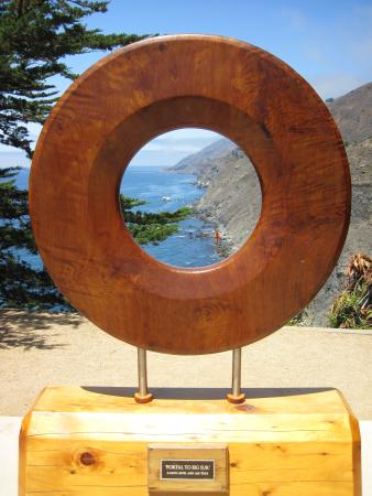
 Helpful Tips:
- No Wifi unless you are staying at the Inn, and even then it is sketchy
- Expensive gas prices
- No cell service
- Rooms are a bit outdated
- A good place to stop on the long drive between outposts of civilization in the area
- Pets are allowed at the Inn and on the premises
Other Fun Activities in the Area:- Hike to Salmon Creek Falls. This natural waterfall is located 3.6 miles north of Ragged point Inn close to Hwy 1. An interesting feature of the waterfall is that it actually starts out as two waterfalls that merge into one as they cascade down 120 feet. It is a relatively easy and popular hike with a round trip distance of only .25 miles. The pullout for the trailhead is 45 miles south of Pfeiffer Big Sur State Park. The falls are visible from Hwy 1. Salmon Creek Falls is also next to the Silver Peak Wilderness area. For more information, see Salmon Creek Falls
- Visit Piedras Blancas Elephant Seal Rookery. Located almost 11 miles south of Ragged Point Inn, the colony includes more than 17,000 elephant seals, which gather seasonally to safely avoid predators and frolic playfully with their pups. Elephant seals are the largest seals in the northern hemisphere. For more information, see Elephant Seals
- Visit Hearst Castle. Located 15 miles south of Ragged Point Inn, Hearst Castle was designed by famed architect Julia Morgan for business magnate William Randolph Hearst. It is nestled on 127 acres of meticulously groomed gardens and terraces. For more information, see Hearst Castle
- Visit San Simeon Pier, 15.5 miles south of Ragged Point Inn. This area is protected by the Marine Life Protection Act and is home to seals, otters, humpback whales, elephant seals, pelicans, ospreys, and much more. For more information, see San Simeon Pier
- Take a tour of Piedras Blancas Light Station, located approximately 9 miles south of Ragged Point. For more information, see Lighthouse
- Visit the romantic village of Cambria, 22 miles south of Ragged Point, for fabulous shopping and delicious sunsets at Moonstone Beach. For more information, see Cambria
- If you are into hiking hidden trails and experiencing isolated beaches, visit the very private Ragged Point Beach. This is 1.8 miles south of Ragged Point Inn. The trailhead starts at a small pull-out parking area on a bend between a blue call box and a “no campfires” sign. The trail is called Ragged Point Cliffside Trail. It is a .6 mile steep and fairly strenuous hike with a 400-foot change in elevation. The black sand beach is extremely private and is flanked by rocky bluffs. There is also a seasonal waterfall here called Black Swift Falls.
- Visit the Big Sur Jade Festival in the Lost Padres National Forest, directly across from Sand Dollar Beach on Hwy 1. This beloved annual festival, which draws people from all over the world, is usually held for three days in October. Multiple vendors sell and showcase their work, ranging from tiny, delicate pieces of jewelry to huge slabs of stone harvested from the sea. For more information, see Big Sur Jade Festival
I hope that you enjoy Ragged Point and the wonderful sights around it! Thank you for visiting my blog. Wishing you peace, love, happiness, and beautiful vistas!
-
Partington Cove: Tanbark Tunnel to the Sea
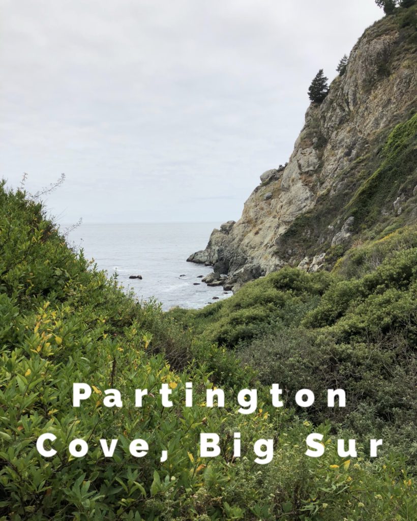 If you have ever wished to find pirates or buried treasure in the Monterey area, your best bet is Partington’s Cove. I think the name should be changed to Pirate’s Cove because it resembles something out of Robert Louis Stevenson’s Treasure Island. It is located 1.8 miles north of the entrance to Julia Pfeiffer Burns State Park, and 6 miles south of Nepenthe. It is easy to pass by due to poor signage. Look for the trailhead turn-off inside a hairpin turn on the west side of Hwy 1. Once you reach the trailhead, follow the half-mile dirt trail downhill. At the bottom, it splits into two trails. Turn left at the bottom and cross a wooden footbridge above Partington Creek.
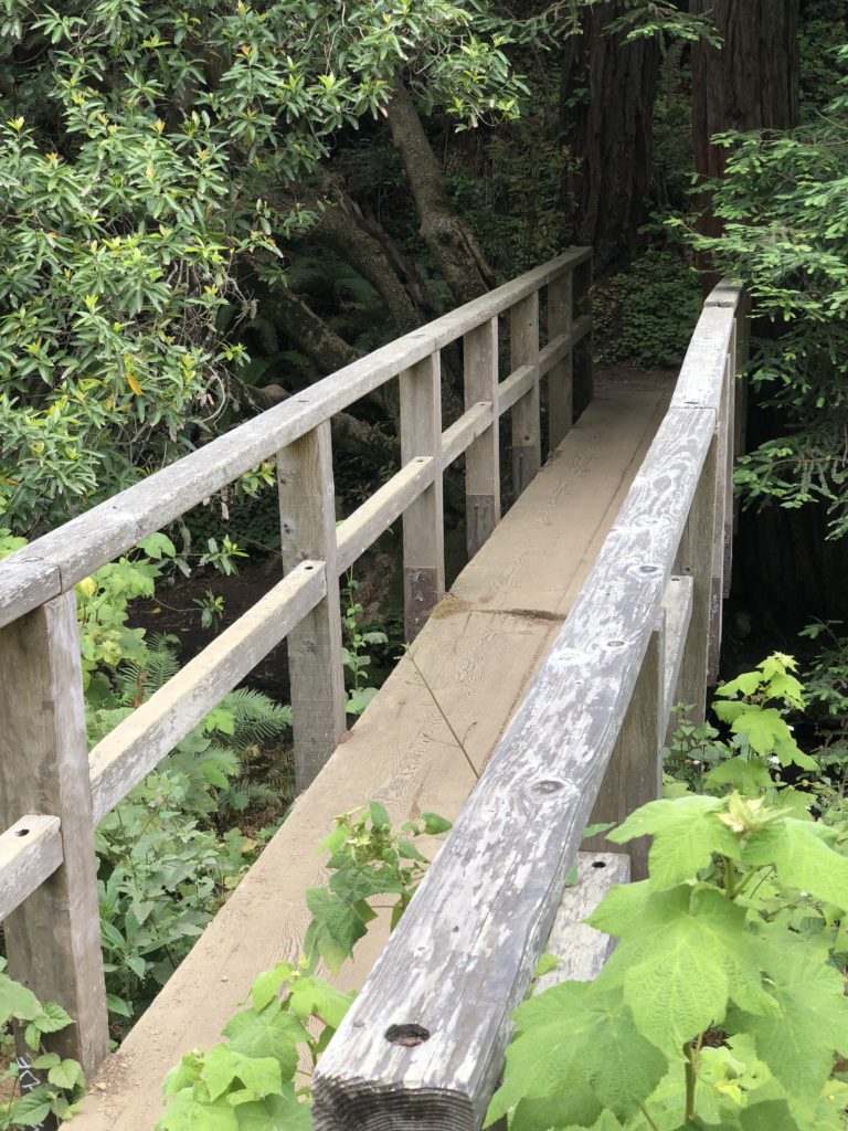 Follow the path along, and you will see a 100-foot-long tunnel bored through rock. The tunnel was constructed in the 1880s by homesteader John Partington, to enable the transport of lumber from the tanbark forest above the canyon to ships moored in the cove. Tanbark provided the tannins necessary to tan hides into leather. Mules were used to haul the lumber down the canyon to the ships.
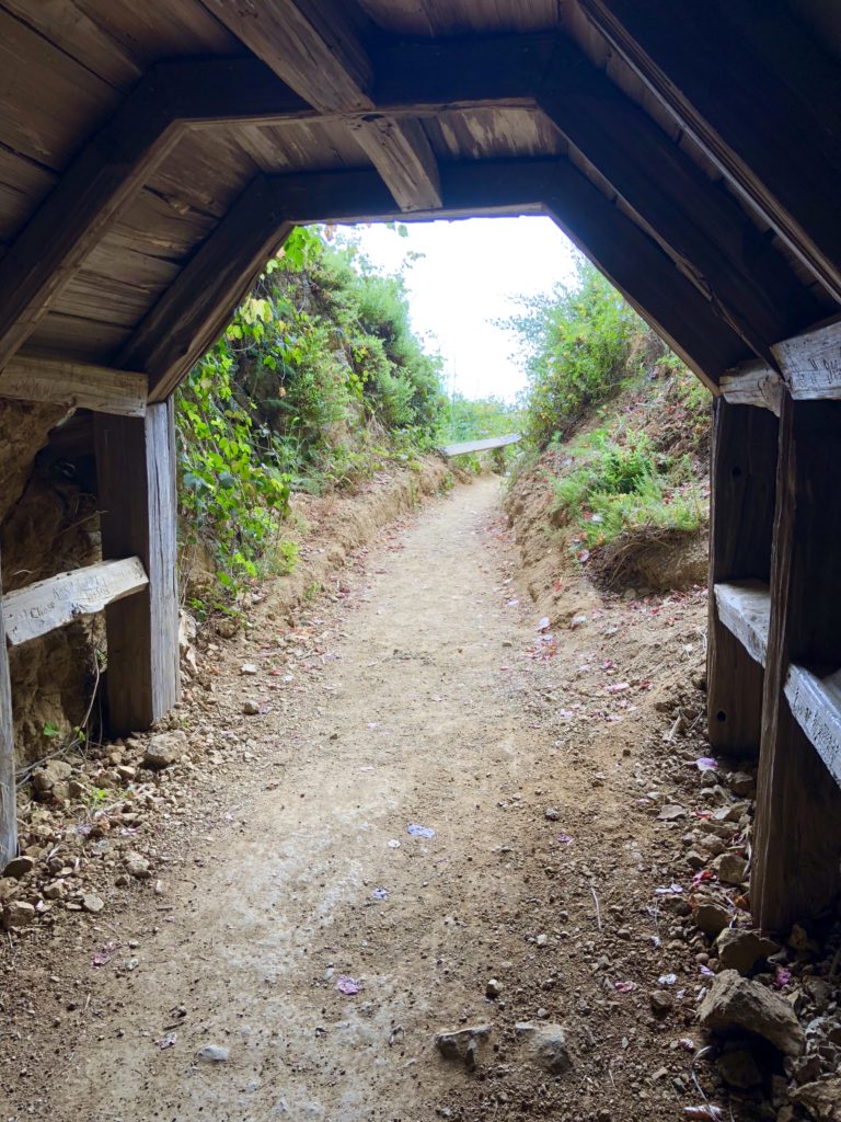 You can still see remnants of iron and wood structures used to moor the ships in the cove. You can also see tangled kelp forests as they sway gently in much of the cove. I imagine what it must have been like to see a ship moored here. It seems to me that swashbucklers could have been here. I can almost hear them chanting “Fifteen men on a dead man’s chest, yo-ho-ho and a bottle of rum!” Speaking of rum, Partington Cove also has been rumored to be affiliated with Prohibition bootlegging ventures, but this has never been substantiated.
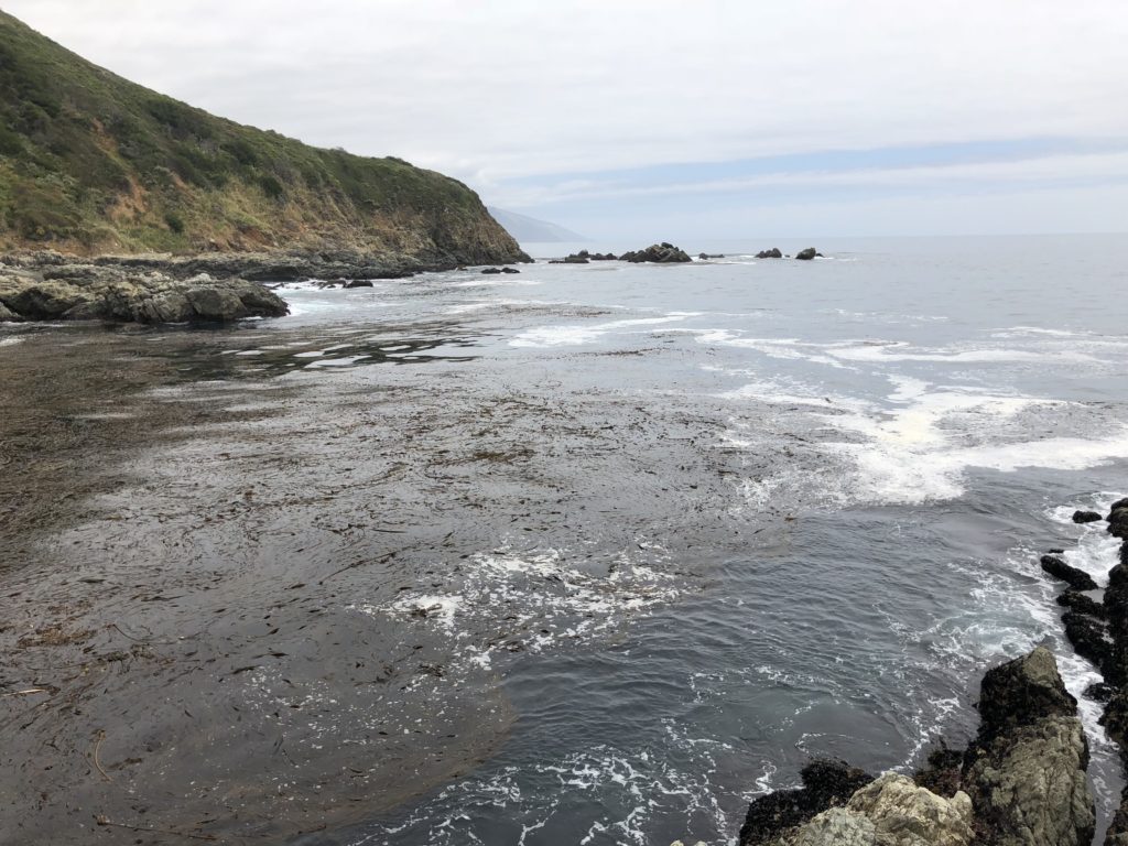 As you return and cross back over the footbridge, instead of turning right to return up to Hwy 1, turn left. Following this will lead you to a beach where Partington Creek cascades and spills over stony boulders and rocks into the ocean. It is a wonderful place to sit and reflect. As the waves crash onto the sandy shore, I think I hear a parrot shrieking “pieces of eight!” But I am shocked out of my reverie when I realize it is my friend calling me, “we’ll be late!” He has been thinking he saw a mermaid in the cove!Whether you like pirates or mermaids, experience Partington Cove yourself and let me know what you think. Adventure awaits!
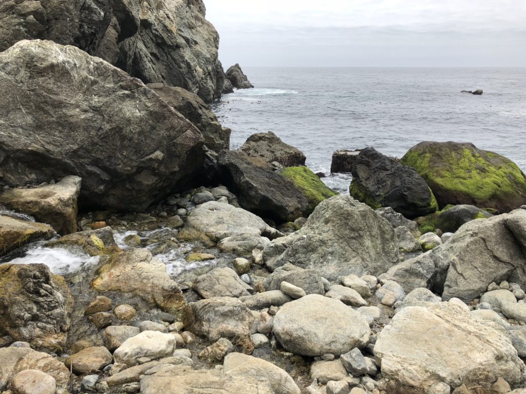 Wishing you peace, love, happiness, and beautiful vistas!
 -
Sand Dollar Beach & Jade Cove in Big Sur
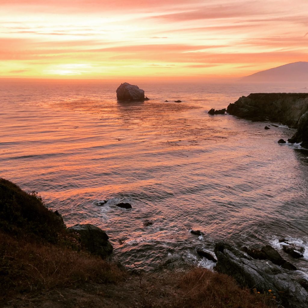
Sunset at Jade Cove in Big Sur We are heading south on Hwy 1 on a jade mission. An hour and 45 minutes after leaving Carmel, we spot it. The rinky-dink parking lot across from the Plaskett Creek Campground. Sand Dollar Beach awaits!
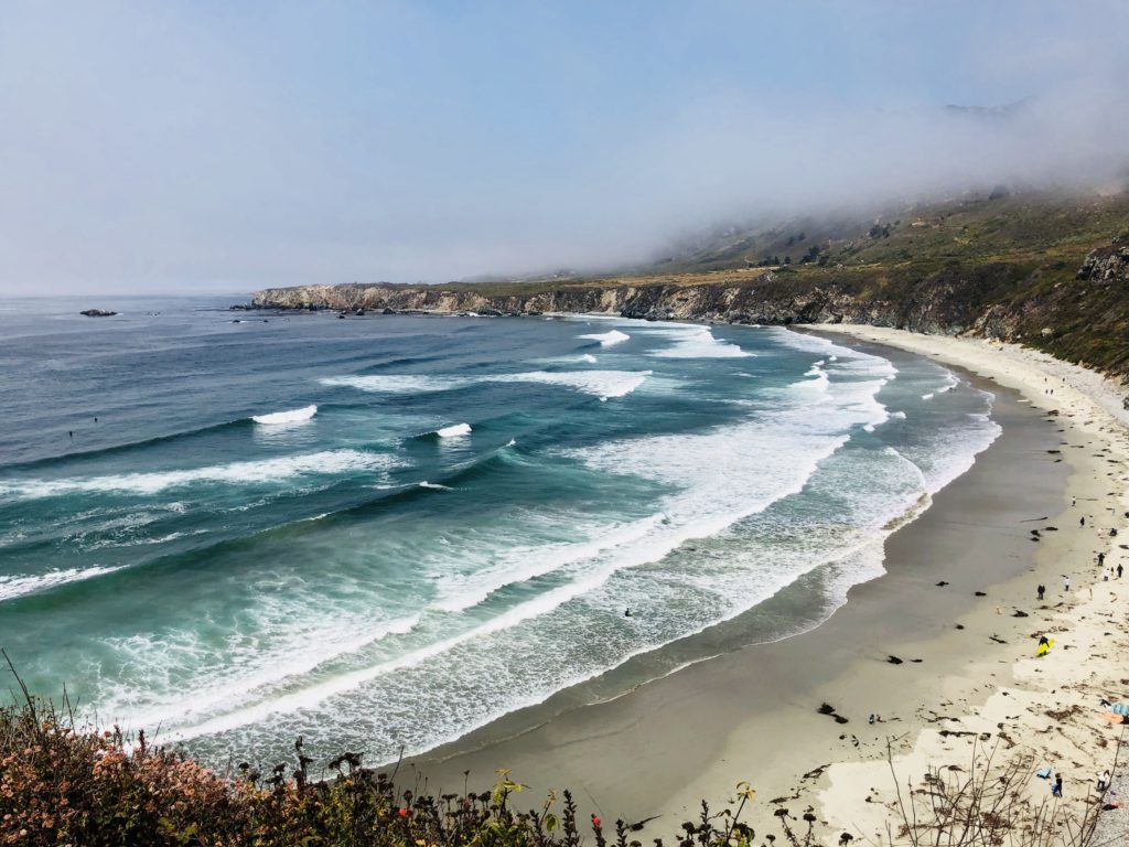
Sand Dollar Beach is the Largest Beach in the Area To get to Sand Dollar Beach, take the wide dirt path running parallel to the parking lot. The hike is .5 miles round trip. Start at the northwest corner of the parking lot and follow the trail for until you reach the steps leading 40 feet down to Sand Dollar Beach. It is extremely isolated and quiet here. There is no cell service, it vanishes shortly after you exit the south end of Carmel. No sound but the ponderous crash of waves as they break onto the beach and the whispering of the wind through the foxtails. Jagged cliffs plunge recklessly below to the sea. The rolling prairie above the beach is punctuated by several meandering trails. Many of these end abruptly and are surrounded by poison oak, however, some lead to breathtaking cliff top views of the beach.
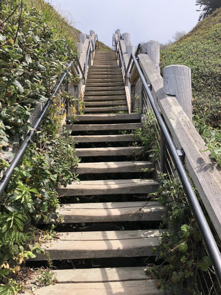
The Stairs Leading to Sand Dollar Beach There are many fun activities here including hiking, fishing, picnicking, and sunbathing. The beach is the largest in the area, a crescent-shaped arc of soft, white sand stretching for over half a mile. Surfing is also big here. Sand Dollar Beach is rated as one of the best surfing spots along this section of the coast. In addition, the level bluffs above the area are a designated hang glider and paraglider landing area. You may also see gray whales, elephant seals, sea otters, or shorebirds such as cormorants, brown pelicans, plovers, and gulls.
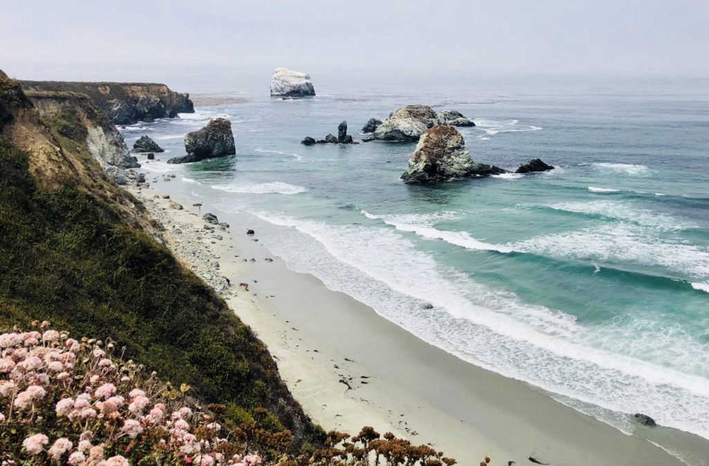
After you are done at Sand Dollar Beach, hike back to where you are parked and head further south for about 1/2 mile until you see a small pullout on the right side of Hwy 1. The trailhead to Jade Cove is unmarked, ostensibly to protect the area from overly ambitious jade seekers. Follow this trail straight back. Large jade boulders extend into the ocean and offshore you can see the picturesque 100-foot high Cave Rock, whose walls of jade are continuously pummeled by the crashing waves. As you near the ocean, follow the trail to the left through coastal grasses and wildflowers. You will pass three more boulders and then, when you see a pine tree, you are near the trail’s final descent to Jade Cove. The round trip hike is 1.5 miles.
The Unmarked Trailhead to Jade Cove Jade has been prized for thousands of years and was considered the “imperial gem” in China. It has been used throughout history for tools, weapons, jewelry and religious objects. It has even been used for its metaphysical properties; some people use it for a talisman, for feng shui, or practice “jade rolling” which is said to draw out negative energy and balance your chi. Jade Cove in Big Sur is the hang out for jade-a-holics who diligently search along the beach or even perform meticulous dives off the coast in search of the beautiful mineral. There is even an annual Big Sur Jade Festival held nearby. People come from all over the world to the three-day fall event to sell and showcase their work, ranging from tiny, delicate pieces of jewelry to huge slabs of stone harvested from the sea.
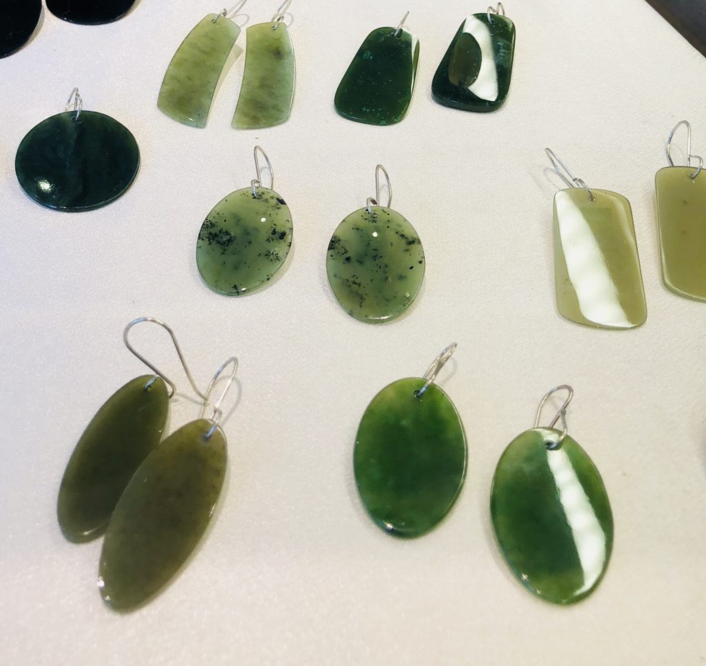
Jewelry made from Big Sur Jade; available at Nepenthe I recently met a girl running on the path to Jade Cove named Joy, who said she often finds jade there and makes it into jewelry which she occasionally sells at her mother’s shop in Pacific Grove, the Rabbit Hole. She kindly showed me what real Big Sur Jade looks like and when I returned home, I did additional research online for information that can help identify it. Apparently, the most problematic look-alike in the area is serpentine. The difference between serpentine and jade is that jade is much, much harder. How hard? If you scrape it with a pocket knife or can opener, serpentine will easily scratch, but jade will not. There are other tips offered including spitting on the stones, licking the salt off them, etc. I cannot vouch for any of these techniques.
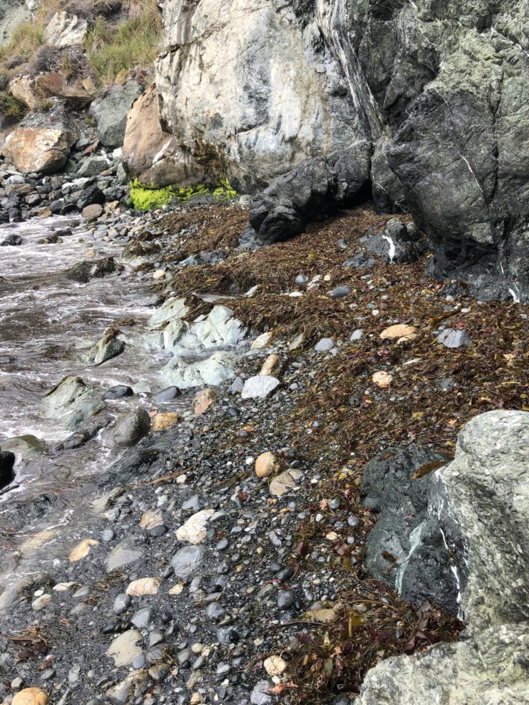
Who knows what the tide will bring in at Jade Cove! It is always a treasure hunt here. Be aware that there are regulations regarding removing jade from the area. 1. Only loose jade from submerged lands may be collected, from below the mean tide level. 2. No tools may be used except a hand tool to maneuver and lift the jade or scratch its surface to determine its authenticity. 3. Divers may use lift bags with a combined capacity of not more than 200 pounds. For more information on regulations see: montereybay.noaa.gov
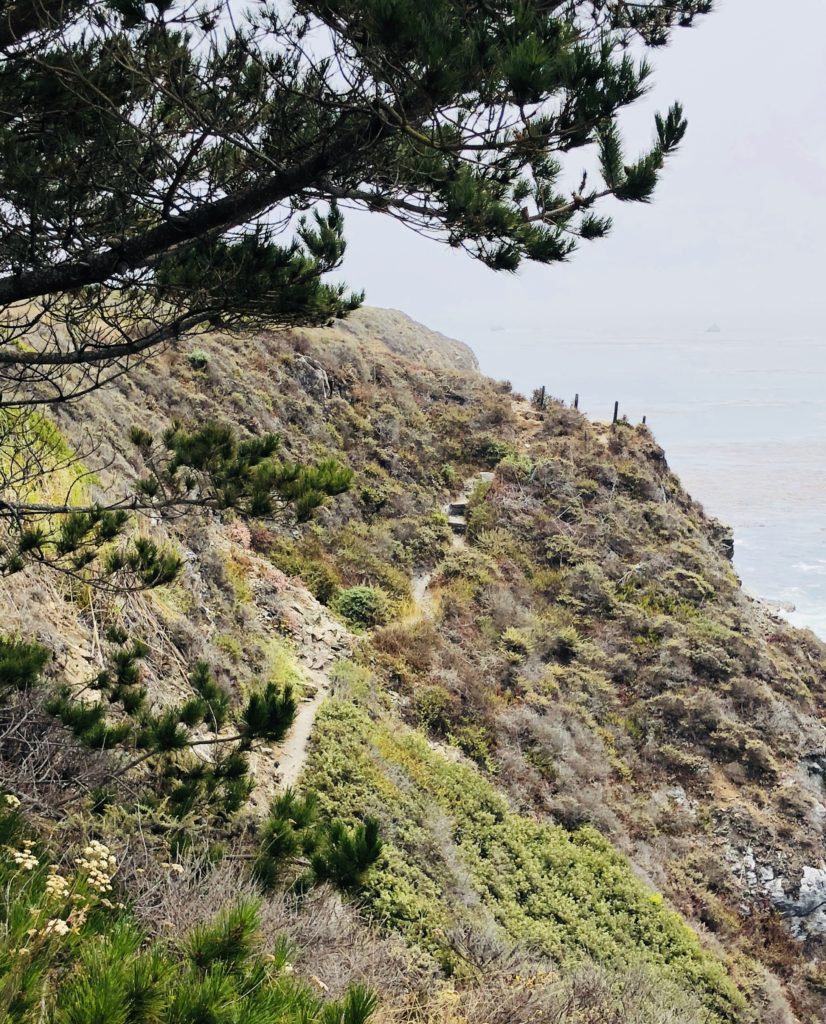
The Rambling Trail to Jade Cove Despite their rugged beauty, Jade Cove and Sand Dollar Beach can also be quite dangerous. Swimming and wading are not recommended due to dangerous rogue waves and strong rip currents. Hiking down the steep and at times slippery and ambiguous path to Jade Cove can also be a bit challenging and is not recommended for inexperienced hikers. There is a rope to hold onto at the bottom of the trail to facilitate a safe descent. Be sure to wear long sleeves, head covering and tick repellent if you will be hiking through the brush. The area is known for harboring ticks and people often leave with unintended guests, much to their chagrin.
Wild Roses Growing Along the Jade Cove Trail To reach Sand Dollar Beach and Jade Cove, travel south approximately 60 miles from Rio Road in Carmel on Hwy 1 or 30 miles north of San Simeon. No camping is permitted except at Plaskett Creek Campground, located directly across Hwy 1 from the parking lot and also at nearby Kirk Creek Campground. A parking lot, picnic tables, and restrooms are available at Sand Dollar Beach, but there is a 10.00 fee to park there. If you camp at Kirk Creek or Plaskett Creek Campgrounds you can use the Sand Dollar Beach Day Use Area without paying the fee. There are also numerous turnouts nearby along Hwy 1 where you can park for free. Sand Dollar Beach and Jade Cove are open daily from sunrise-sunset and are day use only. Dogs on leashes are allowed. No bonfires are allowed on the beach.
Thank you for visiting my Blog! Wishing you peace, love, happiness & beautiful vistas!
-
Purple Sand & Stone Arches at Pfeiffer Beach in Big Sur
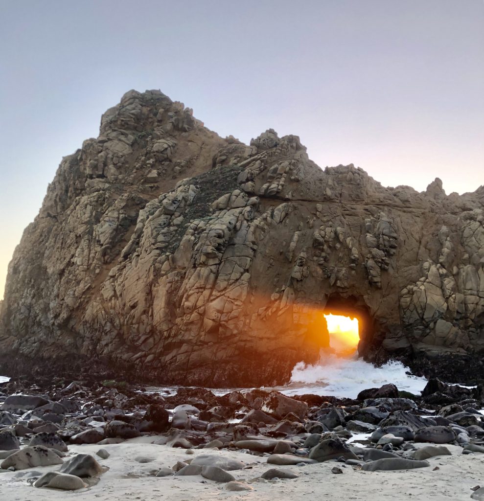
For a few brief weeks around the winter solstice, the sunset casts an ethereal glow through the Keyhole Arch. 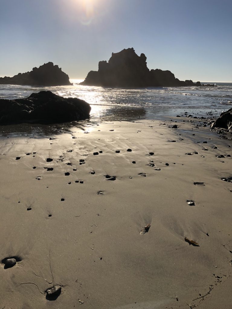
It’s fun to just sit and contemplate the myriad of sea stacks from the beautiful beach. If you are heading to Big Sur, the exquisite Pfeiffer Beach is a must see. It is easy to miss the unmarked turnoff for this secluded beach. Take a severely sharp turn off Highway 1 on Sycamore Canyon Road at mile marker 45.64, the second right turn after Big Sur Station if you are heading south. The meandering, narrow Sycamore Canyon Road is bordered by the occasional and surprising home, given the solitude. Follow Sycamore Canyon Road just over two miles to reach the parking area.
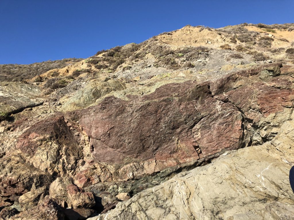
Manganese saturates the rocky outcroppings with its purple hue. 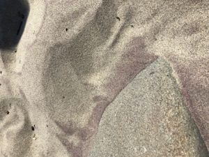
The disintegrating manganese in the cliffside creates a beautiful violet variation in the beach’s sand. Take a ridiculously short .1 mile hike on a flat, sandy path from the parking area to the beach. The path is flanked by Monterey Cypress and the Sycamore Canyon Creek, on the left, flows down to form a serene pool at the beach. The sun beats down on the purple-hued sand and huge waves roll and crash against the rocks and beach. The wind is usually blustery and harsh in this area.
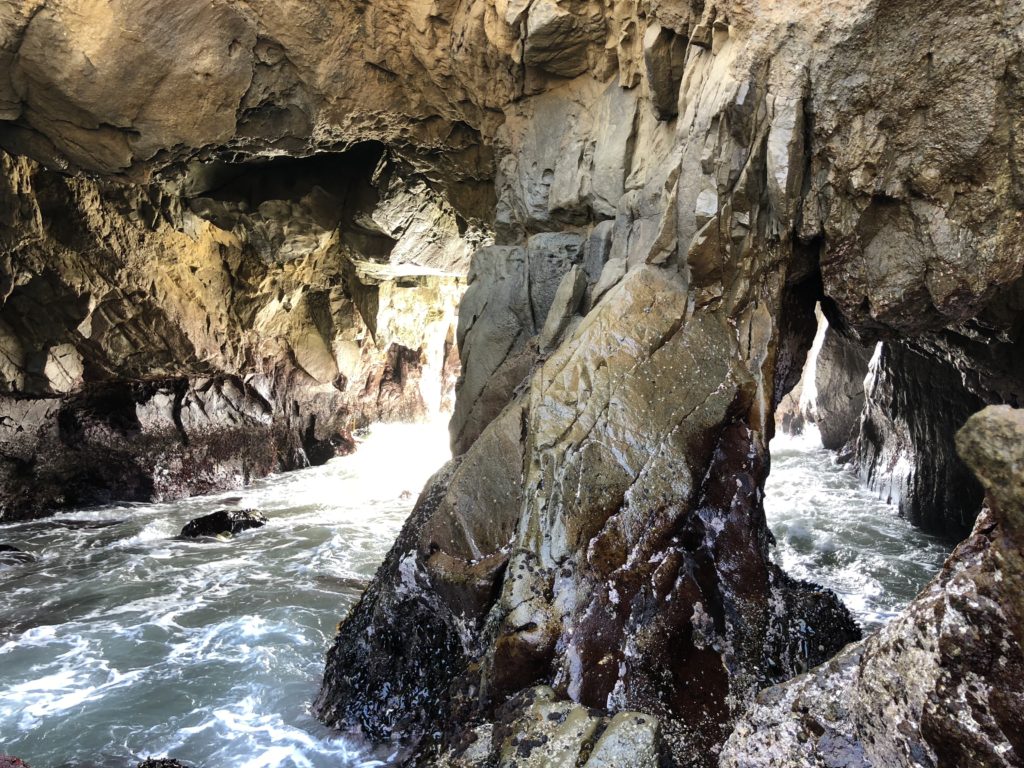
You will be wowed by the sea stack formations here. There are three arches. Two stand side by side, close to the beach. The third, called Keyhole Arch, stands further north, alone and solitary in a wall of rock several yards out in the ocean at high tide. For a few weeks, beginning in mid-December, sunlight comes through the northern keyhole arch perfectly (or close to it) due to the angle of the sunset, and photographers will gather to get that perfect shot. The surf here can also be incredibly powerful, with huge dramatic waves.
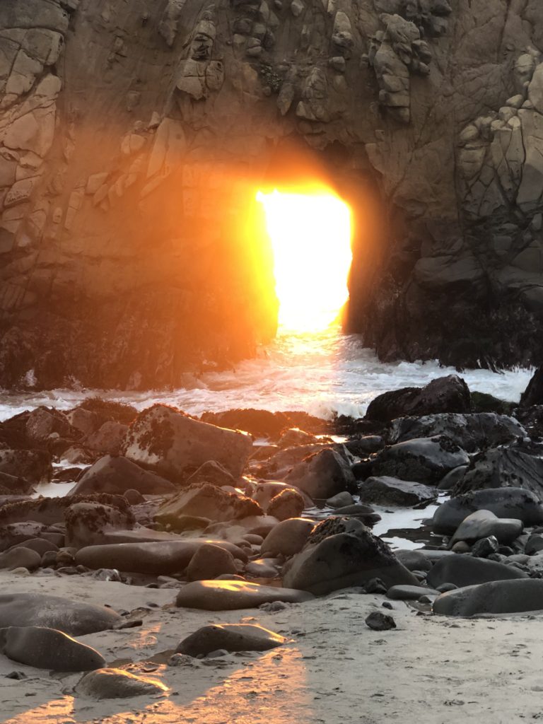
The Keyhole Arch is said to be the most-photographed attraction in Big Sur after Bixby Bridge. Pfeiffer Beach is not a state park, but rather, a part of the Los Padres Nation Forest. During the spring, the low bluffs above the beach are dotted with wildflowers, including California poppies, verbena, Indian paintbrush, and lupines. The cliffs and arches at Pfeiffer Beach are primarily granite which continues to erode over the years with the sea’s crashing waves.
Helpful Tips:
- If you are heading south on Hwy 1, the Pfeiffer Beach turnoff is on the right, shortly after you pass the Pfeiffer Big Sur State Park entrance. The very sharp right turn is at mile marker 45.64 on unmarked Sycamore Canyon Road. Sycamore Canyon Road is a paved, ungated road.
- Pfeiffer Beach does not allow you to park outside and walk in, as you can at other places such as Point Lobos. Au Contraire. You have to pay the $10.00 entrance fee to enter in your vehicle.
- There are a limited number of parking spots and when they’re filled you are out of luck. They do not allow overnight camping, and no RVs or campers are allowed in due to the narrow road.
- Be aware that there is a “nude” section at the extreme far north end of the beach so that if you see a swimsuit or clothing lying on the beach you may be approaching a naked person!
- Pfeiffer Beach can also be extremely crowded on weekends so you may want to visit during the week when it is less busy.
- There are pit toilets available but no water to wash your hands. I recommend bringing hand sanitizer.
- It can be quite chilly and very windy, bring a sweater or jacket.
- The walk from the parking lot to the beach is short and well marked.
- Dogs on leash are allowed on the beach.
- Picnic tables and benches are available near the parking lot.
- GPS coordinates for Pfeiffer Beach are 36.2383,-121.8150.
- No campfires are allowed.
- Swimming and wading are not recommended due to dangerous waves and rip currents.
Cost:
Daily admission is 10.00 or you can purchase an annual pass for 50.00. Both cash and credit cards are accepted.
Hours:
They are open daily 8 am to sunset.
Helpful Links:
For more information, see Sycamore Canyon and Pfeiffer Beach
Thank you for visiting my blog! Wishing you peace, love, happiness, & beautiful vistas!
-
Ventana: Birthday Celebration in Beautiful Big Sur
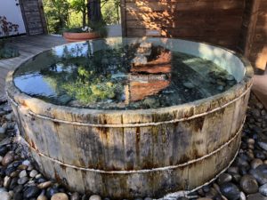
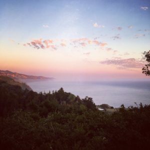
This is the third in my series of iconic Big Sur restaurant reviews; see links for Nepenthe and Big Sur River Inn.A thick veil of fog hovers over the water and blankets the hills as we head south on Highway 1. The road twists and turns, hugging the coastline. As we near Garrapata, torpedo-like rock formations of sandstone appear otherworldly. The ocean rumbles and waves gallop like horses toward the shore, creating milky froth as they crash into and over jagged rocks. There are four squid boats anchored off Rocky Point, their eerie green and yellow lights penetrating the mist. We are headed for my birthday celebration at Ventana, a resort complex in the most heavenly location ever. Ventana means “window” in Spanish. Secluded between the Santa Lucia mountains and the Pacific Ocean, Ventana’s weathered cedar structures perch on a hillside 1200 feet above the coast. Picturesque Post Creek meanders through the 160-acre property, which contains landscaped pathways, canyons, groves of redwoods, Japanese hot baths and two pools. There are 59 guest rooms, suites, and villas and 15 safari-style canvas “glamping” tents, as well as tent only camping sites.
 HistoryVentana is located on land first homesteaded by the Post family in 1890. The Post home, which housed several generations of the family, still stands at the entrance. Ventana first opened in 1975, the creation of Lawrence Spector. Spector co-produced the 1969 anti-establishment hit “Easy Rider” which was written by Peter Fonda, Terry Southern, and Dennis Hopper. Ventana still retains vestiges of its ‘70s hippie beginnings, from its original weathered cedar siding to its clothing-optional policy in the hot baths and the Mountain Pool and nude sunbathing in prescribed areas. From the beginning, Ventana has drawn celebrities, including Dennis Hopper, Ali McGraw, Steve McQueen, Chevy Chase, Goldie Hawn, Barbara Streisand, Julia Roberts, Robert DeNiro, Brad Pitt, Jennifer Aniston, Oprah Winfrey, and Lupita Nyong’o, among many others.
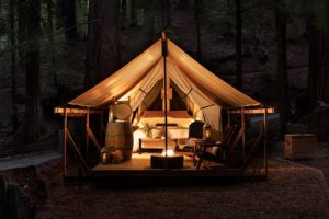 GlampingThe glamping area, one of the newest renovations, is nestled in a 20-acre ancient redwood forest a half mile hike beneath the main resort. Each tent includes beds with luxury hotel linens, hot and cold water, and propane- and wood-burning fire pits. All glamping furniture is built from “reclaimed” redwood from the property. Ascot wine-and-cheese picnic backpacks, custom curated picnic baskets, natural timber walking sticks, and daily housekeeping service are also provided. But wait, there’s more! The glamping tents also include electrical and USB plug-ins, teak-enclosed showers with heated floors, a sheet turndown service every night, hot cocoa, and hot-water bottles to warm your sheets. Apparently, these are often sold out. Actress Mandy Moore recently celebrated her birthday during a girls’ glamping weekend at Ventana.
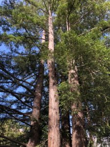 ClassesThis IS Big Sur and not surprisingly, Ventana also offers some pretty far-out classes, including meditation, yoga, tai chi, Pilates, beekeeping, charcoal sketching, mandala coloring for couples, string art & mindfulness, candle making and aromatherapy, bird-watching, photography hikes, mushroom foraging, daily hour-long guided walks, and drum circles. Taylor Swift recently took a falconry class at Ventana during her stay this year.Glass HouseThe Glass House Gallery sells paintings, sculptures, jewelry, clothing, ceramics and local photography. You can have your picture taken on the see-through overlook outside the gallery and fool your friends into thinking you are standing on the edge of a precipice!WeddingsVentana hosts many weddings. Their website states “Imagine saying your vows overlooking the canyons and forest or surrounded by redwoods. Enjoying a sunset reception or dinner under a canopied arbor. And dancing under the stars to celebrate your new adventure together.” Apparently, both Natalie Portman and Ann Hathaway could imagine this. Both had their wedding receptions here.
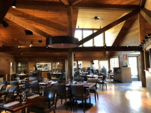
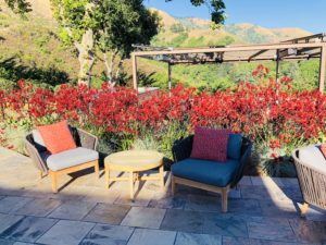
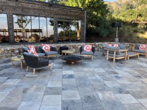
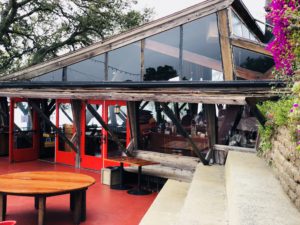
 The RestaurantThe Sur House restaurant features delicious concoctions by Executive Chef Paul Corsentino. Meals feature coastal cuisine, including local seafood, free-range meats, and fresh produce from Ventana’s gardens. There is also a 10,000-bottle wine cellar featuring central coast wines selected by local vintners and Ventana’s sommelier. Craft cocktails and beer are also offered. Sur House decor is both elegant and rustic, featuring natural wood and leather furnishings.
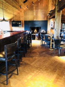
 We arrived at our 6:30 pm reservation time and had planned to dine on the terrace. Instead, we were told that we could not be seated outdoors for our meal because “the temperature drops too quickly” and it would be too cold for us. The temperature was a balmy 75 degrees, nonetheless, we were ushered to an indoor table by a window where, like a fish in a glass aquarium, I could envy, in the distance, a couple having drinks at a table overlooking the ocean. After ordering our food, I dashed outside to get some photos of the terrace.
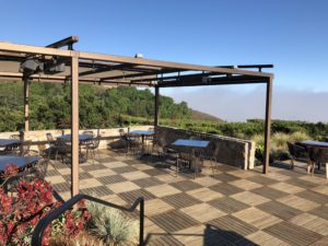
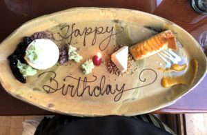
 Ventana offers a prix fixe meal; you are offered four courses for a set price. However, they do allow you to order items a la carte. My friend and I shared our first and second courses, the tuna tartare and soft shell crab with tropical fruit, melon salsa, and Napa cabbage. For the third course, my friend ordered the Alaskan Halibut and I the Ora King Salmon. These were both superb. For my birthday, they brought a platter with samplings of ice cream, mousse, fruit, and cake. I felt like I had just finished Thanksgiving dinner when we were through. It was decadent and thoroughly satisfying.
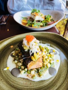
 Following our meal, I watched through the window as hummingbirds levitated up and down through the air. Then three black crows landed on the terrace, the black of their feathers contrasting with the deep oranges and reds of the landscaping and furniture. It was a wonderful birthday. Good food, fresh air, and a beautiful vista of the ocean. And that’s what Big Sur is all about.
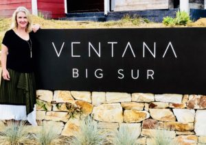
- For more information see Ventana.
- Address: 48123 Highway 1, Big Sur, CA 93920. Directions on how to get here.
- Phone: 800-427-7623.
- Sample Menus
- Check road conditions before you go, it is easy to do. Go to Caltrans and enter 1 (the highway number) then search.
Thank you for visiting my blog. Wishing you peace, love, happiness, & beautiful vistas!
-
Nepenthe’s Phoenix: Bohemian Bliss in Big Sur
 Nepenthe is an ancient Greek word meaning an elixir for sorrow, literally, a “drug of forgetfulness”. And sorrow you will indeed forget when you see the jaw-dropping panoramic view of the Big Sur coastline at this iconic restaurant. Nepenthe started out as a very simple cabin in 1925, located downhill from the log house where writer Henry Miller lived. Orson Welles bought the cabin as a gift for his new bride, the movie star and World War II pinup girl Rita Hayworth. Unfortunately, the relationship failed, and the Big Sur cabin was abandoned. After Welles and Hayworth divorced, Bill and Madelaine “Lolly” Fassett, with five children in tow, purchased the cabin and 12 acres for $12,000. They employed Rowan Maiden, an apprentice of Frank Lloyd Wright, to create Nepenthe. Redwoods hewn from area canyons and hand-made adobe bricks were used. Nepenthe opened in 1949 with an open terrace design so that people could enjoy drinking, eating, reading poetry and dancing under the open sky.
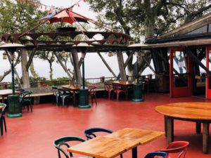
 Nepenthe became a place for creative expression and bohemian culture for people who enjoyed living freely and had disdain for traditional societal propriety. According to “Nepenthe Big Sur Stories and Folktales” (see Nepenthe Stories), visitors arrived from all over the world; “vagabonds, poets, artists, lovers… when there were fewer people on the coast, when nights were longer and days lonelier, Nepenthe was a place to gather”. Famous visitors included Henry Miller, Anais Nin, Man Ray, Ernest Hemingway, Joan Baez, Kim Novak, Steve McQueen, Richard Burton and Elizabeth Taylor. The latter two performed scenes for the 1965 film, “The Sandpiper”, at Nepenthe. Even today, Nepenthe continues to invoke the spirit of the previous beatnik and hippie cultures.
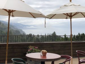
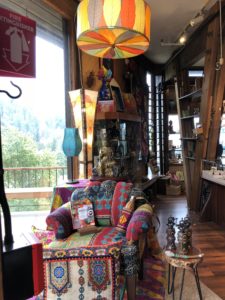 The Phoenix Shop opened in the 1960s, featuring gifts and local artwork, pottery, books, candles, clothing, hand-knitted hats, and jewelry. Café Kevah opened in 1992 above the gift shop and offers a great place to grab brunch.
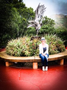 When you first enter the Nepenthe terrace, you see a five-foot-tall rising phoenix with bronze feet, the symbol for Nepenthe. This was created from a huge live oak originally growing here. When it died, sculptor Edmund Kara transformed the tree’s trunk into this amazing sculpture.
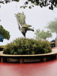
 If you visit Big Sur and want to check out Nepenthe, one caveat is that they are crazy busy on the weekends. It is not unusual to find the parking lot full and cars parked for a half mile down Hwy 1! If you are able to get seating, I recommend the outdoor counter overlooking the beautiful view (except on foggy days such as in this photo!).
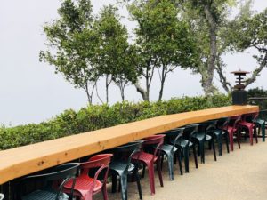 Hours are as follows:Nepenthe – open daily 11:30am -10:00pmCafé Kevah – open daily 9:00 am-4: 00 pm (weather permitting)Phoenix Shop – open Daily from 10:30am-7:00pmNote that they do not take reservations unless it is for a large group.
 Nepenthe is located on Hwy 1, about 30 miles south of Carmel, near the Ventana Inn and Post Ranch Inn. You will see the Nepenthe sign on the west side of the highway. Make sure to check road conditions before you go, it is easy to do. Go to the CalTrans website here caltrans.ca.gov and enter 1 (the highway number) then search. Or you may phone 800-427-7623. Wishing you beautiful vistas, peace, love & happiness!
 -
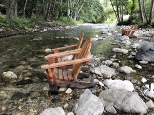
Big Sur River Inn: Dip Your Toes in the River
The venerable Big Sur River Inn is perched on the banks of the Big Sur River. It began humbly in 1934, when Ellen Brown opened the inn and began serving hot apple pie to guests. Her famous apple pie, which is still on the menu today, gave the place its original name, “Apple Pie Inn”. Ellen was a descendant of the famous Pfeiffer family for whom a park and beach are named.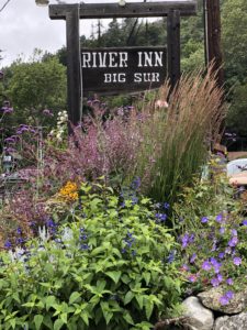
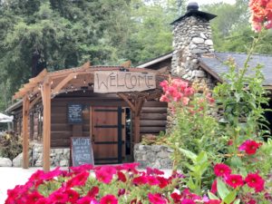
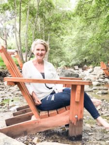 The Big Sur River Inn is now known for its famous Adirondack chairs in the river. Yes, IN the river. I must add that the river is so shallow, a chicken could wade across and get nary a feather wet. It is also well shaded and lined with gorgeous smooth river stones. You can take your glass of wine or bottle of beer and sit IN THE RIVER with your family and friends. You will love dipping your toes in the cool and crystal clear water. Could there be anything more idyllic on a hot day? Big Sur River Inn is located on the west side of Highway 1 and is surrounded by lush forestry and campgrounds. Its central location makes it an ideal place from which to explore Big Sur’s redwoods, hidden coves, and famous landmarks. It is less than 3 miles from Big Sur Station, Andrew Molera State Park, and Pfeiffer Big Sur State Park.
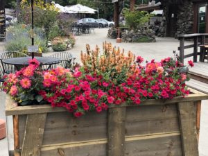
 Since I am a local resident, I have never stayed at the Inn, but I have eaten at their restaurant and the food is amazingly delicious. They offer breakfast, lunch and dinner menus. You may choose to eat indoors in their rustic cabin-like dining room, on their lovely deck, or in those famous chairs in the river. Big Sur River Inn clearly take pride in their landscaping, so that in every direction you look you see a beautiful floral vista. There are also a myriad of wildlife here. During my most recent visit, I was serenaded by a group of gorgeous blue Steller’s Jays as they socialized on the river bank.
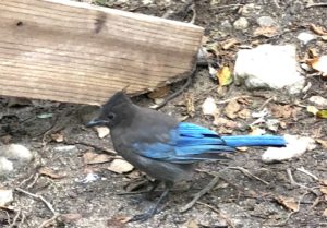 On Sunday afternoons, there is live music on the riverside deck. There is also a gas station (the only one for miles) and a small general store with food and camping supplies on the premises. For more information see River Inn. If you are searching for a down-to-earth, affordable, fun and relaxing place to visit, I would highly recommend the Big Sur River Inn!
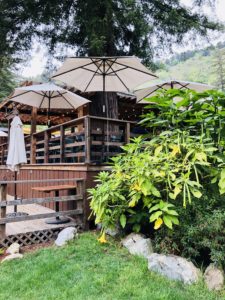 Thank you for visiting my blog! Wishing you peace, love, happiness, & beautiful vistas!
 -
McWay Falls: Beauty & History in Big Sur
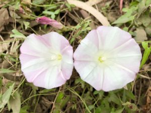
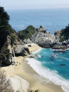 Have you ever imagined living in a home overlooking a gorgeous ocean cove, with a redwood forest behind you? What if you could look out your bedroom window and see an 80-foot waterfall cascading down a granite cliff onto a beautiful beach? One lucky couple, Congressman Lathrop Brown and his wife, Helene, were privy to this view for many years. Lathrop Brown served as best man at his friend Franklin Delano Roosevelt’s wedding. His wife, Helene, was a wealthy heiress. In 1924 they visited Big Sur and became smitten with the area. They purchased Saddle Rock Ranch from pioneer homesteader Christopher McWay. They built a crude redwood cabin at the top of the cliffs facing McWay Falls. In 1940, they replaced this with a fancy two-story mansion. They named it “Waterfall House”.Waterfall House featured fine furnishings, paintings, and an entryway inlaid with brass fish, a gold octopus, and a rose compass. Their ranch foreman, Hans Ewoldsen, built a Pelton wheel from hand-split redwood and installed it on McWay Creek in 1932. This wheel supplied a 32-volt generator with the first source of electricity in Big Sur. It powered three homes, a blacksmith shop, and a funicular railway. What is a funicular railway, you ask? It is a railway on an incline. The Browns used a modified mining car operated by cable to travel up and down the steep Big Sur slope.The Browns left Big Sur for Florida in 1956, and after her husband died, Helene donated the property to the state for a museum and park. For various reasons, the home was demolished in 1965. Helene had stipulated that the park be named for her friend, Julia Pfeiffer Burns, “a true pioneer”. Julia, with her husband, raised cattle at Saddle Rock Ranch before the Browns’ arrival. At the overlook of McWay Falls, you can still see vestiges of the Brown home, landscaping, and railway.Photographers love this area, and it is easy to see why. The sand is often purple from the erosion of manganese garnet which is carried down the creek to the beach. This is generally more apparent after winter storms. Light plays on the colored sand and waves crash through sea sculptured arches and rock formations, creating a beautiful vista. The hills are covered with wild yarrow and pink morning glories. The area is surrounded by redwood, tan oak, madrone, and chaparral. Tall, stately eucalyptus trees line the trail and fill the air with their scent.
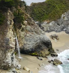
 The waterfall flows year round from McWay Creek and is one of only two entering the ocean in California. Visitors are not allowed access to the beach to protect the marine resources and the pristine beauty of the cove. Per Julia Pfeiffer Burns State Park, ” Cliff areas beyond the fenced boundaries, including the BEACH, SADDLE ROCK and MCWAY FALLS area are completely off limits. Trespassing into these closed areas is a serious offense, resulting in a citation and arrest. The areas are extremely hazardous.” Be safe and stay on the Waterfall Trail.
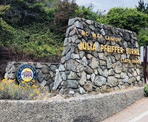
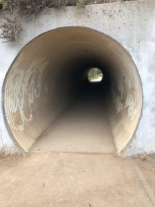
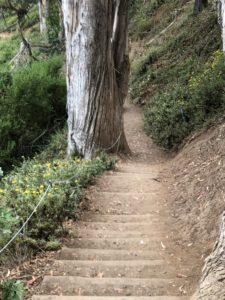
The Tunnel leading from adjacent Parking Lot to Trail You can reach McWay Falls either by 1. parking at JPBSP and walking through a short tunnel under the highway, or 2. parking alongside highway 1 and hiking on the Waterfall Trail to the viewing area. There is a 10.00 fee to park at JPBSP. It opens 30 minutes before sunrise and closes 30 minutes after sunset. There are restrooms available there. If you park along the highway, be mindful of traffic as this is a busy road. Also, if you park on the road, you will have to go down a set of several steps to reach the trail. You may also want to bring a sweater or jacket as it can get quite blustery here.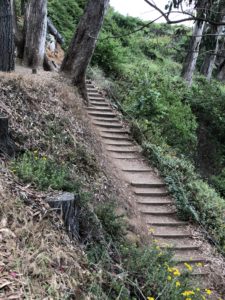
Stairs from Hwy 1 to Trail 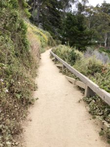
The Trail is Easy to Navigate For more information see parks.ca.gov Thank you for visiting my blog! Wishing you peace, love, happiness, and beautiful vistas!