-
Elkhorn Slough & Moss Landing
 Playful Otters, barking sea lions, and graceful egrets are only a few of the amazing wildlife you may see at Elkhorn Slough and Moss Landing. The area is also home to a plethora of good restaurants, art galleries, and shops. You can also enjoy a variety of outdoor activities here, including fishing, surfing, beach combing, sea kayaking, whale watching, walking trails and even hydro biking.
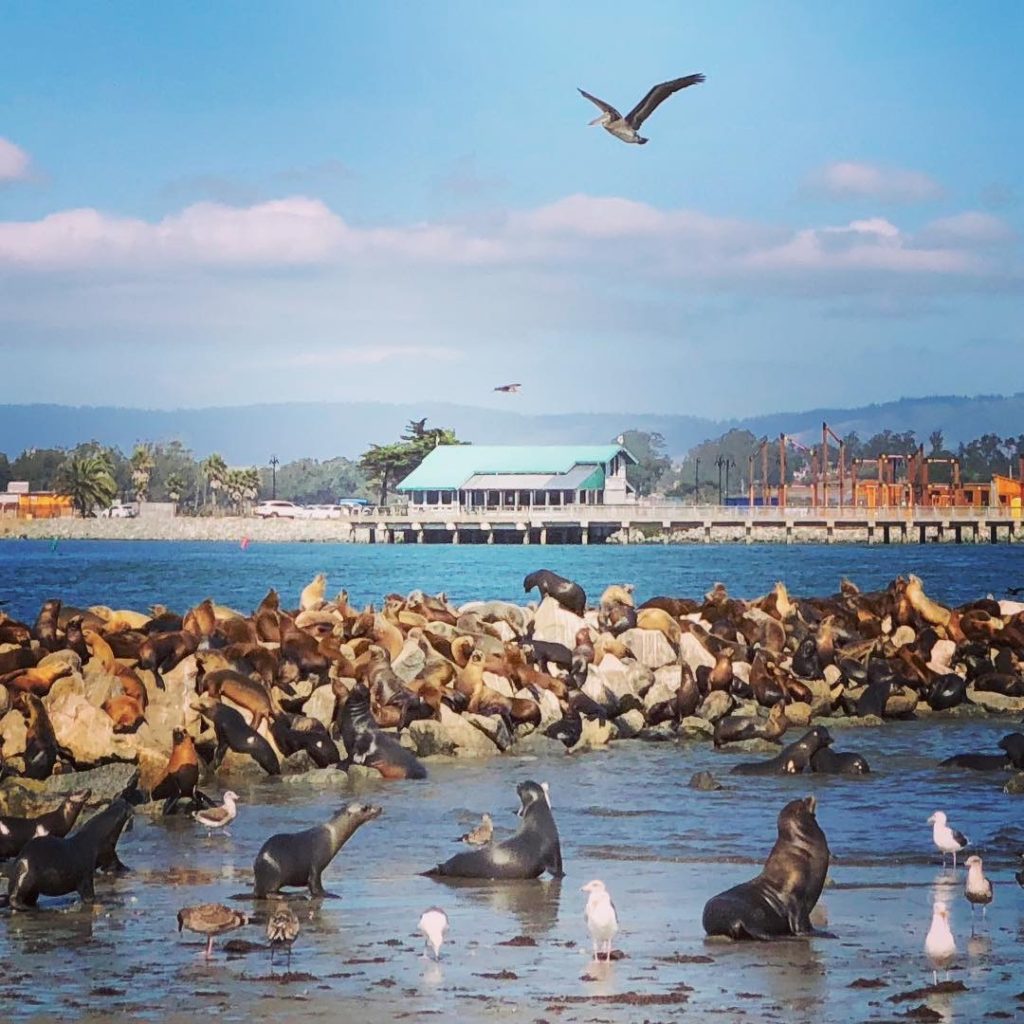
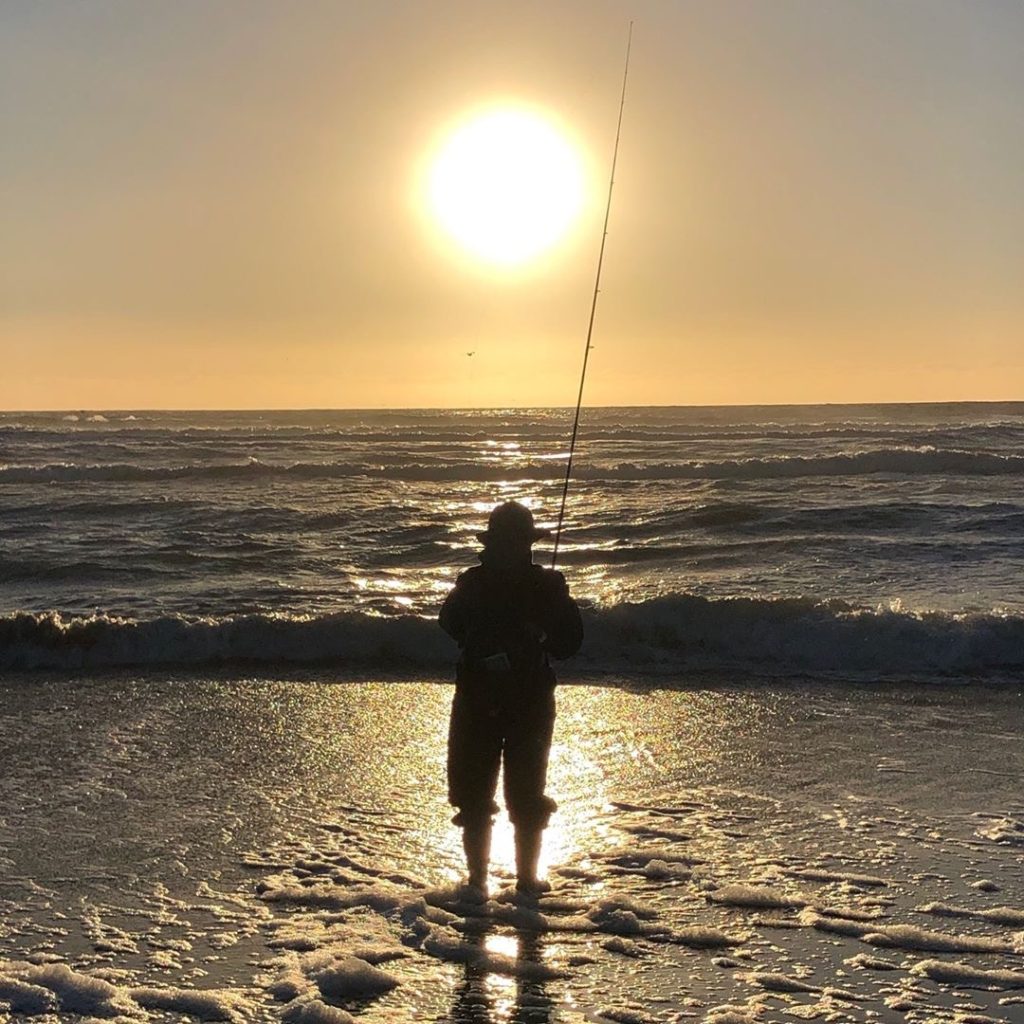
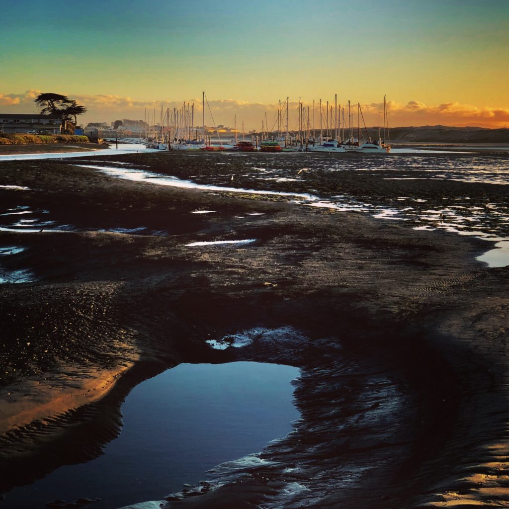
A lone fisherman on Moss Landing Beach during the King Tides. The extreme low tides pose prime conditions for fishing. HISTORY
Located between Monterey and Santa Cruz, Moss Landing is located where the Elkhorn Slough creates an estuary as it flows into Monterey Bay. Moss Landing is named for Charles Moss, a ship captain from Texas who built a wharf here in the mid-1800s. The area was once a very busy whaling and fishing port and the site of many fish processing plants and canneries. Today, Moss Landing Harbor is home to hundreds of fishing, pleasure, research and tour boats. Commercial boats bring in Dungeness crab, halibut, salmon, albacore, sardines, squid, mackerel, prawns, and more. Fresh seafood can be purchased off the boats and in the local restaurants.
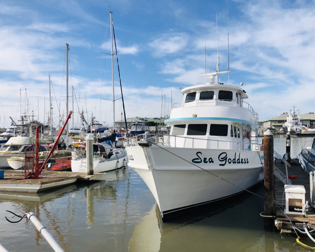
The Sea Goddess is one of several whale watching tour ships in the area. 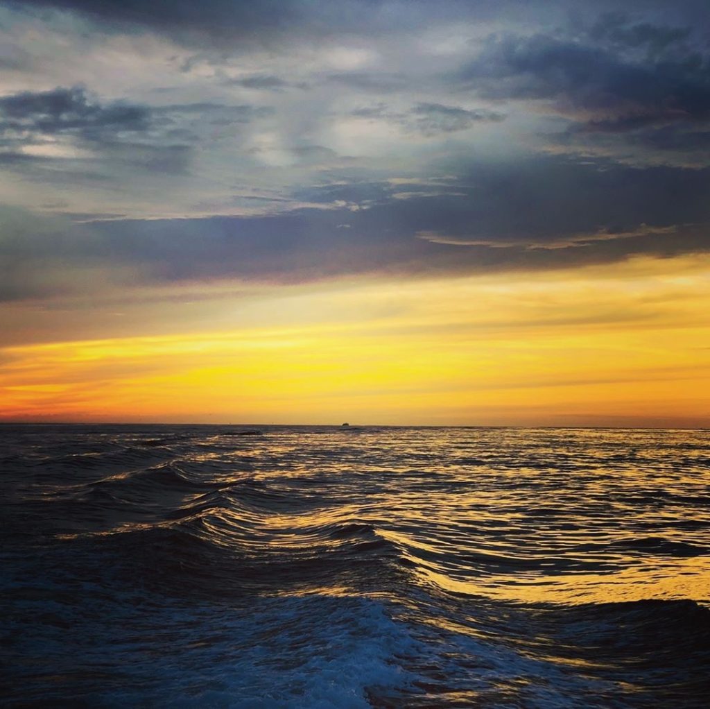
Moss Landing Harbor is home to the Monterey Submarine Canyon, a mile-deep chasm filled with a variety of sea life, including whales! 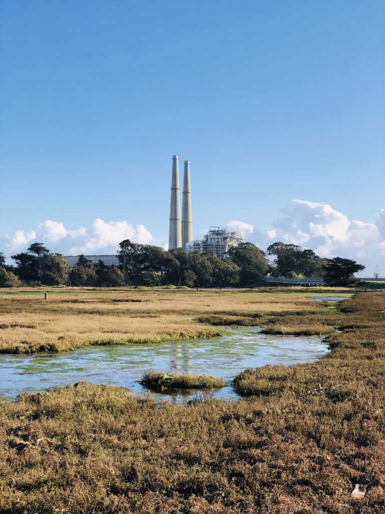
The twin towers of the power plant can be seen for miles. BUILDINGS AND RESTAURANTS
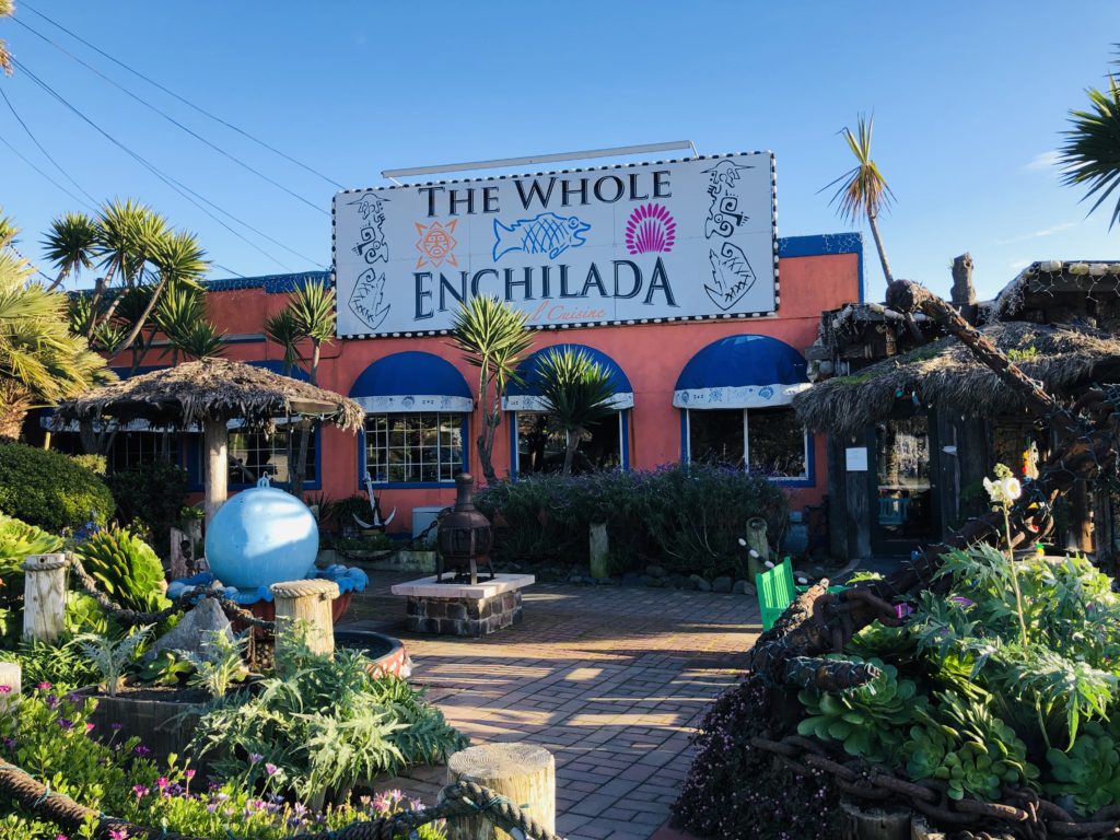
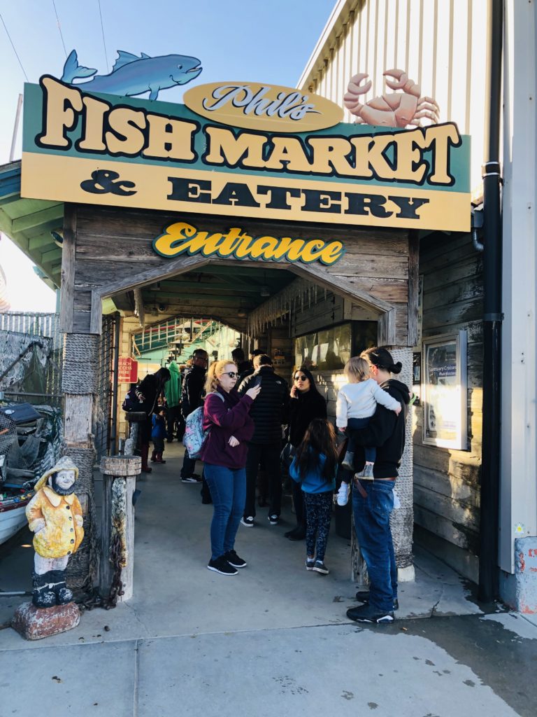
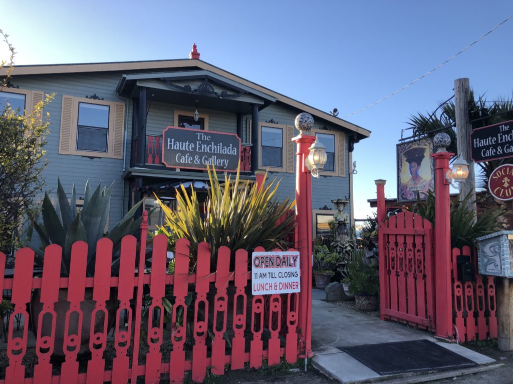
Notable buildings in Moss Landing include the Moss Landing Marine Laboratories operated by California State University, the Monterey Bay Aquarium Research Institute, and the Moss Landing Power Plant. Some of the amazing restaurants in the area include Moss Landing Cafe, The Whole Enchilada, Haute Enchilada, Lighthouse Harbor Grille, Pacific Grill, Lemongrass Seafood, Sea Harvest and Phil’s Fish Market. Lines form daily at Phil’s for the cioppino, one of the restaurant’s most famous dishes. For more information on local eateries in Moss Landing, see Restaurants.
ACTIVITIES AND EVENTS
Moss Landing offers many fun activities and events including dancing, music, and wine and other tastings at both the Haute Enchilada and the Whole Enchilada. The Elkhorn Yacht Club also hosts a multitude of fun events including a crab feed in February as well as seasonal parties and races. There are also open studio art tours in September and October featuring local artists. One of the most popular summer events in the area is the annual Moss Landing Antique Street Fair. It is usually held the last Sunday in July and brings hundreds of vendors and shoppers together for a day of fun. Other activities in the area include the May opener for rock cod fishing, blessing the fleet May 1, open house at the Marine Labs every spring, and a Nautical Flea Market in May. For more information on events in the area, see Moss Landing.
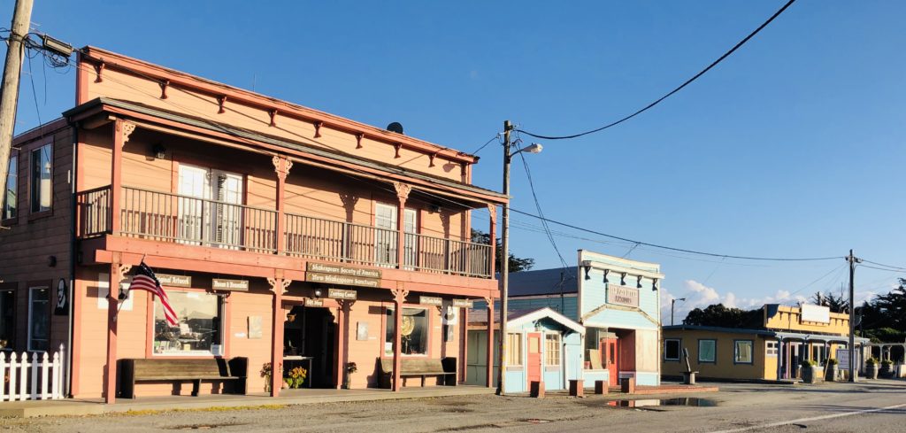
The main drag in Moss Landing has many quaint, historic buildings and shops. 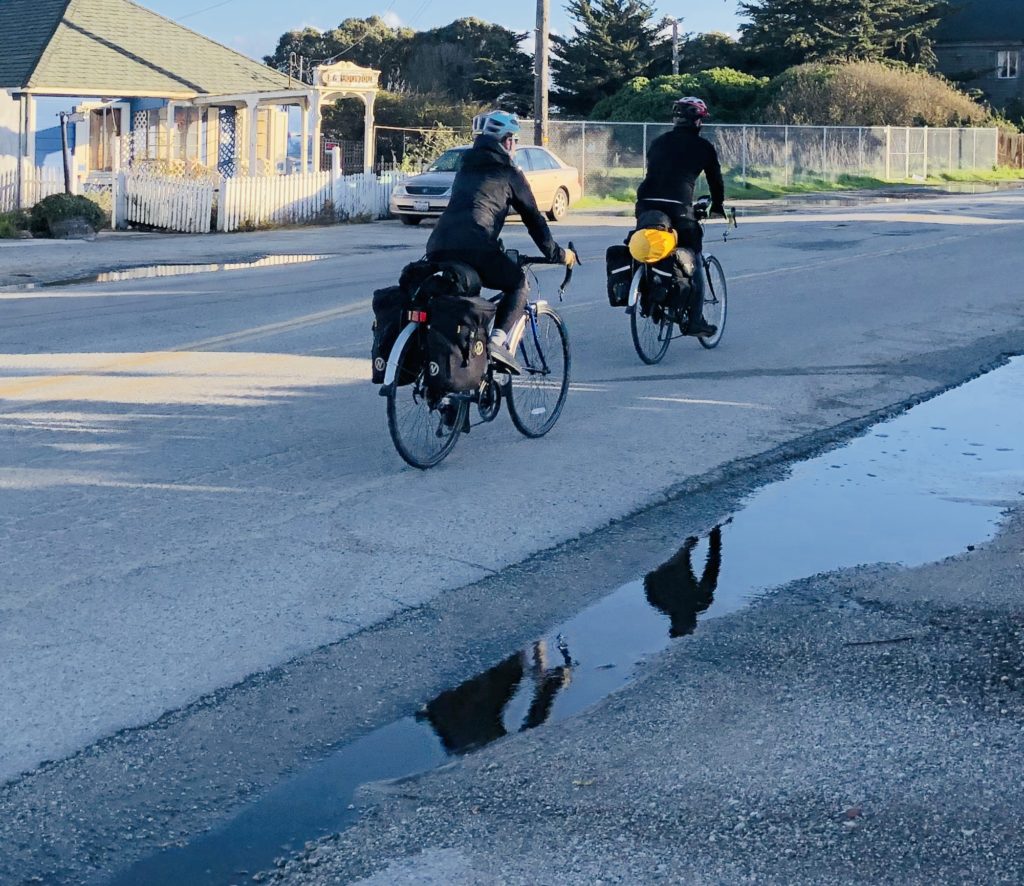
Moss Landing is a great place to bike and enjoy the quiet fishing village. WILDLIFE
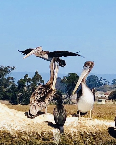
Elkhorn Slough is one of the largest wetlands in California. It began as a salt marsh and efforts are being made to help restore this habitat. It is considered one of the top ten best birding spots in the country, according to Audubon. More than 350 bird species migrate through Elkhorn Slough each year. It is a nesting place for Western Snowy Plover in spring and summer. In fall and winter, the wetland provides habitat for waterfowl and shorebirds. My favorites are the snowy egrets and the endangered brown pelicans.
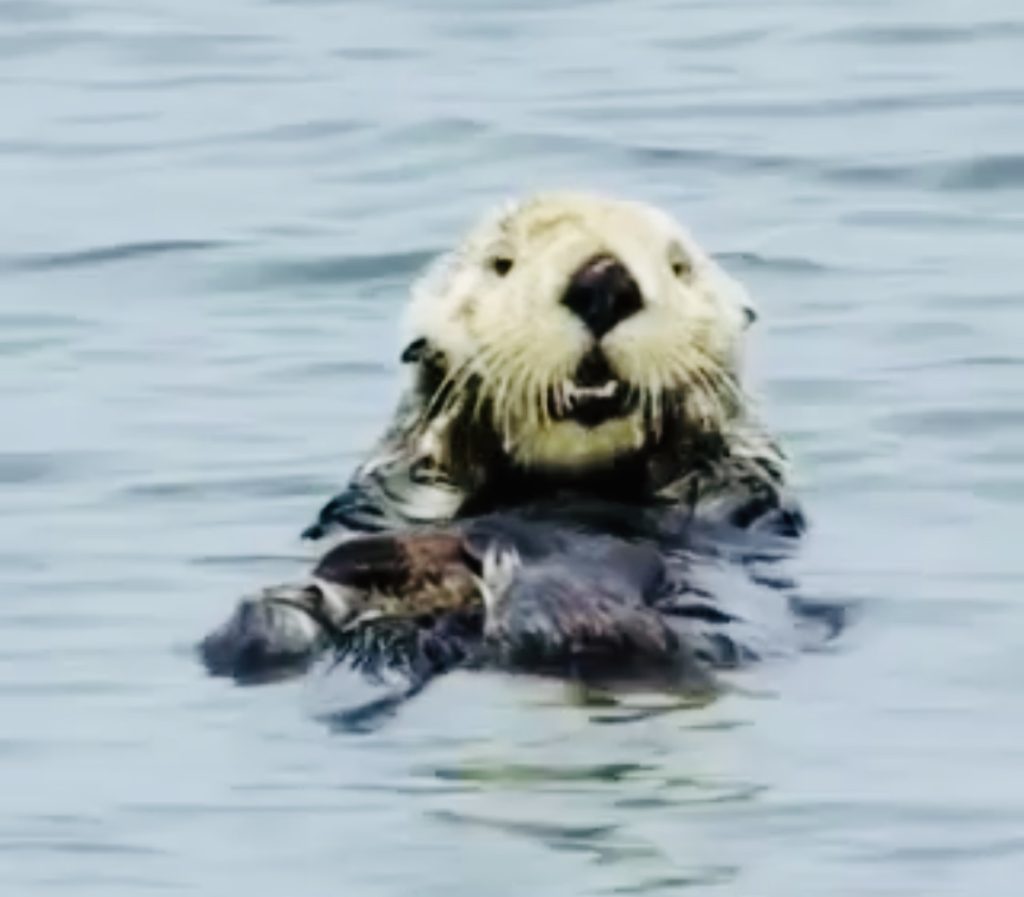
Moss Landing offers wonderful opportunities to view resident sea otters. You can see rafts of sea otters swimming here, sometimes holding hands. A raft refers to a group of sea otters in the water. A group can also be called a family, romp, lodge, and bevy. Whatever they are called, who doesn’t love those faces? Too much cuteness!
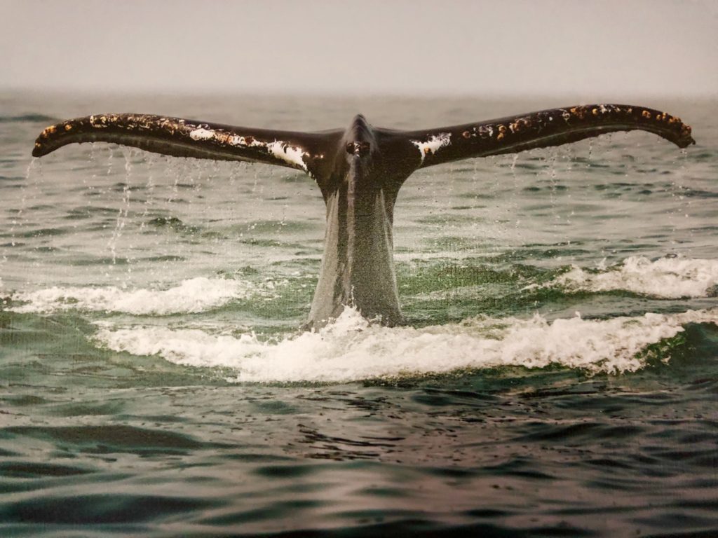
Moss Landing is also one of the best places to spot whales up close! I hope you are able to visit Moss Landing and enjoy its beauty. Thank you for visiting my blog! Wishing you peace, love, happiness, and beautiful vistas.
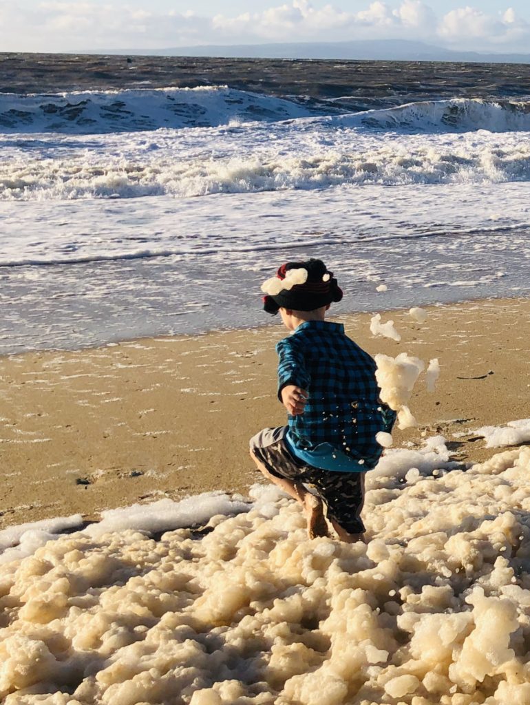
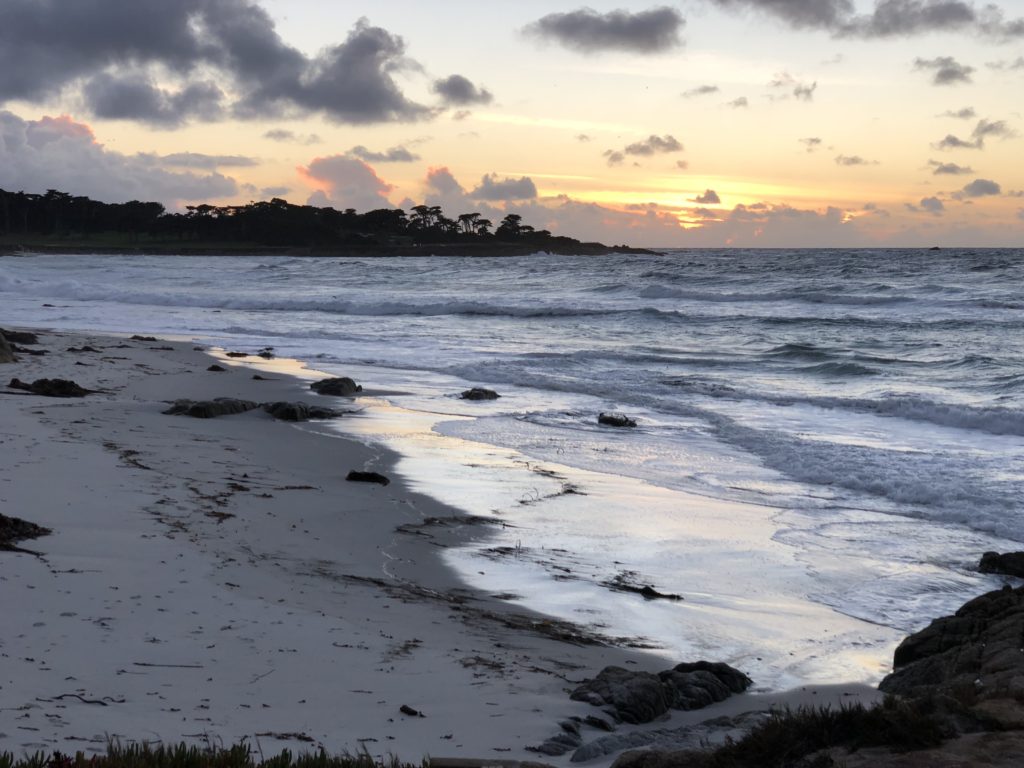
Nothing is more fun than playing in the sea foam when the tide is low. It reminds me of when my Mom used to pour Mr. Bubble in the bathwater and the bubbles got higher and higher in the tub! Good times 🙂 -
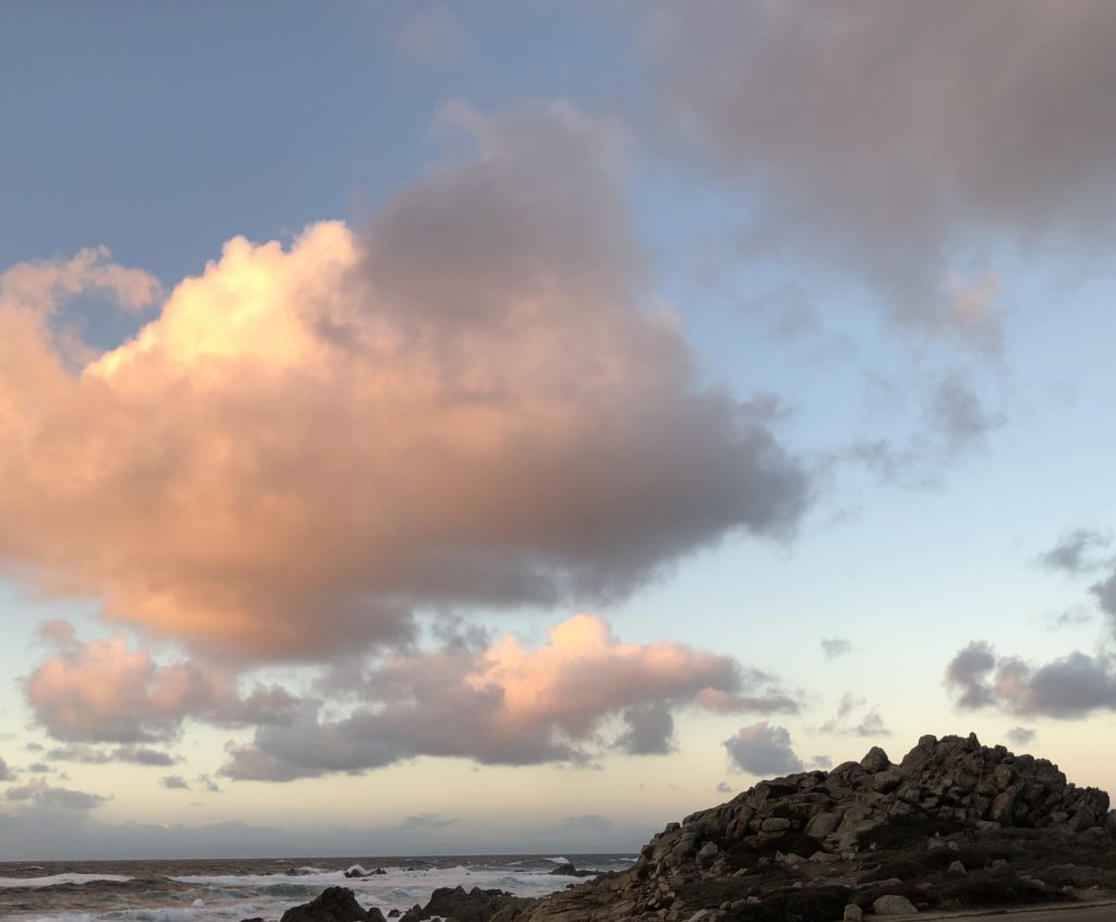
Pebble Beach & 17-Mile Drive’s Beautiful Vistas
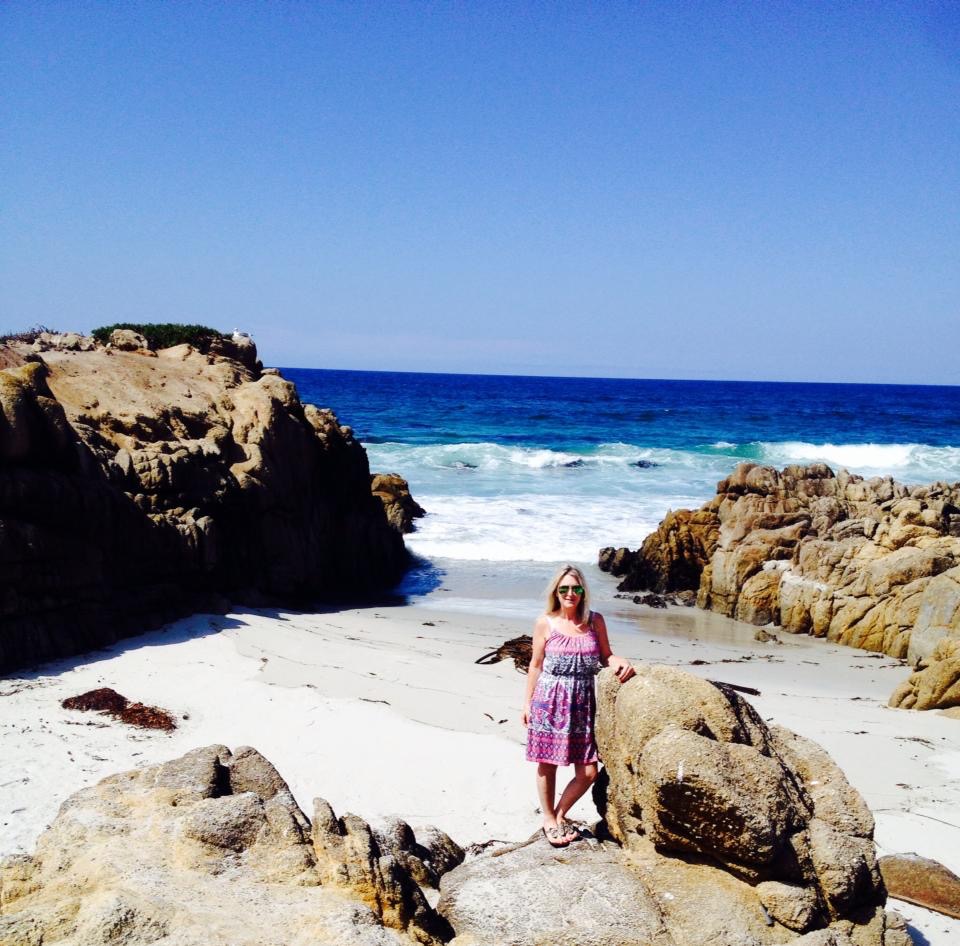
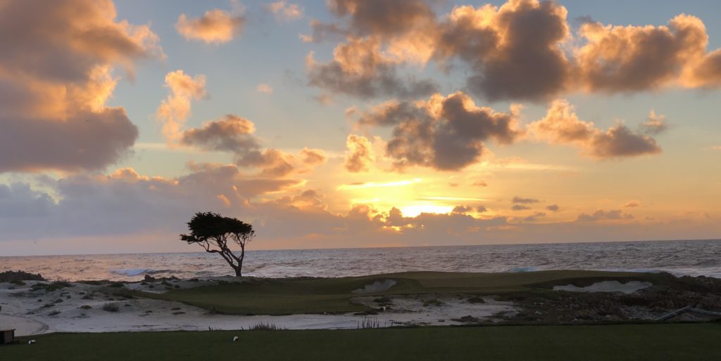 Pebble Beach is well known for its golf courses and mansions, but it is also home to some fabulous beaches and exquisite ocean vistas. Both rugged and romantic, this area is sure to captivate you. Bird Rock, Fanshell, Moss, Seal Rock, Spanish Bay, and Stillwater Cove are some of the beautiful public beaches you may see when you enter 17-Mile Drive in Pebble Beach.
 Spanish Bay Beach
I advise entering 17-Mile Drive at the Pacific Grove gate on Sunset and starting at Spanish Bay Beach, the northernmost beach in Pebble Beach. It lies at the bottom end of Asilomar State Beach. It has a wide, sweeping beach flanked by sand dunes and the Spanish Bay golf course. It is named after Spanish explorers who camped here in the 1700s during their search for Monterey Bay. A wooden boardwalk takes you north to Asilomar and south to Moss Beach. Surfing is big here, but wading and swimming are not recommended due to strong rip currents.
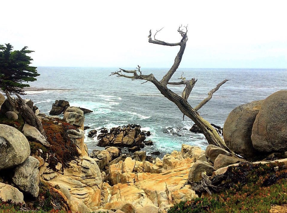
China Rock was initially the site of a Chinese fishing settlement in the 1800s. The Restless Sea, Point Joe & China Rock
After visiting Spanish Bay Beach, continue back onto 17-Mile Drive and head south to the Restless Sea, Point Joe & China Rock. They are bordered on the east by Monterey Peninsula Country Club. The Restless Sea is considered one of the most turbulent wave areas in Pebble Beach and in the past was the site of many shipwrecks. Point Joe was named for a man called Joe. Not Joseph, Joaquin, Joshua or Jonathan, just plain old Joe. Anyway, plain old Joe lived in a driftwood hut here in the early 1900s and sold (no, not drugs!) trinkets. I wonder what plain old Joe would think today if he saw what had sprung up around his original little shack. A bit of a shock, perhaps.
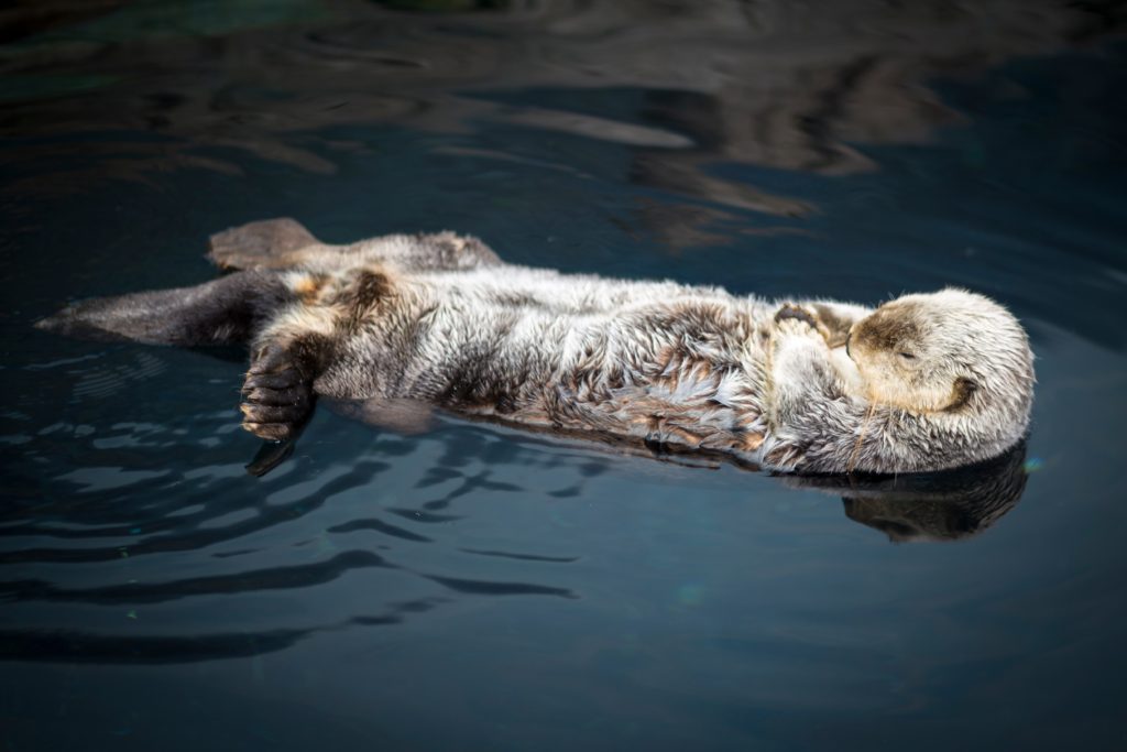
Sea otters are just the cutest. I love when they float around on their backs holding hands. Bird Rock & Seal Rock
Further south are Bird Rock and Seal Rock. They are bordered on the east by Spyglass Hill Golf Course. Bird Rock is a haven for pelicans, cormorants and sea lions. You may also see sea otters frolicking in the water or gray whales during their winter migration.
Fanshell Beach
Fanshell Beach is next on 17-Mile Drive with amazing vistas of Cypress Point and the Pacific Ocean. It is bordered on the east by Cypress Point Golf Club. I must shell you that I am a big fan of this beach because babies are born here! That’s right! Harbor Seals give birth to their pups in this area in the spring. Be aware that areas of the coastline may be closed from April through June to protect the moms & their babies.
Cypress Point Lookout
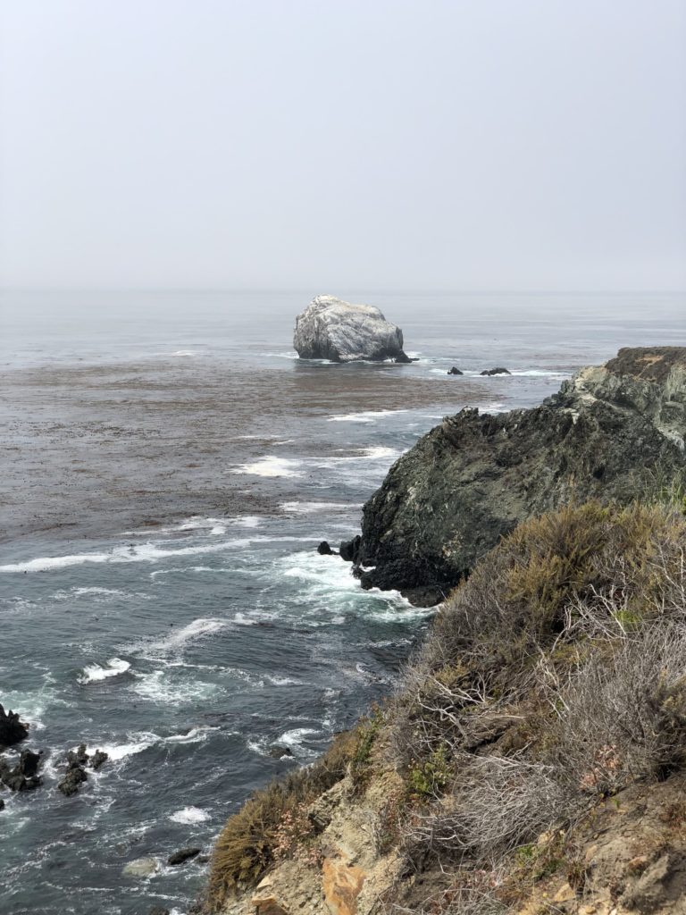
Continuing south to Cypress Point Lookout you will enter the 5,300-acre Del Monte Forest. It is a magical forest because it is home to the rare Monterey Cypress. Monterey Cypress trees are truly enchanting; they can top out at 70 feet tall and live up to 300 years! At Cypress Point Lookout you will also see views of the national marine sanctuary, Carmel Canyon, which is a part of the 10,000 foot deep Monterey Canyon. Be aware that the sanctuary is surrounded by a high, chain link fence.
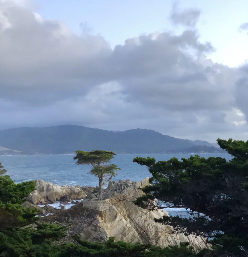
The Lone Cypress
The Lone Cypress is the next stop. This tree is the official symbol of Pebble Beach. Perched on a granite hillside off 17-Mile Drive, the iconic Lone Cypress is said to be as old as 250 years, which would conjoin its beginnings to those of the USA. In 1768, founding father Samual Adams wrote a letter opposing taxation without representation and calling for the colonists to unite in their actions against the British government. And of course, we all know how that came to play out!
Pescadero Point
After the Lone Cypress, you will pass the Ghost Trees at Pescadero Point. This was the setting for the famous “Witch Tree” which was used as a creepy background in movies and television until it was blown down during a storm. Pescadero Point is also a big surfing area with winter waves as high as 50 feet.
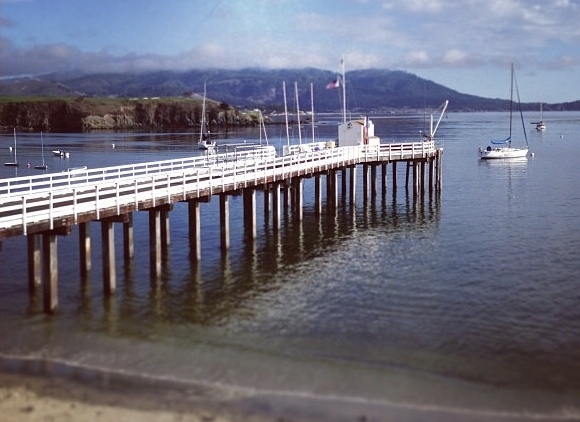
A rite of passage for local kids is jumping off the end of the pier at Stillwater Cove. Stillwater Cove
The final destination is Stillwater Cove. This is a narrow beach accessible below the Pebble Beach Golf Course. It is a great scuba diving site. Paddleboarding and kayak tours from Stillwater Cove into the nearby Monterey Bay National Marine Sanctuary are also fun activities here. To get to this beach, follow 17-Mile Drive to Palmero Way, then continue on Cypress Drive to the end of the Beach Club. There will be signage to guide you.
Helpful Tips:
- Check out the online 17-Mile Drive map beforehand (or pick up one at the entrance).
- Drones and motorcycles are not permitted in Pebble Beach.
- It is often very windy and chilly here, bring a warm jacket or coat.
- Bicyclists can enter for free through the Pacific Grove Gate.
- Follow the signs and red-painted dash lines on the road to stay on the legal route. No vigilantes are allowed here except for Clint Eastwood.
- The $10.25 entrance fee is waived if you will be dining or staying at a Pebble Beach restaurant or inn, or you can get a refund if you spend at least $35.00 at most Pebble Beach businesses.
- There are four primary entrances: the three most frequently used are Hwy 1 at Hwy 68, the Pacific Grove gate on Sunset, and the Carmel gate on San Antonio. I recommend starting at the Pacific Grove gate on Sunset if you only want to see the ocean views; you can then depart through the Carmel gate at the base of Ocean Ave.
- Check the weather before you visit via Pebble Beach webcam.
- The worst time to visit is during the U.S. Open Golf Tournament in June and the Pebble Beach Pro-Am in February due to heavy traffic. The drive also closes on the third Sunday in August for the Concours d’Elegance classic auto show.
- Restrooms are available at Bird Rock and the Visitor’s Center near the Lodge at Pebble Beach.
Thank you for visiting my blog! Wishing you peace, love, happiness & beautiful vistas!
-
Sand Dollar Beach & Jade Cove in Big Sur
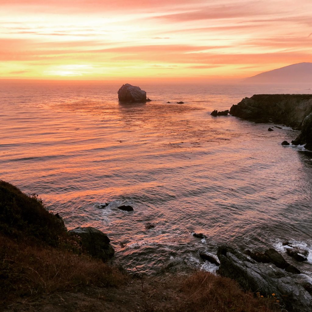
Sunset at Jade Cove in Big Sur We are heading south on Hwy 1 on a jade mission. An hour and 45 minutes after leaving Carmel, we spot it. The rinky-dink parking lot across from the Plaskett Creek Campground. Sand Dollar Beach awaits!
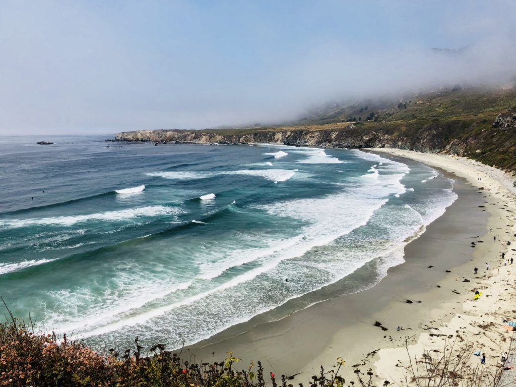
Sand Dollar Beach is the Largest Beach in the Area To get to Sand Dollar Beach, take the wide dirt path running parallel to the parking lot. The hike is .5 miles round trip. Start at the northwest corner of the parking lot and follow the trail for until you reach the steps leading 40 feet down to Sand Dollar Beach. It is extremely isolated and quiet here. There is no cell service, it vanishes shortly after you exit the south end of Carmel. No sound but the ponderous crash of waves as they break onto the beach and the whispering of the wind through the foxtails. Jagged cliffs plunge recklessly below to the sea. The rolling prairie above the beach is punctuated by several meandering trails. Many of these end abruptly and are surrounded by poison oak, however, some lead to breathtaking cliff top views of the beach.
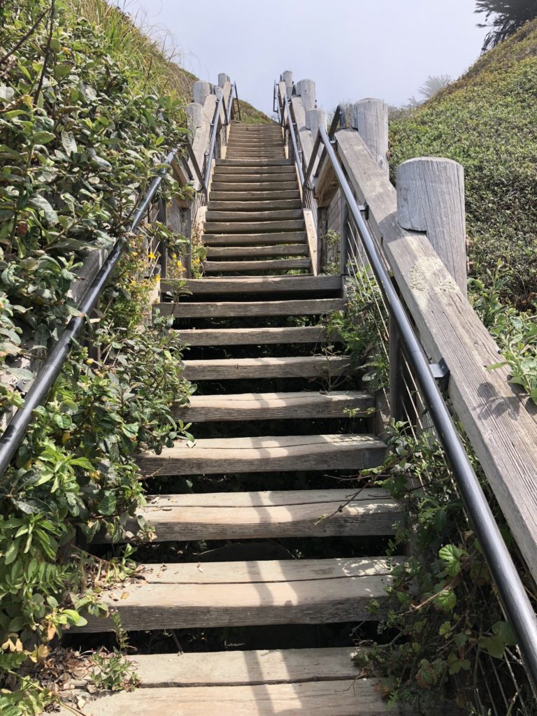
The Stairs Leading to Sand Dollar Beach There are many fun activities here including hiking, fishing, picnicking, and sunbathing. The beach is the largest in the area, a crescent-shaped arc of soft, white sand stretching for over half a mile. Surfing is also big here. Sand Dollar Beach is rated as one of the best surfing spots along this section of the coast. In addition, the level bluffs above the area are a designated hang glider and paraglider landing area. You may also see gray whales, elephant seals, sea otters, or shorebirds such as cormorants, brown pelicans, plovers, and gulls.
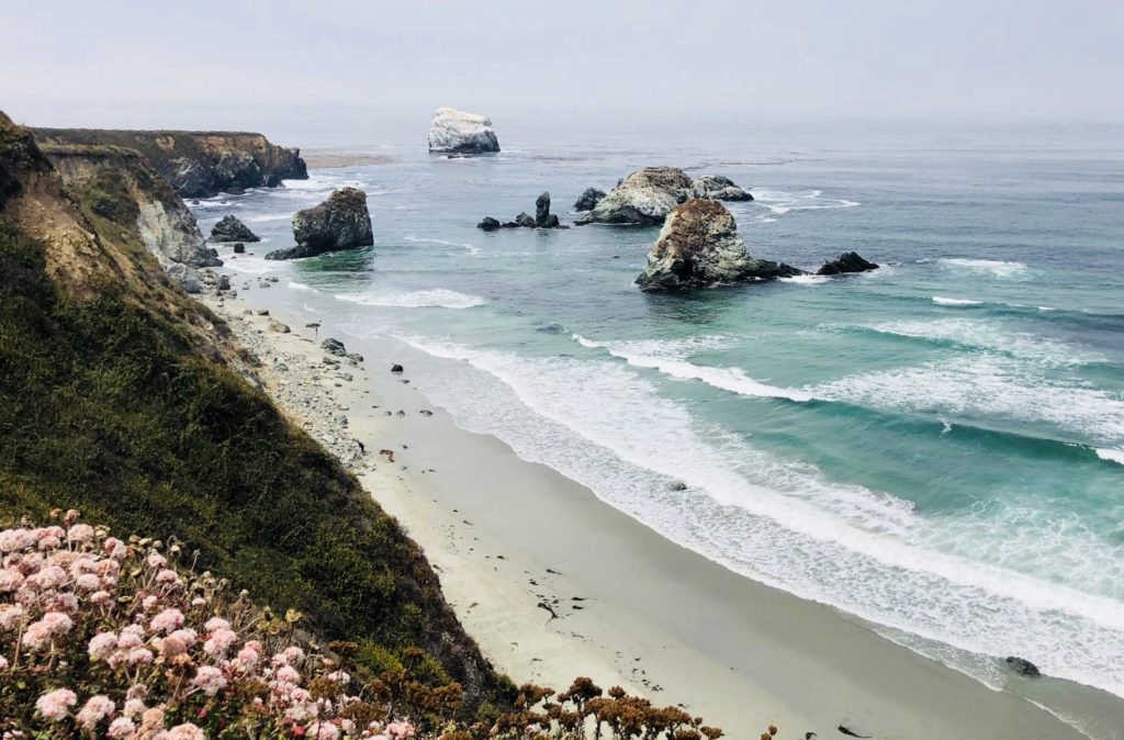
After you are done at Sand Dollar Beach, hike back to where you are parked and head further south for about 1/2 mile until you see a small pullout on the right side of Hwy 1. The trailhead to Jade Cove is unmarked, ostensibly to protect the area from overly ambitious jade seekers. Follow this trail straight back. Large jade boulders extend into the ocean and offshore you can see the picturesque 100-foot high Cave Rock, whose walls of jade are continuously pummeled by the crashing waves. As you near the ocean, follow the trail to the left through coastal grasses and wildflowers. You will pass three more boulders and then, when you see a pine tree, you are near the trail’s final descent to Jade Cove. The round trip hike is 1.5 miles.
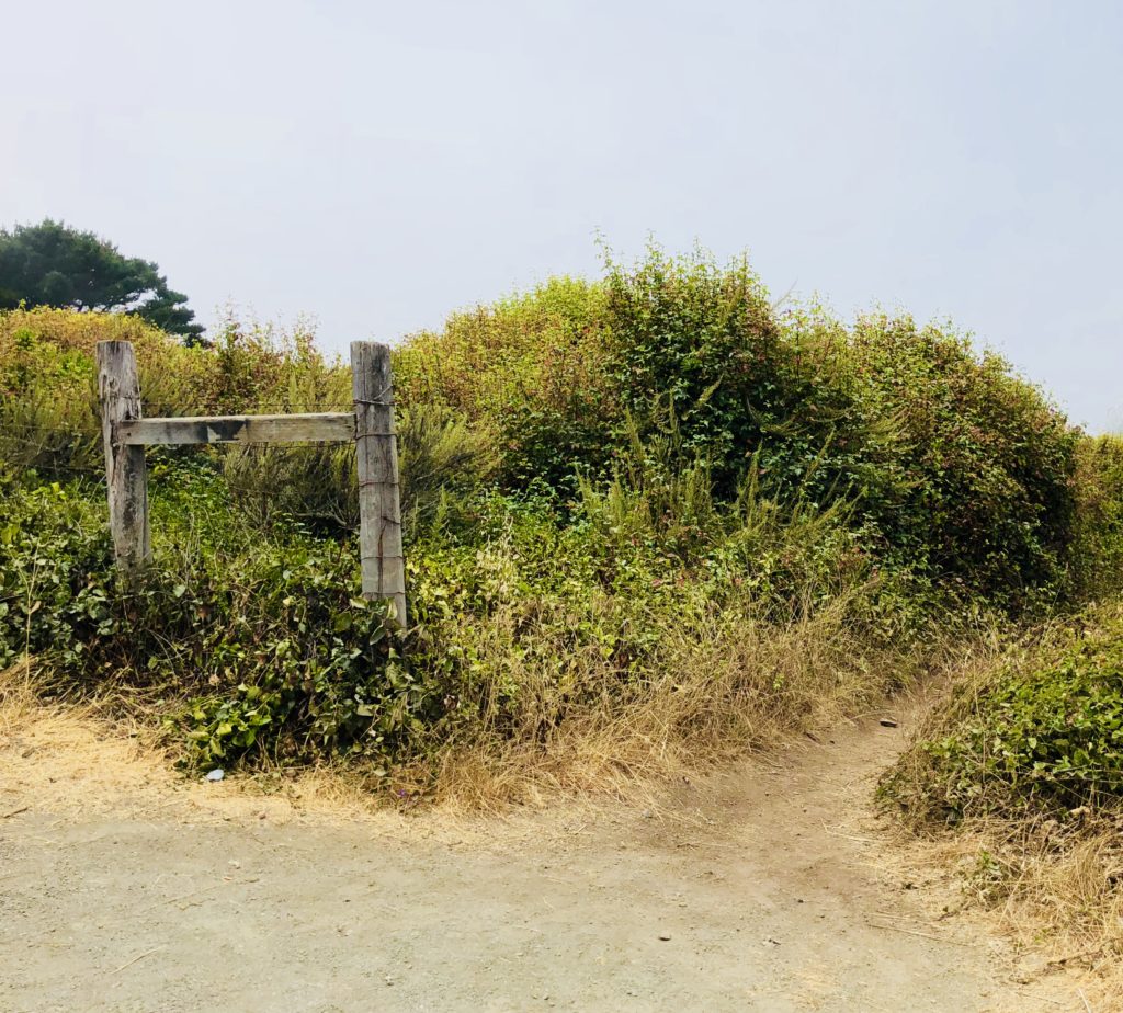
The Unmarked Trailhead to Jade Cove Jade has been prized for thousands of years and was considered the “imperial gem” in China. It has been used throughout history for tools, weapons, jewelry and religious objects. It has even been used for its metaphysical properties; some people use it for a talisman, for feng shui, or practice “jade rolling” which is said to draw out negative energy and balance your chi. Jade Cove in Big Sur is the hang out for jade-a-holics who diligently search along the beach or even perform meticulous dives off the coast in search of the beautiful mineral. There is even an annual Big Sur Jade Festival held nearby. People come from all over the world to the three-day fall event to sell and showcase their work, ranging from tiny, delicate pieces of jewelry to huge slabs of stone harvested from the sea.
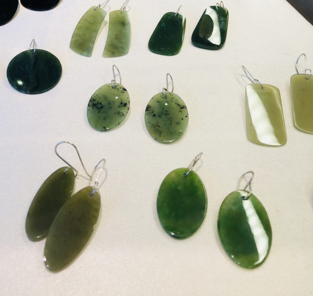
Jewelry made from Big Sur Jade; available at Nepenthe I recently met a girl running on the path to Jade Cove named Joy, who said she often finds jade there and makes it into jewelry which she occasionally sells at her mother’s shop in Pacific Grove, the Rabbit Hole. She kindly showed me what real Big Sur Jade looks like and when I returned home, I did additional research online for information that can help identify it. Apparently, the most problematic look-alike in the area is serpentine. The difference between serpentine and jade is that jade is much, much harder. How hard? If you scrape it with a pocket knife or can opener, serpentine will easily scratch, but jade will not. There are other tips offered including spitting on the stones, licking the salt off them, etc. I cannot vouch for any of these techniques.
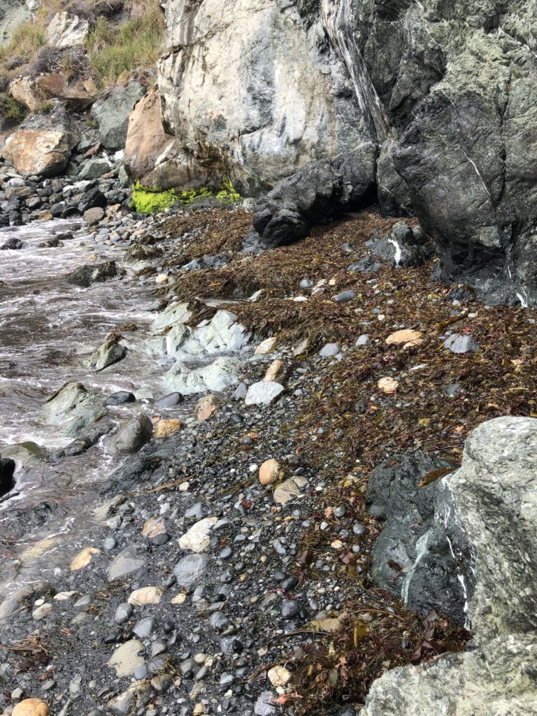
Who knows what the tide will bring in at Jade Cove! It is always a treasure hunt here. Be aware that there are regulations regarding removing jade from the area. 1. Only loose jade from submerged lands may be collected, from below the mean tide level. 2. No tools may be used except a hand tool to maneuver and lift the jade or scratch its surface to determine its authenticity. 3. Divers may use lift bags with a combined capacity of not more than 200 pounds. For more information on regulations see: montereybay.noaa.gov
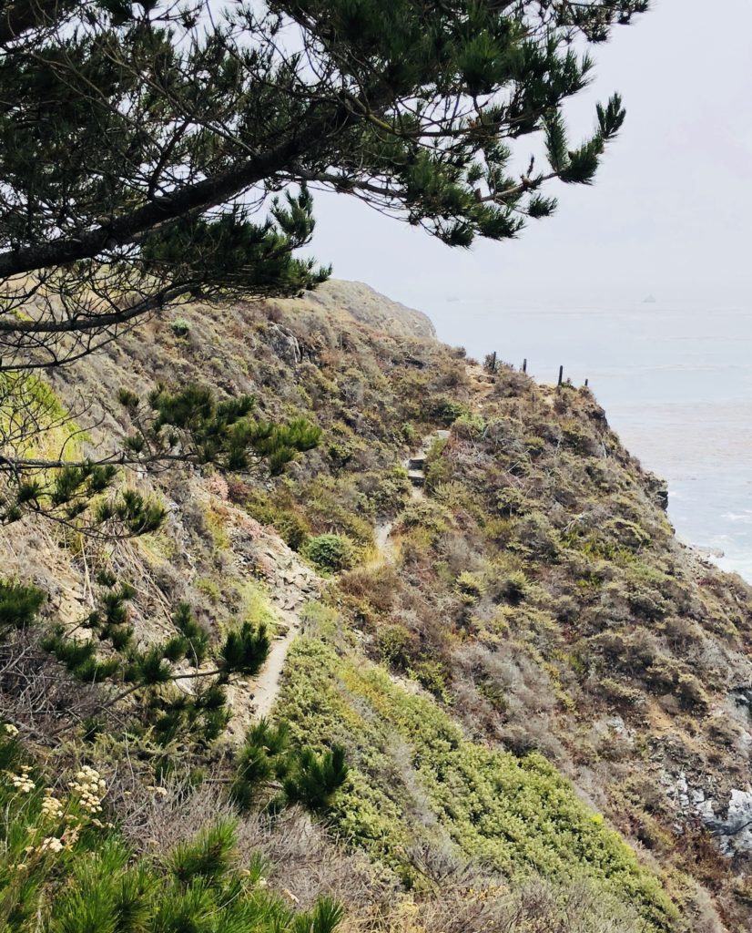
The Rambling Trail to Jade Cove Despite their rugged beauty, Jade Cove and Sand Dollar Beach can also be quite dangerous. Swimming and wading are not recommended due to dangerous rogue waves and strong rip currents. Hiking down the steep and at times slippery and ambiguous path to Jade Cove can also be a bit challenging and is not recommended for inexperienced hikers. There is a rope to hold onto at the bottom of the trail to facilitate a safe descent. Be sure to wear long sleeves, head covering and tick repellent if you will be hiking through the brush. The area is known for harboring ticks and people often leave with unintended guests, much to their chagrin.
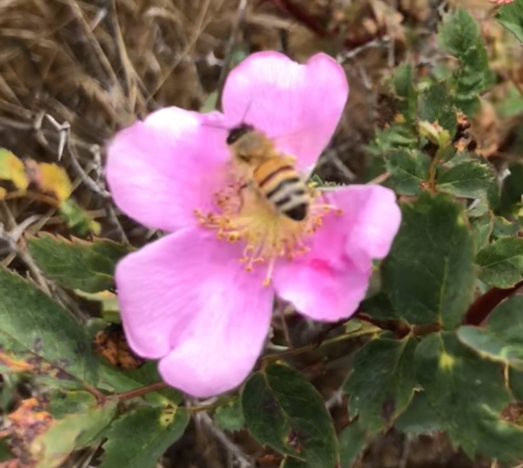
Wild Roses Growing Along the Jade Cove Trail To reach Sand Dollar Beach and Jade Cove, travel south approximately 60 miles from Rio Road in Carmel on Hwy 1 or 30 miles north of San Simeon. No camping is permitted except at Plaskett Creek Campground, located directly across Hwy 1 from the parking lot and also at nearby Kirk Creek Campground. A parking lot, picnic tables, and restrooms are available at Sand Dollar Beach, but there is a 10.00 fee to park there. If you camp at Kirk Creek or Plaskett Creek Campgrounds you can use the Sand Dollar Beach Day Use Area without paying the fee. There are also numerous turnouts nearby along Hwy 1 where you can park for free. Sand Dollar Beach and Jade Cove are open daily from sunrise-sunset and are day use only. Dogs on leashes are allowed. No bonfires are allowed on the beach.
Thank you for visiting my Blog! Wishing you peace, love, happiness & beautiful vistas!