-
Point Reyes: Gateway to Adventure!
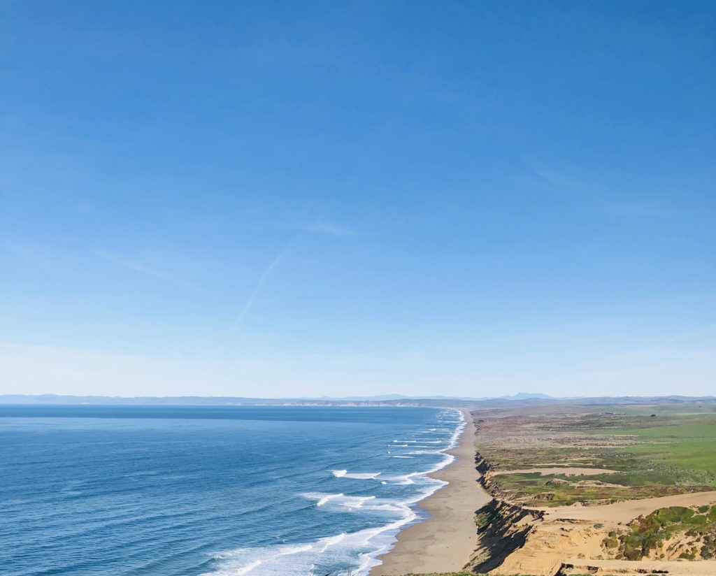 Point Reyes is an incredibly picturesque area located in Marin County. It is only about an hour and a half drive from San Francisco but it feels like you are in a different world here, with thousands of acres of wilderness, secluded villages, rolling hills with dairy farms, achingly beautiful beaches, and amazing wildlife. If you look at geologic maps, the San Andreas Fault Line slices through the area like a knife cutting the end off a loaf of bread. Point Reyes is the end of the loaf being cut off. It sits on the Pacific Tectonic plate, the same one as the country of Japan, while the rest of Marin County is on the North American plate. Point Reyes is basically an island that moved up the coast on this plate over millions of years to its present location. Apparently, Point Reyes Peninsula continues to move 3-4 centimeters a year towards the northwest. If it keeps moving it could ostensibly end up in Alaska or something. Crazy, right? Anyway, here are the FIVE most fun, must see and do things in the Point Reyes area.
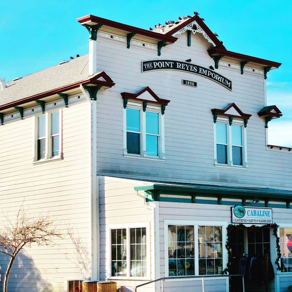
1. POINT REYES STATION
This tiny town, population 350, was previously a stop on the North Pacific Coast Railroad that connected the northern town of Cazadero all the way to its southern stop in Sausalito. After the great 1906 earthquake, this railway was used to haul redwood and other lumber to rebuild San Francisco. The wonderful old Victorian buildings in Point Reyes Station offer a glimpse of the past with a plethora of cute little shops and amazing restaurants. It is a great place to stop, shop, and eat. Places to eat here include Cafe Reyes which is known for its bomb diggety wood-fired pizza and fresh shucked local oysters and the Station House Cafe which serves everything from beer and burgers to fancier fare, all sourced from local farms and creameries. Station House Cafe has it all, from their quaint bar to their lovely outdoor garden seating and there is even live music on Sundays with no cover charge. The Bovine Bakery offers coffee, espresso, and yummy baked goods and soups. Cowgirl Creamery creates delicious artisanal cheeses as well as soups, salads, and sandwiches at their local digs. For more information on the unique food venues here, check out Where to eat in Point Reyes Station.
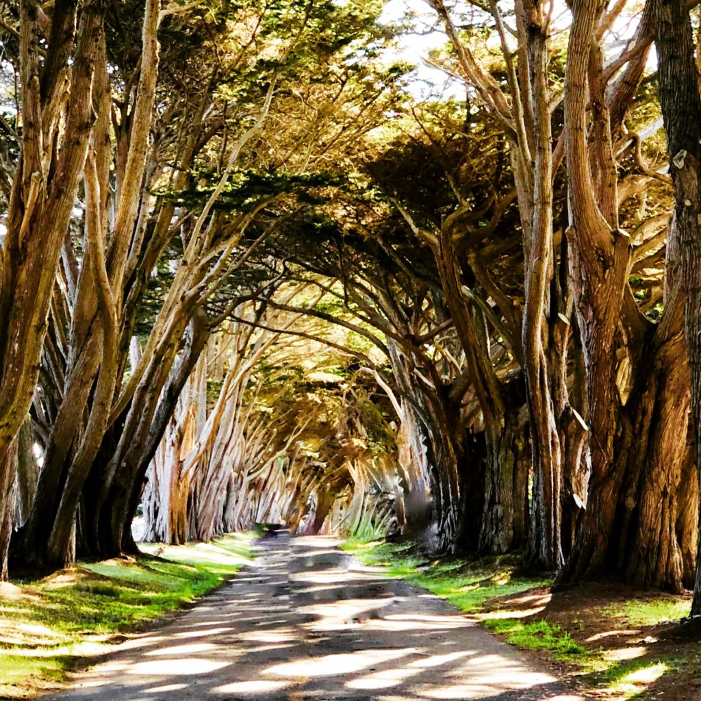
2. CYPRESS TREE TUNNEL & ART DECO RADIO STATION
From Point Reyes Station, take Mesa Road west to Shoreline Highway. Follow for .2 miles until you come to Sir Francis Drake Boulevard. Turn right and follow for 10 miles to see the famous Cypress Tree Tunnel. This has been photographed a gazillion times by probably every photographer on the planet because it is so ridiculously amazing. The cypress trees were originally planted in the 1930s. The road through the trees leads to an old white art deco building that houses the Point Reyes National Seashore North District Operations Center and the KPH RCA Radio Station. KPH is the only surviving Morse code coastal station in North America. It was created in the early 1900s and was called the “wireless giant of the Pacific”. For decades, it provided a communication link to ships at sea using telegrams and radioteletype. The station was nearly destroyed after it fell into disrepair, but fortunately, the Maritime Radio Historical Society, in conjunction with the Point Reyes National Seashore, came to the rescue. Today, you can hear KPH every Saturday from 12-4 pm. Special events and weekend tours are occasionally held at the station. For more information see KPH Maritime Radio Station. Where: 17400 Sir Francis Drake Blvd, Inverness, California. Note: The only roadside signage is for the “North District Operations Center” and is on the right side of the road adjacent to the Cypress Tree Tunnel. Visitors are asked to park along the highway or follow the driveway to the parking lot on the left end closest to the station. They request that you do NOT park along the driveway next to the cypress trees because it damages their roots. Save the trees, people!
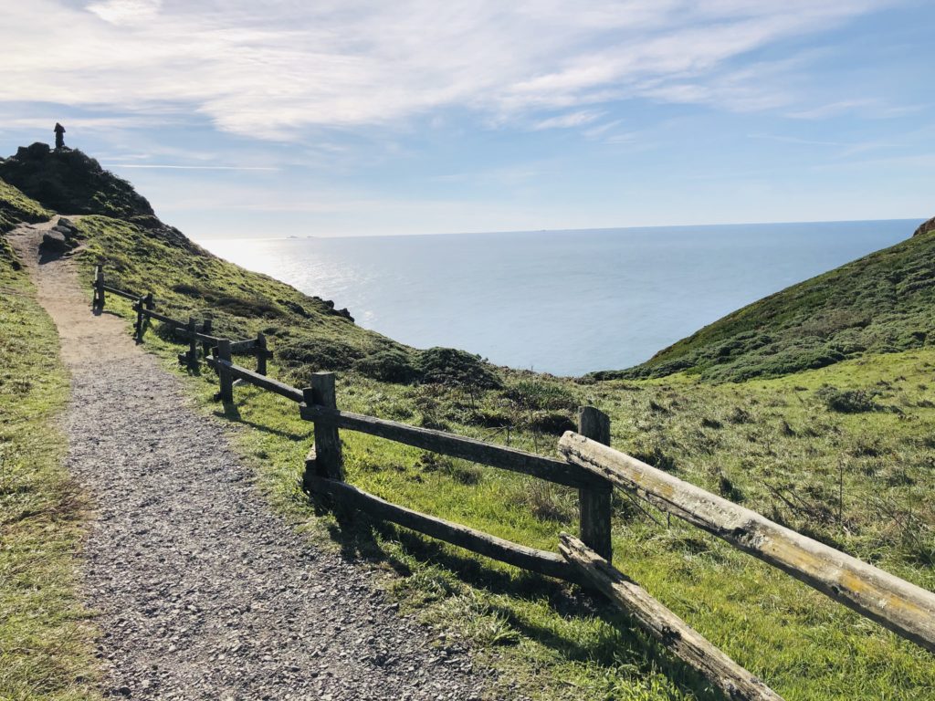
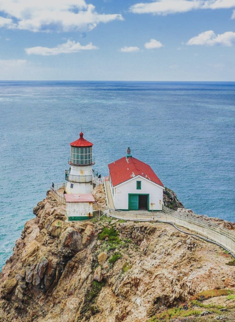
3. POINT REYES LIGHTHOUSE
Continue west on Sir Francis Drake Boulevard towards the Point Reyes Lighthouse. Your travels will become very lumpy, bumpy, and bouncy as you follow the road past bucolic farms with happily grazing Holsteins. These black and white bovines gave me warm fuzzies. They reminded me of my days as a cheesehead, living in the heart of dairy farm country in Wisconsin. The Point Reyes Lighthouse, a national historic landmark, was built in 1870. It was in service until 1975 when the Coast Guard installed an automated light below it. The lighthouse is currently owned by the National Park Service. Although it is not currently open due to restoration, you can follow its progress here: Point Reyes Lighthouse. The most current blog post indicates that it will be closed through January 31, 2019. Even with the lighthouse closed, this is a great area for hiking and has amazing vantage points to view the wind-swept coastline and possibly do some whale watching. If you want to wait and visit when the lighthouse is open, be aware that it is a .4 mile walk down 308 stairs down to the lighthouse. The lighthouse website indicates that they will return to their regular hours (Friday through Monday from 10 am-4:30 pm) once restoration is completed. Wear good walking shoes and bring a jacket as it can be chilly and windy. There is no entrance fee. There are restrooms in the parking area. Please remember to take your garbage with you and respect the property and wildlife here. Where: 27999 Sir Francis Drake Blvd. Inverness, CA 94937. Phone: 415-669-1534
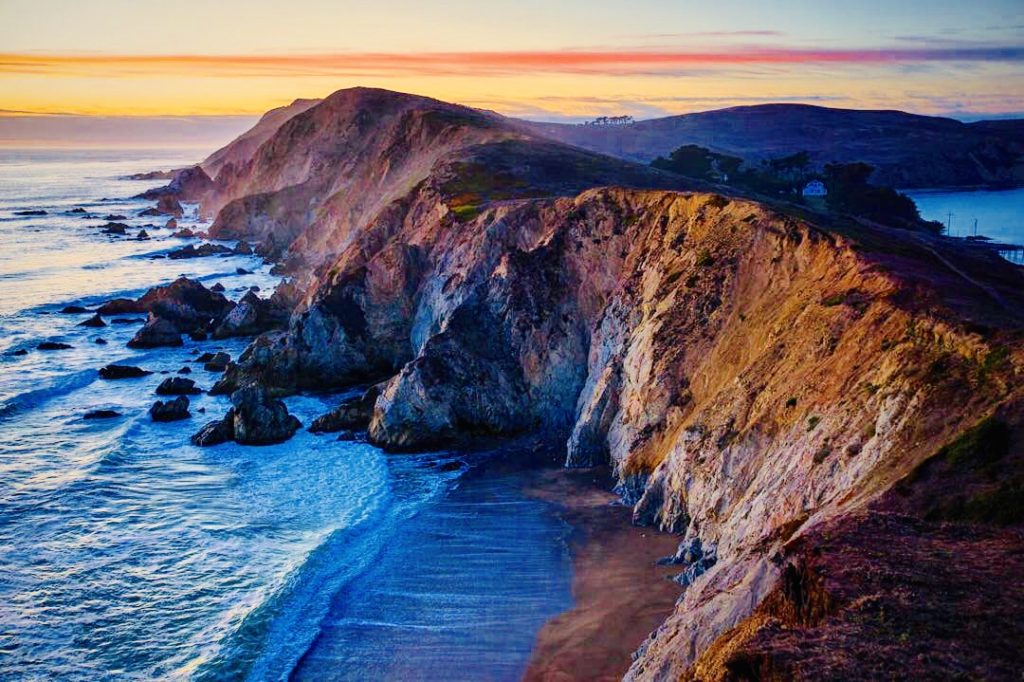
4. ELEPHANT SEALS & HISTORIC LIFEBOAT STATION NEAR CHIMNEY ROCK
When you leave the lighthouse, follow the one lane Chimney Rock Road to the right to the Chimney Rock parking area. Here you can check out the history of life-saving surf boats at the station (read about them here), observe the elephant seal rookery at Drake’s Beach, or hike three miles round trip to Chimney Rock for breathtaking cliffside views of the beach. Beginning in December, male elephant seals arrive and are soon followed by pregnant females in preparation for the birth of their pups. Point Reyes is one of only a handful of places on the Pacific Coast where they can be observed. Elephant seals were previously hunted to the point of near extinction for their oil-rich blubber. Fortunately, due to protection, their population has revived. The Point Reyes elephant seal population is now estimated to be between 1500 and 2000. Last year around Valentine’s Day, most of Drake’s Beach was closed due to being completely inundated with these honkers going bonkers! Be aware that no dogs are allowed on Drake’s Beach. It is a great place to stop and have a picnic, build sand castles, or collect driftwood and sea glass. You may want to bring binoculars for better views of the wildlife here. A visitor’s center and restrooms are available near the parking area. For more information see Drake’s Beach. If you enjoy history, by this time you may be wondering what is up with Sir Francis Drake Boulevard, Drake’s Beach, Drake’s Bay, etc. Apparently, Sir Francis Drake originally discovered Point Reyes in 1579, named it “New Albion”, and claimed it for England. In 2012, the area was designated a National Historic Landmark.

Photo courtesy of Jay Slupesky @jayslu 5. HIKING AT TULE ELK PRESERVE BY TOMALES BAY
Follow Sir Francis Drake Boulevard east for .3 miles until you come to Pierce Point Road, and follow this for 3.8 miles, staying left. The hike begins at the abandoned Pierce Point Ranch and ends on stately bluffs overlooking the ocean. The hike is 9.4 miles round trip. Stay on the well marked and maintained Tomales Point Trail to view herds of tule elk as they graze overlooking Tomales Bay. Tule elk are found only in California. They get their name from the tule, or sedge, in the freshwater marshes they feed upon. They almost became extinct in the late 1800s but due to conservation measures, there are approximately 5700 tule elk in the wild in California today per the California Department of Fish and Wildlife. Studies have shown that they play a critical role in maintaining native ecosystems. The males, with their antlers, remind me of Santa’s reindeer. Apparently, the best time to see the males bugling and fighting with each other over the females is in August through October. Bugling is a call the bulls make to attract the girls. Because they are wild animals, please observe them from a distance, stay on the trail, move and talk quietly, do not bring pets along, and do not feed the elk. The park service also asks that you do not remove any elk antlers as they provide an important source of calcium for other wildlife species. For more information, check out the California Department of Fish and Wildlife’s Tule Elk page. Restrooms are available at the beach parking lot on Pierce Point Road. Where: Pierce Point Road, Inverness, CA 94937 Phone: 415-464-5100
Helpful Hints:
- I highly recommend checking out the Point Reyes National Seashore Association, it has so much information it could literally be made into a book or even a documentary film. Seriously.
- If you want to check out the weather before you visit, see the Point Reyes Lighthouse Visitor Center Webcam
I hope you enjoyed this post and get a chance to visit Point Reyes. Tell me what you think! Thank you for visiting my blog! Wishing you peace, love, happiness, & beautiful vistas.
-
Surfing Museum Lighthouse in Santa Cruz
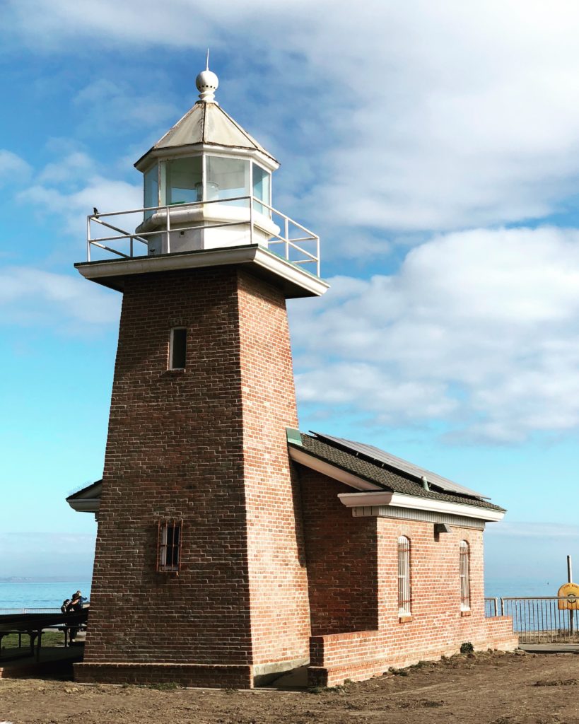 “Let’s go surfin’ now, everybody’s learning how, come on and safari with me” begins the popular Beach Boys song “Surfin’ Safari”. This could well be the theme song of the beautiful seaside city of Santa Cruz, California. Surfing is an obsession here. Legend has it that three Hawaiian princes first brought surfing to America while visiting Santa Cruz in the 1800s. This is the story of how a lighthouse built shortly after the civil war transformed into a shrine to surfing culture.
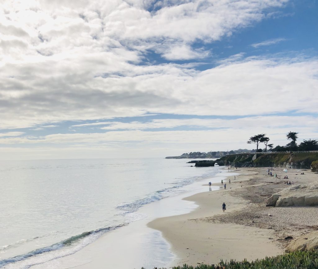
The beach north of the museum offers a serene view. Santa Cruz’s original lighthouse was completed in 1870, constructed at Point Santa Cruz and modeled after the Ediz Hook Lighthouse in Washington Territory. By 1878, the prolific formation of new sea caves along the cliffs at Point Santa Cruz began to jeopardize the lighthouse’s structural integrity, with the potential for collapse. It was removed from its foundation and moved on wooden rollers three hundred feet further inland, using a team of horses.
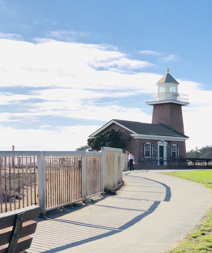
A handful of lighthouse keepers and their families lived at Point Santa Cruz. The most notable was Laura Hecox, the daughter of the first lighthouse keeper, Adna Hecox. When her father passed away, she became the official keeper, a job she held until her resignation in 1916. Laura began the study of shells and amassed an expansive and well-renowned collection of artifacts, some of which can be viewed today at the Santa Cruz Museum of Natural History.
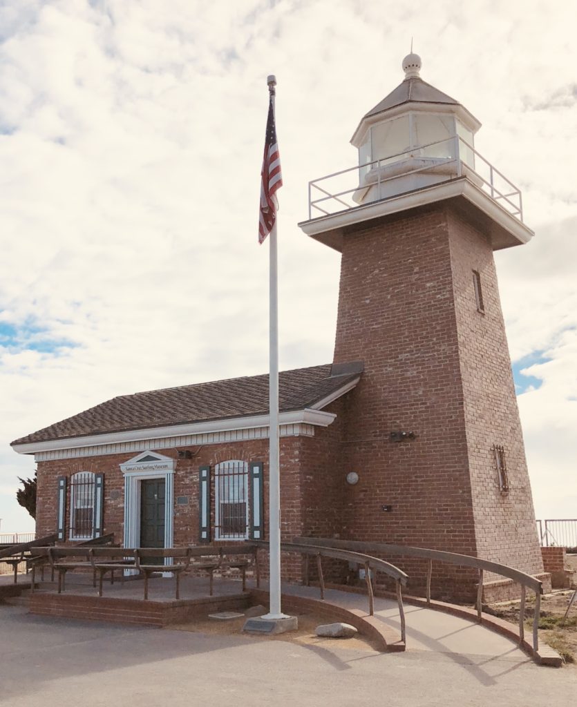
In 1941, the Coast Guard built a twenty-six-foot high tower 200 feet seaward of the lighthouse which became the station’s official beacon, and the original lighthouse and grounds were leased to the city of Santa Cruz for a park. In 1948, the Coast Guard sold the aging lighthouse with the stipulation that it be entirely removed from the property. A local carpenter purchased it and completely dismantled it for the lumber. The city of Santa Cruz later purchased the property at the site of the original lighthouse. The lighthouse that had stood here for over seventy years was gone forever. This could have been the end of the story, but a tragic accident brought about a very beneficial reinvention.
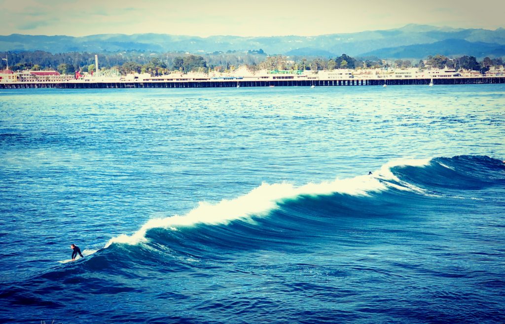
It’s fun to watch today’s surfers catching waves. In the background is Santa Cruz’s beach boardwalk. Surfing can be a perilous sport, and in 1965, a promising young 18-year-old surfer named Mark Abbott lost his life at nearby Pleasure Point surf break. In 1967, Mark’s grieving parents wanted to do something positive to commemorate their son. They donated life insurance money for the completion of a new 550 square foot new lighthouse in honor of their son. The Abbott Memorial Lighthouse was built of red brick and featured a lantern from the defunct Oakland Harbor Lighthouse. A beautiful plaque inside the lighthouse reads “This lighthouse is further dedicated to all our youth whose lives, through fate or misadventure, are terminated before realizing their true potential. May their spirits find new dimension in the unknown horizons that await us all.”
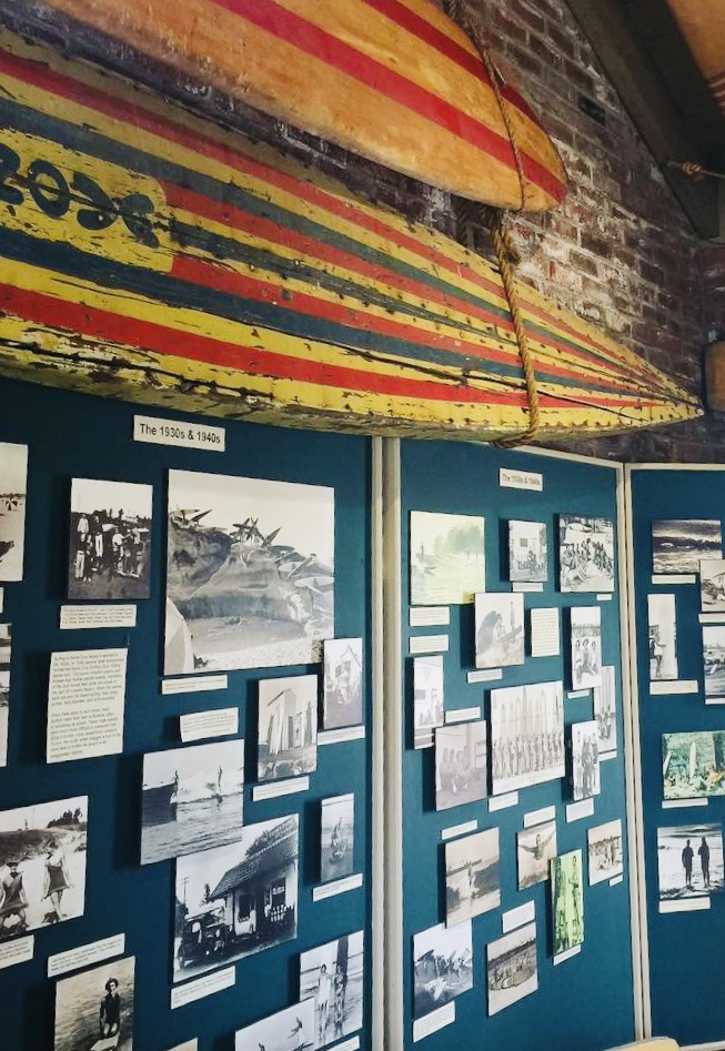
In 1986, the lighthouse became home to the Santa Cruz Surfing Museum, the first surfing museum in the world. In 2008, it was nearly closed due to city budget difficulties. The Santa Cruz Surfing Club Preservation Society raised enough money to keep the lighthouse open temporarily, and other donors soon came forward to rescue the museum.
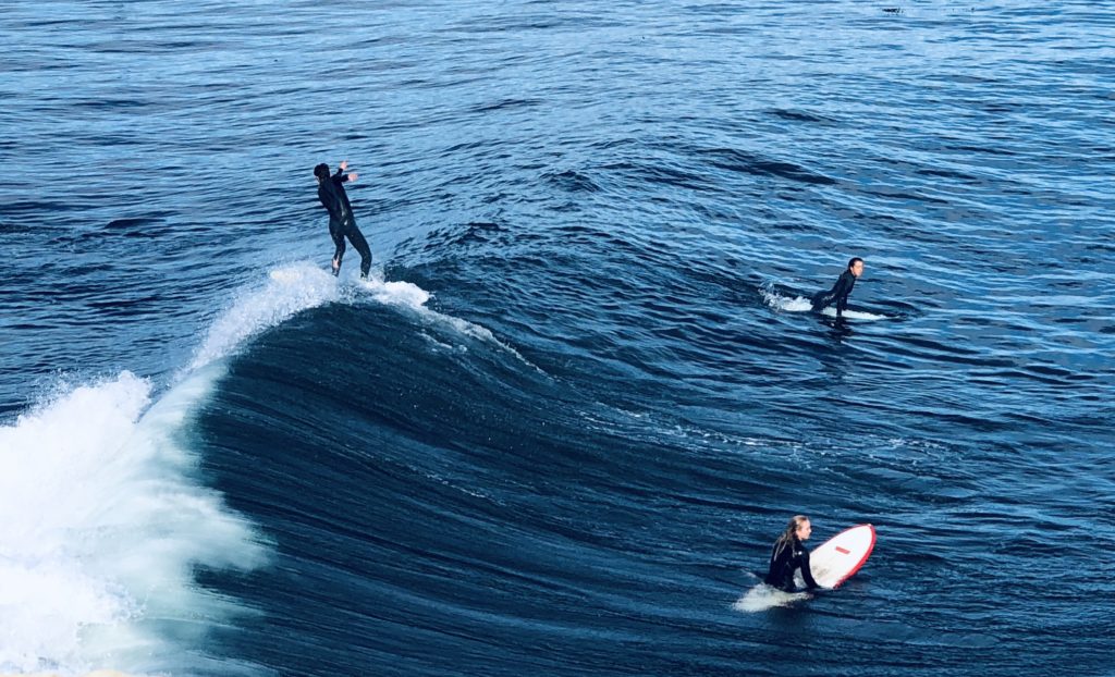
While I am not a surfer, I was truly impressed by the extensive collection of photographs, videos, surfboards, and other surfing memorabilia in the museum. Notable features include locally crafted redwood surfboards from the 1930s and the very first wetsuit invented by Santa Cruz native Jack O’Neill. You really feel the passion that this sport has elicited in people and the historic role (over 100 years) it has played in the area. Santa Cruz is highly respected in the surfing world. In 2011, Santa Cruz received approval as a World Surfing Reserve, ranking highly on criteria such as wave quality and consistency, surf culture and history, and its unique environmental characteristics. There are over 23 surf spots in the region, including the iconic Steamer Lane and Pleasure Point.
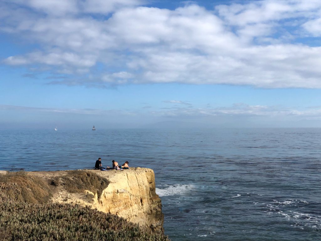
It is a beautiful place to relax and contemplate the sea and sun. The museum/lighthouse has been a staunchly revered local landmark and hosts the annual “Caroling Under the Stars” tradition each Christmas. Admission to the museum is free but donations are welcome. There are numerous benches around the area and it is wheelchair accessible. It is a beautiful and peaceful place to sit and watch the surfers, enjoy a picnic lunch, or just bask in the sunshine while enjoying the beautiful beach.
Location: 701 West Cliff Drive, Santa Cruz, CA 95060
Summer Hours (July 4 – Labor Day): 10:00 a.m. – 5:00 p.m. (closed Wednesdays)
After Labor Day Hours: Noon – 4:00 p.m. (closed Tuesdays and Wednesdays) and
Phone: 831 420-6289
Helpful Hints: No restrooms are on the premises, but public restrooms are available approximately one block south of the museum on the opposite side of the street.
More Information: Santa Cruz Lighthouse and Surfing Museum
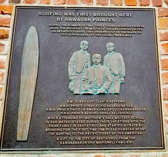
Plaque commemorating Hawaiian Princes who introduced surfing to Santa Cruz in 1885. Thank you for visiting my blog! Wishing you peace, love, happiness, and beautiful vistas!
-
Picturesque Pigeon Point Lighthouse
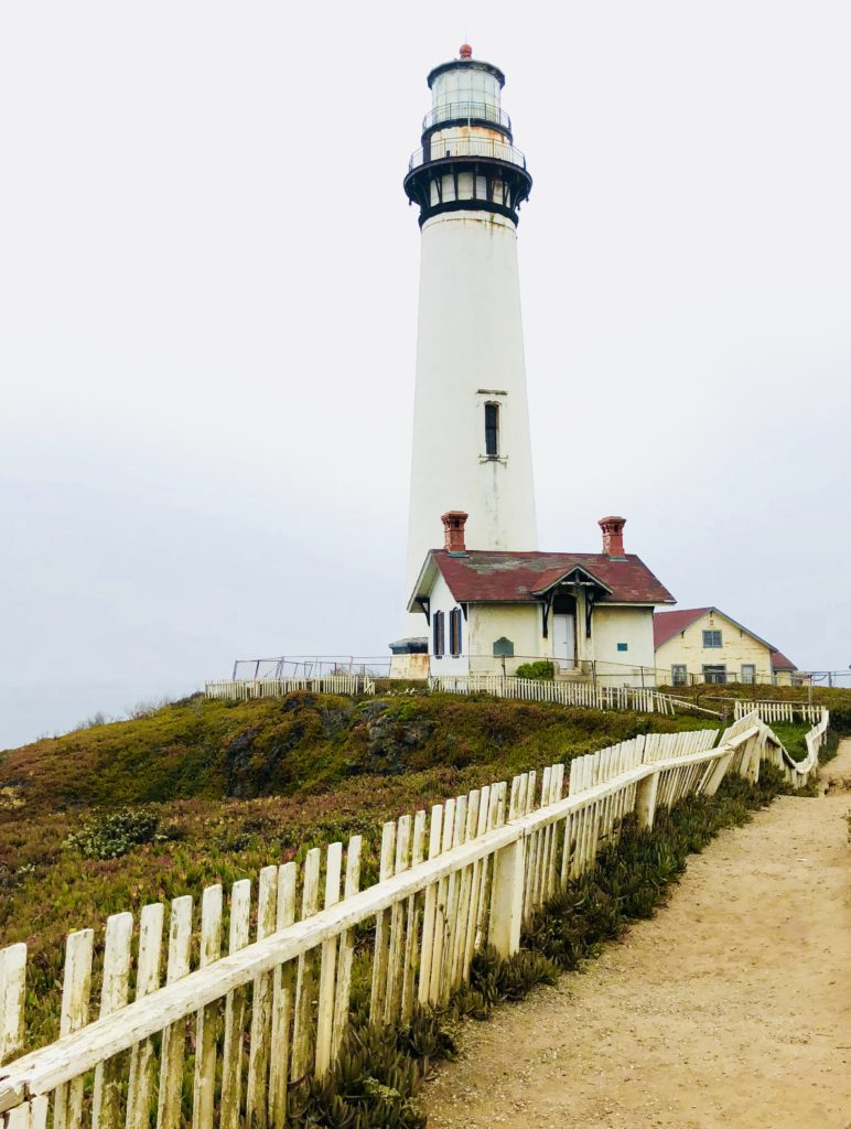
Pigeon Point is one of the most picturesque lighthouses to grace the Pacific Coast. It is also one of the tallest lighthouses in California, standing 115 feet high (it ties for this honor with Point Arena Light north of San Francisco). It was built in 1871. It is named for the clipper ship Carrier Pigeon which ran aground near Whale Point, which was renamed Pigeon Point in memory of the shipwreck. Rock-strewn and foggy, the ocean here is treacherous. Submerged rocks, swirling currents, and eddies presented a challenge even for the most experienced sailors. Due to persistent thick fog, navigational readings were unreliable. Signals from fog horns and other ships were also easily misinterpreted. After three more shipwrecks occurred in the area, Congress approved the construction of a lighthouse at a cost of $90,000, which would be over two million dollars today.
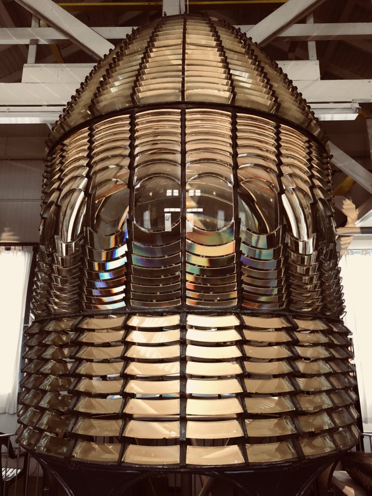
The Fresnel “beehive” design used glass prisms to bend and refract the light within to create a powerful beam. The lighthouse originally used a first-order Fresnel lens but now uses an automated one to aid navigation. Pigeon Point’s original first order lens was the largest size made. It is nearly eight feet tall, weighs 2,000 pounds, and is the biggest and strongest lens size. The lens was invented by Augustine Fresnel and consists of 1008 glass prisms. These prisms concentrate a light source within to project a strong beam over a great distance. The original Fresnel lens is now housed in the on-site museum. Pigeon Point Lighthouse had a specific pattern of a flash of light every 10 seconds to help ships identify their location. Pigeon Point also had a steam generated foghorn installed in 1899.

In 2001, brickwork supporting outside walkways on the top of the structure collapsed, and the lighthouse was closed to tours. Although you cannot tour Pigeon Point Lighthouse due to structural instability, you may explore the grounds on your own or follow a docent lead tour. It is sad to see such an amazing part of California history crumbling and deteriorating due to lack of funds to repair it. There currently are efforts by the California State Parks Foundation and the Coastside State Parks Association to raise private funds to restore the lighthouse and grounds. I hope they are successful!
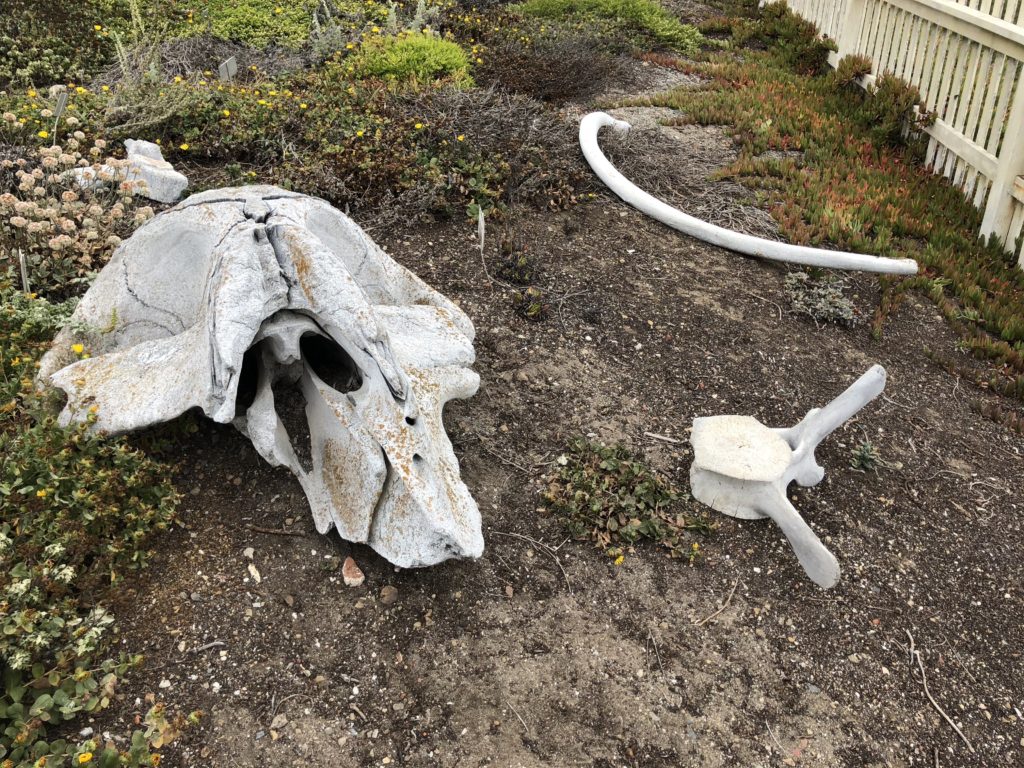
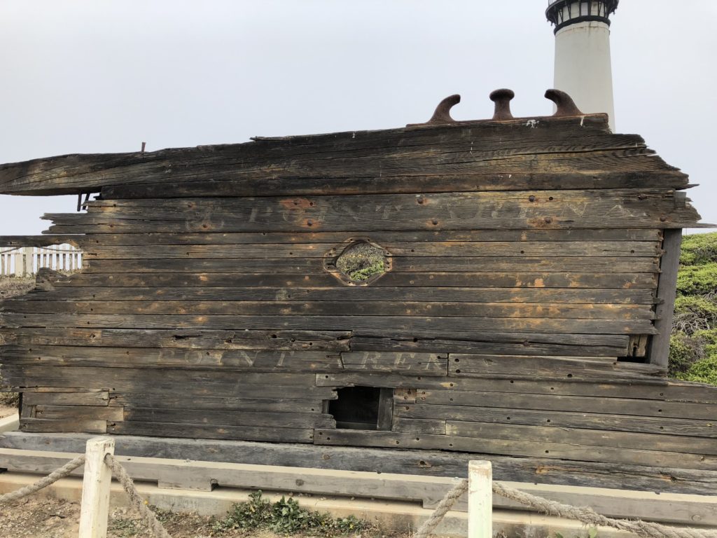
The skeletal remains of a whale are displayed on the grounds. Pigeon Point is a great place to view native wildlife, including humpback and gray whales, pelicans, cormorants, sea lions and harbor seals. You can also see a rocky island in Whaler’s Cove called Prisoner Rock because local fishermen were often trapped there during high tides. You may also enjoy seeing the remains of the Point Arena, a ship that was loading tanbark at Pigeon Point in 1913 when rough seas forced her onto the rocks, tearing a hole in her hull. You can still make out the ship’s name in the weatherbeaten wood.
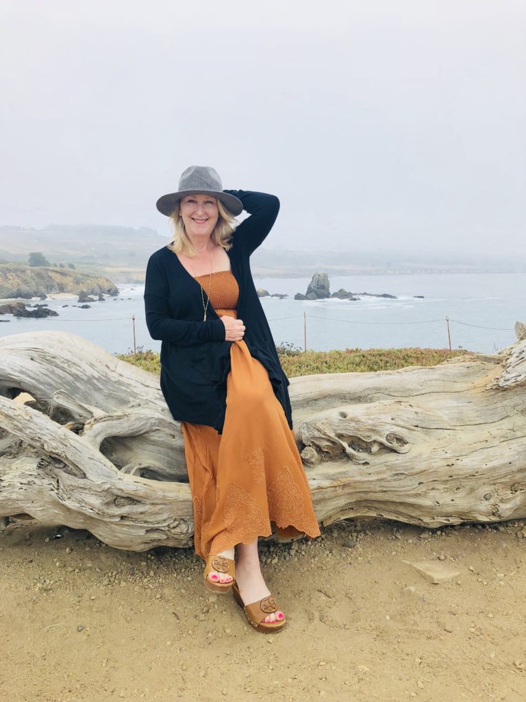
There are many meandering pathways and trails on the property to follow for great views of Whaler’s Cove. There is also a huge piece of driftwood which provides opportunities for photo ops!
Pigeon Point is a State Historic Landmark and is owned by California State Parks.
- Location: 210 Pigeon Point Road, Hwy 1, Pescadero, CA. It is 50 miles south of San Francisco and lies between Santa Cruz and Half Moon Bay.
- The phone number is 650-879-2120.
- Hours: 8 am to sunset.
- Admission is free.
- Half hour guided tours are available daily at 1 p.m.
- A museum and gift shop are open
- Pit toilets are available.
- Hostelling International rents cottages on site, see California Hostel
- Dogs, drones, and smoking are not allowed on the premises.
For more information on Pigeon Point Lighthouse, see Lighthouse and for more interesting history regarding this lighthouse see Lighthouse History
Thank you for visiting my blog! Wishing you peace, love, happiness, & beautiful vistas!
-
Point Pinos Lighthouse, Pacific Grove
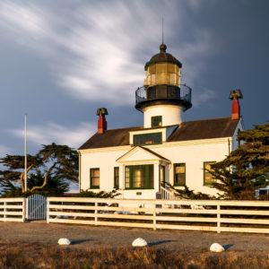
Point Pinos Lighthouse, located In Pacific Grove, is the oldest continuously operating lighthouse on the west coast of the United States. In 1855, it was the second lighthouse built in California. Alcatraz Island Lighthouse had been built 8 months previously, but in 1909 was replaced by the famous prison. Point Pinos was built atop a quaint house enabling keepers to tend the light without fearing the elements. Point Pinos Lighthouse uses a Fresnel lens manufactured in France in 1853. The beacon is still used by the Coast Guard to aid navigation and the city of Pacific Grove maintains the property. While it began as just a narrow light beam fueled by whale oil, in 1912 it used an “eclipse” that made the light blink on for 10 seconds and off for 20 seconds. Today, the light is electronic and is on for three seconds and off for one, which helps mariners identify it. Point Pinos stands 43 feet tall, approximately 90 feet above the ocean, and its lens can be seen 17 miles out to sea.
History
Point Pinos Lighthouse has had many keepers, but perhaps the most interesting was Emily Fish. Emily Fish’s sister died in childbirth, and at age 17, Emily married her dead sister’s husband, Malancthon Fish, and raised her sister’s baby daughter, Juliet. Mr. Fish, a medical doctor, died when Emily was 50 years old. Following his death, Emily applied for the position of lighthouse keeper at the Point Pinos Lighthouse in Pacific Grove, CA. This was considered highly unusual, as most women only received their positions upon the death of their lighthouse keeper husbands. Emily, however, was an anomaly. She bucked the norms and defied gender roles. She would not be foiled in her efforts, proving that no matter how old you are and what society thinks, you should always follow your dreams and aspirations.
She thrived in her position, and for over twenty years, lived and worked at the lighthouse with her menagerie of French poodles, Holstein cows, horses, and chickens. She excelled at gardening and created an oasis of grass, hedges, and trees on the lighthouse grounds. From her home in Oakland, she brought antique furniture, paintings, china, and silverware. Being a lighthouse keeper was no easy chore; rather, it was a difficult and demanding life. Emily, however, excelled at her job, and soon became known as the “Socialite Keeper” because of her flair for style and fashion and her reputation for entertaining guests at the lighthouse. During her keep, Point Pinos Lighthouse consistently received high marks for being well-kept.
While Emily is the most memorable female lighthouse keeper at Point Pinos, she was not the first. The light’s first keeper, Charles Layton, was serving on a posse in pursuit of an outlaw when he was fatally shot the first year he was appointed. His wife Charlotte, left alone with four children, replaced her husband as keeper until 1860 when she was remarried and her new husband took over the position.
If you are planning on visiting the area and would like to tour the lighthouse, please see pointpinoslighthouse for information including directions, hours, and parking. *Photo courtesy of Jay Slupesky, follow him on Instagram @jayslu
-
Point Sur Lighthouse in Big Sur, California
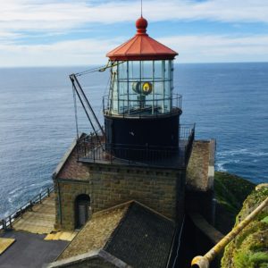 Located between Carmel and Big Sur, the 48-foot high sandstone Point Sur lighthouse stands duty, warning ships approaching the treacherous coast. Point Sur, a National Historic Landmark, is the only complete turn-of-the-century light station open to the public in California. The lighthouse was originally fueled by whale oil, lard oil, and kerosene before becoming electric in 1948. It used a Fresnel lens invented by Augustin Jean Fresnel, a French physicist, until the 1970s. It is still in use today, operated by the U.S. Coast Guard.
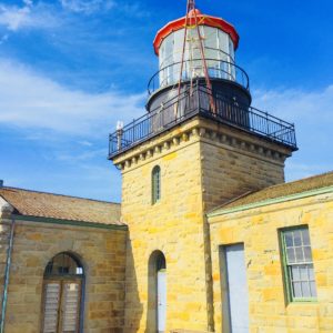
During its history, Point Sur has been home to four lightkeepers and their families. Beginning in 1899 up until 1974, these lighthouse keepers and their families lived in isolation in this remote and desolate place. Supplies were brought every four months by ship. It is hard to imagine what life must have been like for these folks, without the modern conveniences that we take for granted and so distant from the rest of the world. To live at Point Sur clearly required grit. Point Sur could originally be reached only by boat, as it was an island. Now, it is reached by walking a little less than a mile from the parking lot below.
 Despite a light that could be seen for 23 nautical miles and a coal-powered fog horn, the Point Sur lighthouse still witnessed its share of shipwrecks. If you are interested in ghosts and haunted places, you may enjoy the Ghost Hunts and annual Halloween Tours. Nature lovers may also enjoy the Whale Watch Tours. Gray whales are often seen on their migration route during the winter and during the summer you may see humpback and blue whales.
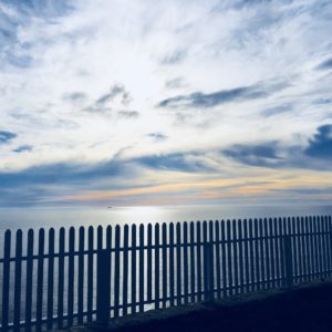
 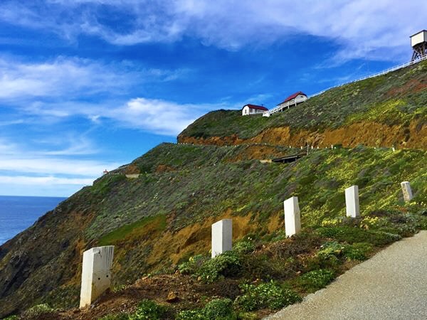 Tours last approximately three hours and are led by docents. It can be very cold and blustery so bring a jacket or sweater to be on the safe side. You will also have to do a great deal of walking, so sensible footwear is advised. You have to climb almost a mile with a 360-foot elevation to get to the lighthouse. There is a picnic area surrounded by a cute picket fence so bring a lunch and enjoy the amazing views! If you are planning on visiting the lighthouse and have questions regarding parking, fees, and tour schedules, call 831-625-4419 or see Point Sur Lighthouse
- September through March Tours are Saturday and Sunday at 10:00 am and Wednesday at 1:00 pm
- April through August Tours are Saturdays and Wednesdays at 10:00 am and 2:00 pm, Sundays 10:00 am, and only in July and August, Thursdays at 10:00 am
- For regular tours, adults are $15, ages 6-17 are $5, and children 5 and under are free
- Moonlight Tours in 2018 are Sunday, August 26 and Monday August 27 at 6:45 pm, and Monday, September 24 and Tuesday, September 25 at 6:00 pm
- For Moonlight tours, adults are $20, ages 6-17 are $10, and ages 5 and under are free
- Arrive early; first come, first served (reservations are not accepted)
- Visa, Mastercard, American Express and Discover are accepted
- No visitors may remain in their vehicles
- No pets ( even left in cars), large motorhomes or campers, baby strollers, or smoking is allowed
Thank you for visiting my blog! Wishing you peace, love, happiness & beautiful vistas!